Nature reserve Chihuahua Municipality of Chihuahua
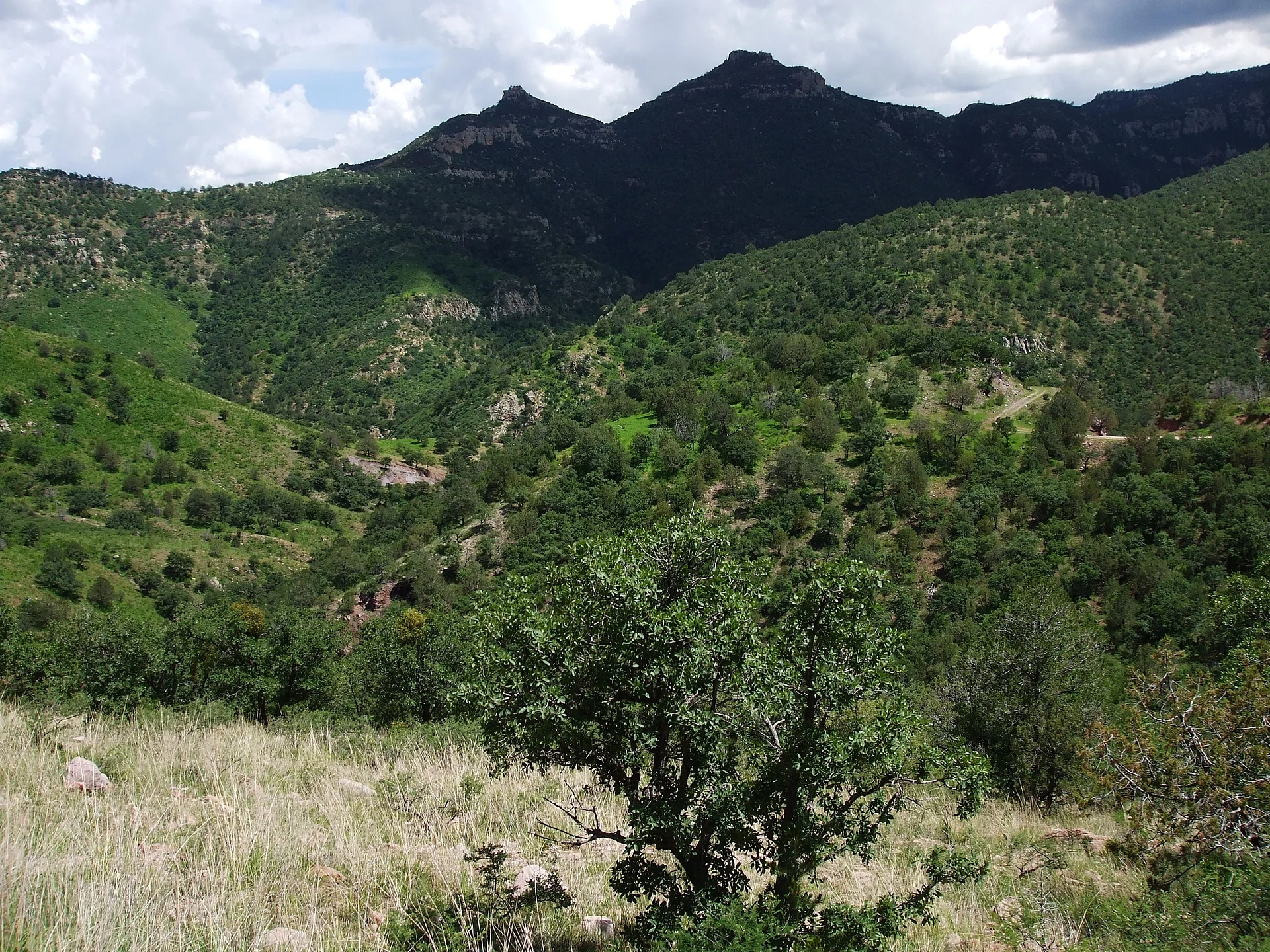
Pine forest and wind-carved volcanic rock in the Sierra de Majalca, north of Chihuahua city; a national park since 1939.
From Chihuahua: about 50 min by road (~55 km) How to get there ↓
Near here
See everything nearby ↓

Plan your visit to Parque Nacional Cumbres de Majalca
Where to stay near Parque Nacional Cumbres de Majalca
Compare hotels, posadas and guest houses in Parque Nacional Cumbres de Majalca.
Tours to Parque Nacional Cumbres de Majalca
Day trips and guided outings from Chihuahua often include Parque Nacional Cumbres de Majalca; with a local guide you can get there without a car.
How to get to Parque Nacional Cumbres de Majalca
- From Chihuahua: about 50 min by road (~55 km)
Links open a partner site. We may earn a commission if you book, at no cost to you.
About Parque Nacional Cumbres de Majalca
Cumbres de Majalca is the national park closest to Chihuahua city: about 4,772 hectares of sierra to the north, protected by a presidential decree of 1 September 1939. Its signature sight is the volcanic rock, worn by rain and wind into odd towers and boulders that stand up among the pines.
The park covers part of the Sierra de Majalca, a range of the Sierra Madre Occidental that tops out around 2,900 metres. The main summits are Las Escobas, La Puerta, Los Almíceres and Cerro del Agua. The Sacramento River rises here and runs down towards the city, where it joins the Chuvíscar.
The higher ground is conifer forest: Chihuahua pine, Mexican pinyon and Apache pine (Pinus engelmannii), with a few firs, and some areas were replanted with pine after the park was created. Lower down it turns to grassland with juniper and desert scrub. It is one of the few places in northern Mexico with black bears; white-tailed deer, porcupines and bobcats live here too, and birders can look for peregrine falcons, golden eagles, woodpeckers and wild turkeys.
The climate is mild and semi-dry. Summer days can top 35 °C, with heavy rain at the end of the season; winter brings an average of 112 frost days a year, lows below -10 °C and frequent snow. Chihuahua families drive up on weekends to hike, camp and take in the views, and the ejidos inside the park offer basic services.
How to get to Parque Nacional Cumbres de Majalca
From Chihuahua city take federal Highway 45 (the Panamericana) towards Ciudad Juárez. Around kilometre 31 to 33 the turn-off to the park branches left; from there it is roughly 30 more kilometres of winding mountain road to Majalca, best driven slowly and in daylight. We found no regular public transport to the park: come by car, taxi or on an organised trip from Chihuahua, whose bus station and airport are the nearest gateways.
Directions to Parque Nacional Cumbres de Majalca on Google Maps
Distances are in a straight line; the road is usually longer.
Links open a partner site. We may earn a commission if you book, at no cost to you.
From the nearest cities to Parque Nacional Cumbres de Majalca
- Chihuahua · about 55 km by road, ~50 min
- Cuauhtémoc · about 75 km by road, ~1 h 10 min
- Delicias · about 155 km by road, ~2 h 15 min
Drive times by road from OpenStreetMap, without traffic or stops. Times marked ~ are estimated from the straight-line distance.
Before you go to Parque Nacional Cumbres de Majalca: hours, prices and tips
- Best season
- Winter averages 112 frost days, with lows below -10 °C and frequent snow; heavy rain comes at the end of summer. Wikipedia · checked Oct 2026
Hours and prices change, especially around holidays. Each fact links to where we checked it.
Visiting Parque Nacional Cumbres de Majalca: what to see and do
Wind-carved volcanic rock towers
Pine-forest walks in the Sierra de Majalca
The Las Escobas, La Puerta, Los Almíceres and Cerro del Agua summits
The source of the Sacramento River
Birding: peregrine falcon, golden eagle, wild turkey
Snow in winter
Plan your trip
Places to stay in Parque Nacional Cumbres de Majalca
Compare hotels, posadas, and rentals in and around Parque Nacional Cumbres de Majalca.
Tours & activities
Day trips and guided outings from Chihuahua often include Parque Nacional Cumbres de Majalca; with a local guide you can get there without a car.
Travel insurance
If you plan on hiking at Parque Nacional Cumbres de Majalca, check that your policy covers it: some plans leave adventure activities out.
Mobile data
Signal can drop away from Chihuahua: download a map of the way to Parque Nacional Cumbres de Majalca before you set out, or carry an eSIM with data.
Links open a partner site. We may earn a commission if you book, at no cost to you.
Closest to Parque Nacional Cumbres de Majalca
-
Grutas Nombre de Dios · Cave · 40 km away
-
Centro Histórico de Chihuahua · Landmark · 43 km away
-
Chihuahua · City · 43 km away
Near Parque Nacional Cumbres de Majalca
-
Cuauhtémoc · City
~1 h 10 min drive · 59 km
Drive times by road from OpenStreetMap, without traffic. Times marked ~ are estimated from the straight-line distance.
Lists with Parque Nacional Cumbres de Majalca
Nature Parks in Chihuahua · 3Location from OpenStreetMap. Written by Puebloteca.