
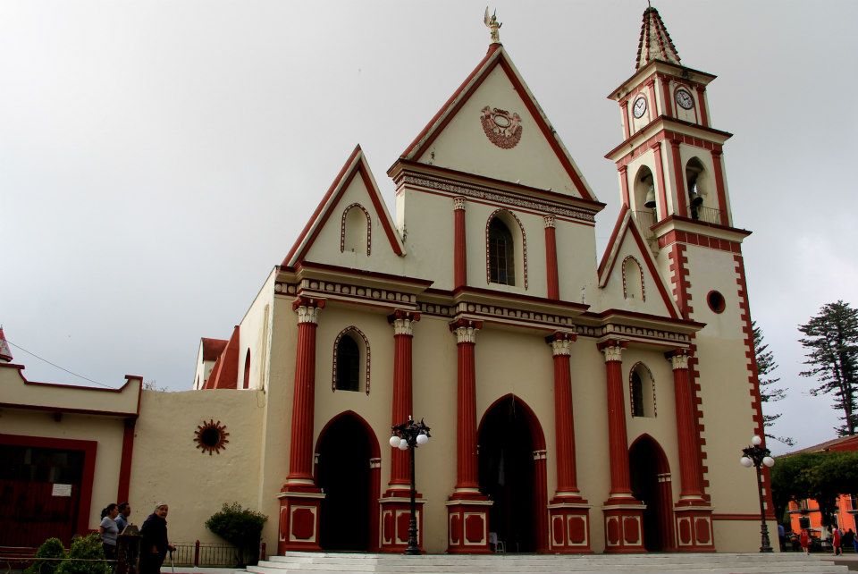
Coatepec is a coffee town in the misty hills a few kilometers from Xalapa, the capital of Veracruz. Locals sum it up with a line: we are coffee, cane, orchid, fog and mountain. The center is a grid of tile-roofed houses with interior patios around the parish of San Jerónimo, and the smell of roasting beans follows you down the street. People come to taste coffee at its source, buy orchids, visit old haciendas and escape the heat of the coast.
History
Before the Spanish arrived, Totonac and Nahua communities farmed these volcanic slopes, growing maize, beans, squash and chile. The name is Nahuatl for "on the hill of the snakes". After the fall of Tenochtitlan the area came under Spanish control during the 1520s, and the town of San Jerónimo de Coatepec was formally established around 1560, when scattered Indigenous settlements were gathered into one place for administration and evangelization. Its street grid dates from that time.
Coatepec sat close to the royal road between the port of Veracruz and Mexico City, and muleteers became a fixture of local life. From the late 1500s sugar haciendas transformed the landscape. The largest, La Orduña, was bought in 1593 by the merchant Francisco de Orduña and ran several water-powered mills. The work was done by enslaved Africans, seasonal Indigenous laborers and free workers of mixed descent, and that mix shaped the town's food, festivals and traditions. Sugar, raw piloncillo and cane liquor went to markets across New Spain, and molasses gave rise to a local sweets trade.
Coffee later took the place of sugar as the main crop and gave Coatepec the nickname it carries today, the coffee capital. It was among the earlier towns to be named a Pueblo Mágico, in 2006.
Plan your trip
Places to stay in Coatepec
Hotel Casa Real del Café Hotel · ★★★ · 220 m from the center Find on Booking.com Hotel San Jose Plaza Coatepec Hotel · ★★★ · 300 m from the center Find on Booking.com Hotel Posada San Jerónimo Hotel · ★★★ · 360 m from the center Find on Booking.com Spa Shalam Hotel · ★★★ · 1.6 km from the center Find on Booking.com Casa Miguel Arcangel Hotel · ★★ · 400 m from the center Find on Booking.com Hotel Boutique La Orquidea Hotel · ★★ · 680 m from the center Find on Booking.comTours & activities
Guided tours, tastings, and day trips in and around Coatepec.
Links open a partner site. We may earn a commission if you book, at no cost to you. Hotel names from OpenStreetMap.
Photos
Where it is
Coatepec within Mexico
The town up close · Open in Google Maps
Getting there
- Fly into VER: General Heriberto Jara International Airport, about 88 km away in a straight line
Drive times are estimates from OpenStreetMap routing, without traffic.
Nearby Pueblos Mágicos

6 km away
24 km away

44 km away

61 km away
Sources: population from Wikidata (may count the whole municipality) · elevation and climate from Open-Meteo · airports from OurAirports (straight-line distance).