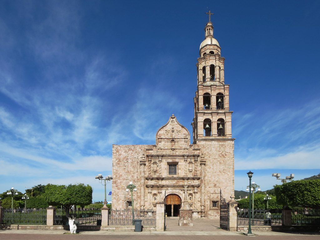
El Rosario is a small former mining town in southern Sinaloa, about an hour south of Mazatlán on Highway 15. Its main sight is the church of Nuestra Señora del Rosario, whose gilded Baroque altarpiece reflects the silver and gold that came out of the ground here. You can also visit the museum dedicated to singer Lola Beltrán, who was born here, walk the old center and the Spanish cemetery, and continue to the beaches of El Caimanero.
History
The area was home to three peoples, the Totorames, Xiximes and Acaxees. The town dates its founding to August 3, 1655, and tells it as a legend. A foreman named Bonifacio, out looking for lost cattle, lit a campfire for the night and found melted silver stuck to a rock under the ashes the next morning. He marked the spot with his rosary beads before going to tell his boss, and the mine and the town took their name from that rosary.
Mining went on for close to three centuries, and El Rosario became the richest town in northwestern Mexico. More than 70 kilometers of tunnels were dug, and people say there are more tunnels underground than streets above. The church of Nuestra Señora del Rosario was consecrated in 1731 and finished in 1759. When the tunnels made the ground sink beneath it, the faithful took it apart and moved it stone by stone to its present place on the main square.
The singer Lola Beltrán grew up here, and a small museum keeps her memory. Today the town makes pottery, furniture and leather goods, and it joined the Pueblos Mágicos program in 2012.
Plan your trip
Places to stay in El Rosario
Hotel Yauco Hotel · ★★★ · 900 m from the center Find on Booking.com Los Arcos Hotel · 810 m from the center Find on Booking.com Baluarte Hotel · 830 m from the center Find on Booking.com San Angel Hotel · 830 m from the center Find on Booking.com D' Lola Hotel · 960 m from the center Find on Booking.comTours & activities
Guided tours, tastings, and day trips in and around El Rosario.
Links open a partner site. We may earn a commission if you book, at no cost to you. Hotel names from OpenStreetMap.
Photos
Where it is
El Rosario within Mexico
The town up close · Open in Google Maps
Getting there
- Fly into MZT: General Rafael Buelna International Airport, about 45 km away in a straight line
Drive times are estimates from OpenStreetMap routing, without traffic.
Nearby Pueblos Mágicos

120 km away

127 km away
151 km away

172 km away
Sources: population from Wikidata (may count the whole municipality) · elevation and climate from Open-Meteo · airports from OurAirports (straight-line distance).