Mountain Unión Juárez, Chiapas Soconusco
The 4,092-meter active volcano on the Mexico–Guatemala border, climbed in about ten hours from the coffee town of Unión Juárez with a local guide.
Reached on foot from Unión Juárez: 10 h each way. How to get there ↓
Plan your visit to Volcán Tacaná
Where to stay near Volcán Tacaná
Compare hotels, posadas and guest houses in Volcán Tacaná.
Tours to Volcán Tacaná
Day trips and guided outings from Chiapas often include Volcán Tacaná; with a local guide you can get there without a car.
How to get to Volcán Tacaná
- Reached on foot from Unión Juárez: 10 h each way.
- From Tapachula: about 45 min by road (~45 km)
Links open a partner site. We may earn a commission if you book, at no cost to you.
About Volcán Tacaná
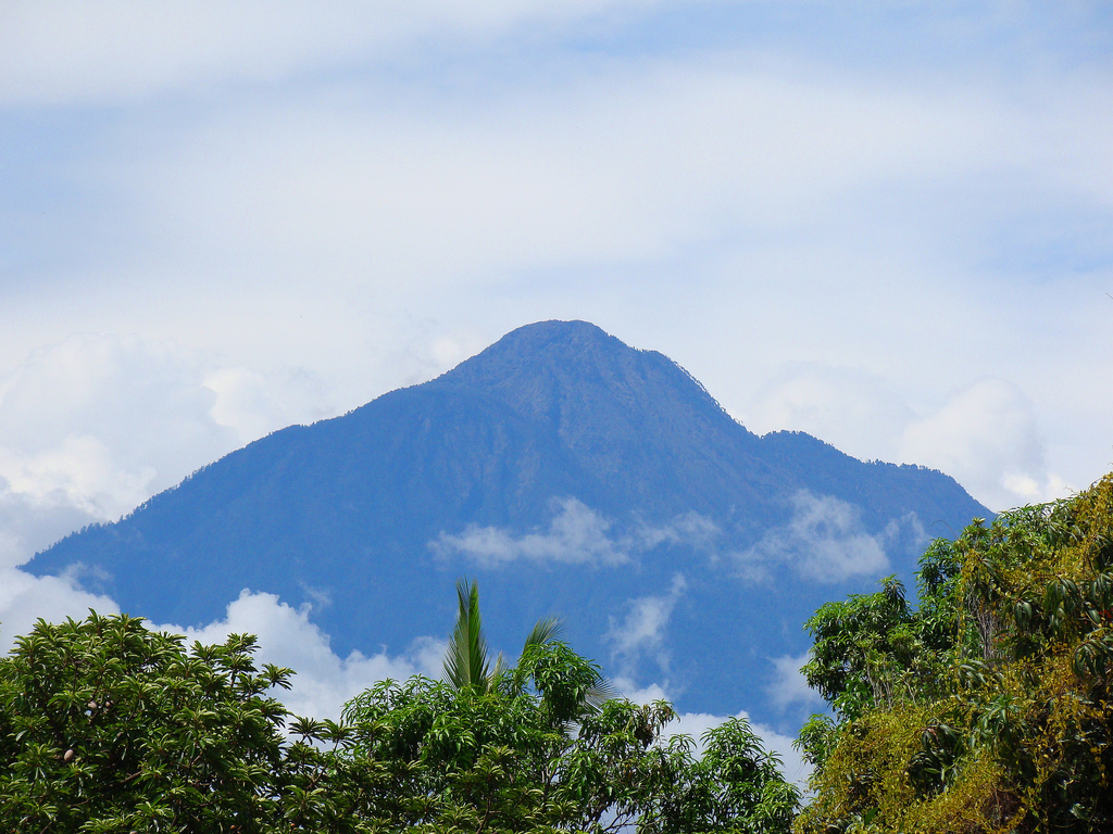
The Tacaná is the volcano that closes the southern end of Mexico. Its summit, 4,092 meters above sea level, sits right on the border between Chiapas and the Guatemalan department of San Marcos, and the mountain is counted as the eighth-highest peak in Mexico and the second-highest in Guatemala. It is an active stratovolcano: there were phreatic explosions and fumarolic activity in 1855, 1878, 1903, 1949 to 1951 and 1986, fumaroles on its western flank reach 82 to 94 °C, and hot springs at 1,500 to 2,100 meters, at a place called Agua Caliente, run at 40 to 55 °C. Scientists from the state civil protection agency and UNICACH university monitor it with a network of seismic stations, one of them at the summit.
The name comes from Mam and means house of fire. In colonial times it was simply the volcano of the Soconusco, and in Mexico it is also called the Colossus of the South. Snow is rare, but a light snowfall did whiten its upper slopes on both sides of the border in January 2010. The Mexican side of the mountain, across the municipalities of Unión Juárez, Cacahoatán and Tapachula, is protected as the Volcán Tacaná Biosphere Reserve, managed by CONANP.
The climb starts in Unión Juárez, a coffee town at about 1,250 meters, and follows one of two routes, through Chiquihuites or through Talquián. Local people work as guides and rent pack mules, and the walk to the top takes about ten hours, through farmland and coffee, old lava flows, cloud forest and pine woods, up to the treeline and a summit with views over the Central American volcanic chain, including Tajumulco. Weather on the upper mountain changes fast: in a hailstorm one recent winter about 80 hikers had to shelter in the refuges known as Casas de Fuego, and access was closed for a week before CONANP reopened it in January 2026. Every Easter a gathering of mountaineers from Mexico and Central America meets on the summit.
How to get to Volcán Tacaná
Drive from Tapachula to Unión Juárez: 45 min, 45 km
Drive or take a colectivo from Tapachula through Cacahoatán to Unión Juárez, where the climb begins; the road also connects through the Talismán border area. From Unión Juárez a vehicle can take you up to the trailheads at Chiquihuites or Talquián, and from there the only way up is on foot. Hire a guide and, if you want, a mule in Unión Juárez, and register with CONANP before you go up and when you come down.
Reached on foot from Unión Juárez: 10 h each way.
Directions to Volcán Tacaná on Google Maps
Distances are in a straight line; the road is usually longer.
Links open a partner site. We may earn a commission if you book, at no cost to you.
From the nearest cities to Volcán Tacaná
- Tapachula · 45 km by road, 45 min to Unión Juárez, then 10 h on foot
- San Cristóbal de las Casas · about 255 km by road, ~3 h 45 min to Unión Juárez, then 10 h on foot
- Comitán · 289 km by road, 4 h 30 min to Unión Juárez, then 10 h on foot
Drive times by road from OpenStreetMap, without traffic or stops. Times marked ~ are estimated from the straight-line distance.
Before you go to Volcán Tacaná: hours, prices and tips
- Time needed
- About ten hours to reach the summit. México Desconocido · checked Oct 2026
- Best season
- Authorities close access in bad weather: rain, frost and mud shut the trail after a hailstorm in which 80 hikers were rescued, and it reopened in January 2026. Mountaineers gather on the summit every Easter week. Uno TV; Excélsior (Jan 2026) · checked Oct 2026
- Guide or tour
- Climb with a certified guide; CONANP asks that you go with accredited guides or people who know the trail. Locals in Unión Juárez offer guiding, pack mules, drinks and food. Tours: Viator GetYourGuide México Desconocido; Visit Mexico · checked Oct 2026
- What to bring
- Thermal and waterproof clothing, proper boots, enough water, snacks and electrolytes, and at least one first-aid kit per group. Check the forecast before you set out. Excélsior, citing CONANP (Jan 2026) · checked Oct 2026
- Rules
- Register with CONANP when you go up and when you come down, stay on authorized trails and carry out all your trash. Excélsior, citing CONANP (Jan 2026) · checked Oct 2026
Hours and prices change, especially around holidays. Each fact links to where we checked it.
Visiting Volcán Tacaná: what to see and do
Climb to the 4,092-meter summit from Unión Juárez with a local guide, through Chiquihuites or Talquián.
Walk through coffee plantations, cloud forest and pine woods on the way up.
Look out from the top over the volcanoes of Guatemala, including Tajumulco.
If you are not climbing, watch the cone from Unión Juárez or from Izapa on a clear morning.
Plan your trip
Places to stay in Volcán Tacaná
Compare hotels, posadas, and rentals in and around Volcán Tacaná.
Tours & activities
Day trips and guided outings from Chiapas often include Volcán Tacaná; with a local guide you can get there without a car.
Travel insurance
If you plan on hiking at altitude at Volcán Tacaná, check that your policy covers it: some plans leave adventure activities out.
Mobile data
Signal can drop away from Chiapas: download a map of the way to Volcán Tacaná before you set out, or carry an eSIM with data.
Links open a partner site. We may earn a commission if you book, at no cost to you.
Closest to Volcán Tacaná


Location from OpenStreetMap. Written by Puebloteca.