
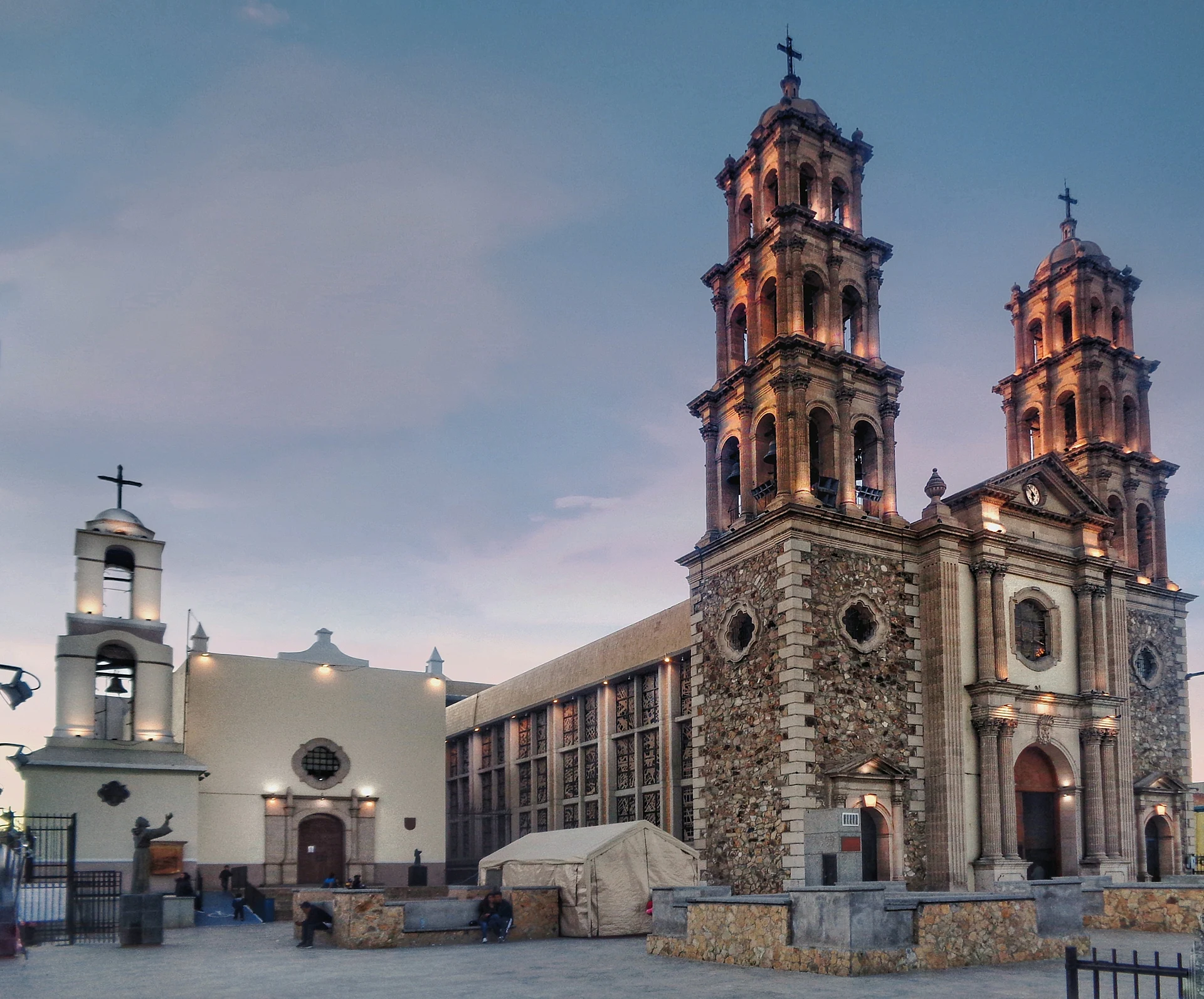


City Juárez, Chihuahua
Chihuahua's largest city, across the Río Bravo from El Paso: the 1660s Misión de Guadalupe, border-history museums and the Samalayuca dunes nearby.
From Nuevo Casas Grandes: 4 h 5 min by car (281 km by road) How to get there ↓
Plan your visit to Ciudad Juárez
Where to stay near Ciudad Juárez
Compare hotels, posadas and guest houses in Ciudad Juárez.
Tours to Ciudad Juárez
Day trips and guided outings from Chihuahua often include Ciudad Juárez; with a local guide you can get there without a car.
How to get to Ciudad Juárez
- From Nuevo Casas Grandes: about 4 h 5 min by road (~281 km)
Links open a partner site. We may earn a commission if you book, at no cost to you.
About Ciudad Juárez
Ciudad Juárez is the largest city in the state of Chihuahua, with about 1.5 million people in 2020, spread along the south bank of the Río Bravo (the Rio Grande) directly opposite El Paso, Texas. Together the two cities form one of the biggest binational metropolitan areas on the border. It sits at about 1,140 meters in a wide desert valley between the Franklin Mountains on the US side and the Sierra de Juárez to the west, at the point where the border stops following the river and becomes a straight line running west.
For most of its history the city was called Paso del Norte. On 8 December 1659 the Franciscan friar García de San Francisco founded the Misión de Nuestra Señora de Guadalupe de los Mansos del Paso del Río del Norte here, at the river crossing on the Camino Real de Tierra Adentro, the colonial road between central Mexico and Santa Fe. The mission church that still stands downtown was built between 1662 and 1668, and it is the oldest building in the metropolitan area; its plain, simple exterior hides a carved wooden ceiling with pine-cone and floral designs. When the US–Mexico war ended in 1848, the river became the border and the settlement on the north bank grew into El Paso. Benito Juárez took refuge here in 1865 during the French intervention, and in 1888 the town was renamed Ciudad Juárez in his honor. During the Revolution it was a provisional seat of government under Madero and Carranza and a headquarters of Pancho Villa.
The historic center is compact and easy to walk. The mission stands beside the larger Catedral de Ciudad Juárez on the Plaza Misión de Guadalupe, and a few blocks away the old customs house, the Ex Aduana, holds the Museo de la Revolución en la Frontera. Other stops include the Museo de Arte, the archaeology museum in the Parque Público Federal El Chamizal (land returned by the United States in the 1960s after a century-long dispute over the river's course), the Centro Cultural Paso del Norte and the Casa Museo Juan Gabriel, devoted to the singer. About 50 km south of the city, the Médanos de Samalayuca are a protected area of tall, fine sand dunes, with archaeological sites protected by INAH in the nearby Sierra de Samalayuca; the dunes host sandboarding, motocross and an annual extreme-sports festival.
How to get to Ciudad Juárez
Drive from Nuevo Casas Grandes: 4 h 5 min, 281 km
Abraham González International Airport, on the south side of the city, has direct flights to Mexico City, Monterrey, Guadalajara, Chihuahua and other Mexican cities. Federal Highway 45 links Juárez with Samalayuca, Villa Ahumada and Chihuahua city to the south. From El Paso, the downtown Paso del Norte bridge carries traffic into the US, the Reforma (Stanton Street) bridge carries it into Mexico, and the Córdova de las Américas bridge in El Chamizal handles both directions.
Directions to Ciudad Juárez on Google Maps
Distances are in a straight line; the road is usually longer.
Links open a partner site. We may earn a commission if you book, at no cost to you.
From the nearest cities to Ciudad Juárez
- Nuevo Casas Grandes · 281 km by road, 4 h 5 min
- Chihuahua · 368 km by road, 5 h
- Agua Prieta · 380 km by road, 5 h 40 min
Drive times by road from OpenStreetMap, without traffic or stops. Times marked ~ are estimated from the straight-line distance.
Visiting Ciudad Juárez: what to see and do
Step inside the 1660s Misión de Guadalupe and look up at its carved wooden ceiling beams.
Visit the Museo de la Revolución en la Frontera in the old customs house.
Walk the Parque Público Federal El Chamizal and its archaeology museum.
See the Casa Museo Juan Gabriel.
Drive south to sandboard on the Médanos de Samalayuca dunes.
Plan your trip
Places to stay in Ciudad Juárez
Compare hotels, posadas, and rentals in and around Ciudad Juárez.
Tours & activities
Day trips and guided outings from Chihuahua often include Ciudad Juárez; with a local guide you can get there without a car.
Mobile data
Signal can drop away from Chihuahua: download a map of the way to Ciudad Juárez before you set out, or carry an eSIM with data.
Links open a partner site. We may earn a commission if you book, at no cost to you.
Photos
Location from OpenStreetMap. Written by Puebloteca.