Town Guerrero, Chihuahua
Railway town where the Chepe line meets Highway 16 on the way into the sierra: a Chepe Regional stop amid apple country.
From Cuauhtémoc: about 55 min by road (~60 km) How to get there ↓
Plan your visit to La Junta
Where to stay near La Junta
Compare hotels, posadas and guest houses in La Junta.
Tours to La Junta
Day trips around Creel sometimes stop in La Junta; a tour is the easy way to see it without a car.
 Tours from Creel
Copper Canyon
★ 4.7 (31) · From US$79
How to get to La Junta
- From Cuauhtémoc: about 55 min by road (~60 km)
- Nearest airport: Chihuahua (CUU), 3 h 59 min by car to Creel
Links open a partner site. We may earn a commission if you book, at no cost to you.
Tours from Creel, near La Junta


Tours, prices and ratings from Viator, checked weekly. We may earn a commission if you book.
About La Junta
La Junta was born with the railway and is named after it. This is where two lines met, or "joined": the Chihuahua al Pacífico, running from Ojinaga to Topolobampo, and the Ferrocarril del Noroeste de México, which climbed from here through northwestern Chihuahua to Ciudad Juárez. The 88 km branch to Temósachic was laid between 1902 and 1908 by the Kansas City, Mexico and Orient company. The town also held the oldest and largest workshops of the Chihuahua al Pacífico, now out of use. With roughly 8,400 people, it is the biggest town in Guerrero municipality, larger than the municipal seat itself, which lies about 20 km away.
The town turns up in Revolution history too. During the Punitive Expedition, General John J. Pershing's US troops camped at La Junta while hunting for Pancho Villa, who in those days was shot in the leg at Guerrero and dropped out of sight for a while, recovering in a cave in the area. In the Chepe era, on May 19, 1965, the station was officially renamed Estación Lic. Adolfo López Mateos after the president who opened the line. The name never caught on with locals; a decree of June 11, 2003 restored La Junta, though the old name still shows up on some documents and signs. The town's founding is commemorated every October 12.
As train traffic fell off, above all on the old Noroeste line, La Junta made a second living as a crossroads. Federal Highway 16 passes through on its way from Chihuahua across the sierra to Hermosillo and Bahía de Kino, and the state road to Guerrero and Madera starts here, so anyone bound for Creel, the Copper Canyon or Basaseachi Falls passes through. Apples are the other mainstay: the area grows high-quality fruit, sold fresh and turned into jams, pies and dried apple.
The town sits in the foothills of the Sierra Madre Occidental, where a cool semi-arid climate shades into a temperate, subhumid one. It gets 500 to 600 mm of rain a year; June and July can reach 35 °C, snow is common in winter, and frosts go below −15 °C. On January 11, 2025 the temperature fell to −23.8 °C.
How to get to La Junta
From Cuauhtémoc it is 49 km and about 40 minutes west on Federal Highway 16 (Chihuahua–Madera), paved throughout; just before town, at the junction with Chihuahua state highway 11 to Guerrero and Madera, you turn into La Junta. From Chihuahua city, take toll road 16D to Cuauhtémoc and carry on the same way.
Into the sierra: for Creel, continue about 16 km west on Highway 16, then turn onto Chihuahua state highway 25 (the Creel branch), which runs through San Juanito; the whole trip is 108 km and about 1 h 45 min, on a winding mountain road. Highway 16 itself goes on toward Basaseachi, Yécora and Hermosillo.
By train: La Junta is a Chepe Regional station. Westbound, the train leaves Chihuahua on Tuesdays and Saturdays at 6:00, calls at Cuauhtémoc at 8:25 and La Junta at 9:24, and reaches Creel at 11:47. Eastbound, on Wednesdays and Sundays, it leaves Creel at 16:39, stops at La Junta at 19:12 and arrives in Chihuahua at 22:34. The tourist Chepe Express does not come this far.
By bus: Rápidos Cuauhtémoc and Noroeste run Chihuahua–Creel (about 5 hours, roughly 300 and 320 pesos) along this corridor; check at the ticket office whether your bus stops in La Junta.
Directions to La Junta on Google Maps
Distances are in a straight line; the road is usually longer.
Links open a partner site. We may earn a commission if you book, at no cost to you.
From the nearest cities to La Junta
- Cuauhtémoc · about 60 km by road, ~55 min
- Chihuahua · about 160 km by road, ~2 h 25 min
- Delicias · about 240 km by road, ~3 h 35 min
Drive times by road from OpenStreetMap, without traffic or stops. Times marked ~ are estimated from the straight-line distance.
Before you go to La Junta: hours, prices and tips
- Best season
- The town's founding is commemorated on October 12. Enciclopedia de los Municipios de México (INAFED) · checked Oct 2026
- What to bring
- Heavy winter clothing: snow is common and frosts drop below −15 °C. Wikipedia (es) · checked Oct 2026
Hours and prices change, especially around holidays. Each fact links to where we checked it.
Visiting La Junta: what to see and do
Watch the Chepe Regional pull through the station, mid-morning heading into the sierra or in the evening on the way back.
Walk around the station, the heart of a town that grew up with the railway.
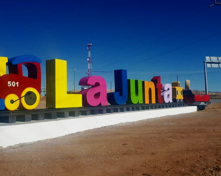
Take a photo at the colorful town-name letters with the little 501 train, beside the highway.
Buy local apples, fresh, as jam or dried.
Drive 20 km on to Guerrero, the municipal seat, with its 19th-century churches.
Come on October 12, the anniversary of the town's founding.
Plan your trip
Places to stay in La Junta
Compare hotels, posadas, and rentals in and around La Junta.
Tours & activities
Day trips around Creel sometimes stop in La Junta; a tour is the easy way to see it without a car.
Rental cars
Pick up a car at CUU (Chihuahua): about 3 h 59 min by road to Creel, then 86 km more to La Junta, on your own schedule.
Flights
The nearest airport with scheduled flights is Chihuahua (CUU), about 3 h 59 min by road from Creel, the base for La Junta.
Mobile data
Signal can drop away from Creel: download a map of the way to La Junta before you set out, or carry an eSIM with data.
Links open a partner site. We may earn a commission if you book, at no cost to you.
When to go to La Junta cool
La Junta shares the climate of Creel, 86 km away. The best months to visit are April, May, September, and October.
See the month-by-month climate of Creel
Weather in La Junta now and the next 7 days
Live forecast from Open-Meteo. Chance of rain is the day's highest.
The closest Pueblo Mágico: Creel

Creel is the Pueblo Mágico closest to La Junta, with places to stay, food, and more to see.
Near La Junta
-
Cuauhtémoc · City
~55 min drive · 46 km


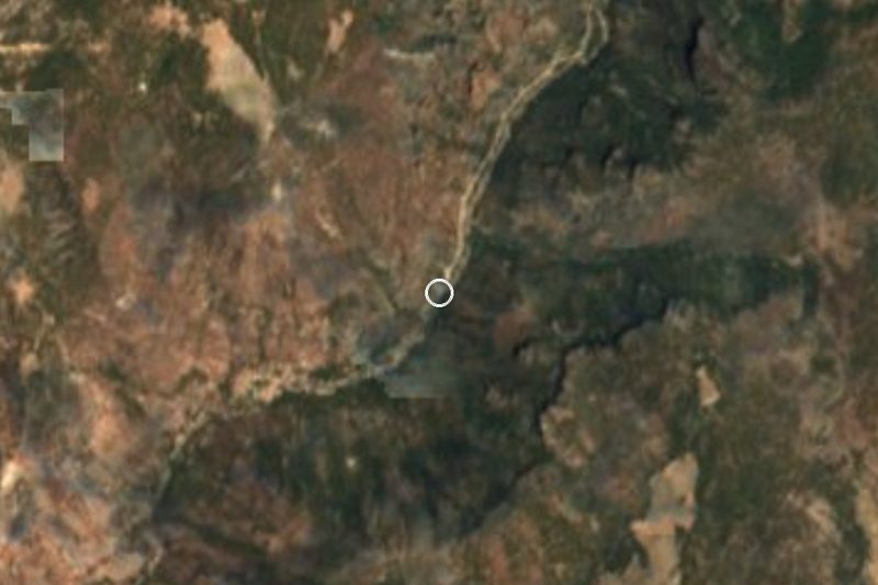

Drive times by road from OpenStreetMap, without traffic. Times marked ~ are estimated from the straight-line distance.
Location from OpenStreetMap. Written by Puebloteca.