Village Matamoros, Chihuahua
Once San Isidro de las Cuevas, a ranching village 25 minutes south of Parral on the Durango highway; San Isidro feast on May 15.
From Hidalgo del Parral: about 25 min by road (~25 km) How to get there ↓
Near here
See everything nearby ↓


Plan your visit to Villa Matamoros
Where to stay near Villa Matamoros
Compare hotels, posadas and guest houses in Villa Matamoros.
Tours to Villa Matamoros
Day trips and guided outings from Hidalgo del Parral often include Villa Matamoros; with a local guide you can get there without a car.
How to get to Villa Matamoros
- From Hidalgo del Parral: about 25 min by road (~25 km)
- Nearest airport: Chihuahua (CUU), 3 h 43 min by car to Hidalgo del Parral
Links open a partner site. We may earn a commission if you book, at no cost to you.
About Villa Matamoros
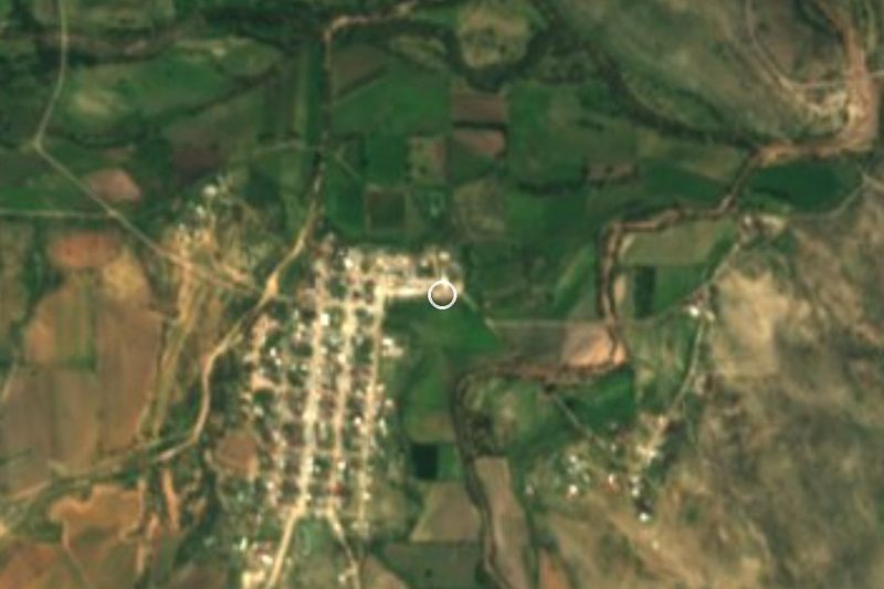
Villa Matamoros lies at the southern tip of Chihuahua on Federal Highway 45, about 22 km south of Parral and 39 km short of the Durango state line. It is the seat of Matamoros municipality and had 2,694 residents in 2020, more than half the municipality's population. The village sits at roughly 1,700 meters, with the Santa Bárbara, El Fraile, Roncesvalles and El Tecuán ranges rising to the west.
Its first name was San Isidro de las Cuevas, and for a long time it answered to bigger neighbors: to Allende through the colonial era, then to Parral from 1847. The state congress made it the seat of a new municipality on July 31, 1874, and in July 1922 renamed it Villa Matamoros after the insurgent priest Mariano Matamoros. The municipality was abolished and folded into Parral in 1931, then restored on May 7, 1932. Since November 18, 1995 the official name has been Mariano Matamoros, though the region still calls it Villa Matamoros.
The oldest landmark is the church of San Isidro Labrador, built by the Franciscans in 1879, and the farmer saint is still the patron, honored on May 15. One kilometer away stands the old Hacienda de Sombreretillo, dating from 1868, near the Río del Valle, and at the turnoff to Ciénaga de Ceniceros is the Hacienda El Mirador, from 1879. Gustavo L. Talamantes, the agronomist who handed out ejido land in the 1920s and later became governor of Chihuahua, was born in 1891 at the Hacienda de Roncesvalles in this municipality.
The country around is mostly cattle range of grass, huizache, mesquite, yucca and agave; the Río Concepción rises in the municipality and, with the Río del Valle, flows on toward the Florido. The climate is dry and mild, averaging 16 °C, with summer highs up to 39 °C and frosts down to −12 °C. Food is all about beef: carne asada, dried beef with chile, barbacoa and carne con chile pasado with melted asadero cheese, with norteño music in the background.
How to get to Villa Matamoros
From Hidalgo del Parral it is 25 km and about 25 minutes: head south on Federal Highway 45, the Pan-American route to Durango, and the village sits right on the road. Keep going south and the Durango state line is 39 km on, with Ocampo the first sizable town across it. Chihuahua city is about 254 km away.
By bus: reach Parral first on Ómnibus de México, Chihuahuenses or Rápidos Delicias from Chihuahua, Jiménez or Delicias. Parral–Durango buses (Chihuahuenses, Valle del Guadiana and Ómnibus de México, from the Central de Autobuses on Avenida Pedro de Lille) use this same highway, but we found no published timetable with a stop in Villa Matamoros: ask at the ticket window whether they will let you off, or take a taxi from Parral.
Directions to Villa Matamoros on Google Maps
Distances are in a straight line; the road is usually longer.
Links open a partner site. We may earn a commission if you book, at no cost to you.
From the nearest cities to Villa Matamoros
- Hidalgo del Parral · about 25 km by road, ~25 min
- Delicias · about 205 km by road, ~3 h 5 min
- Chihuahua · about 280 km by road, ~4 h 5 min
Drive times by road from OpenStreetMap, without traffic or stops. Times marked ~ are estimated from the straight-line distance.
Before you go to Villa Matamoros: hours, prices and tips
- Best season
- Feast of the patron saint, San Isidro Labrador, on May 15; Independence celebrations on September 15 and 16, and a parade on November 20. Enciclopedia de los Municipios de México (INAFED) · checked Oct 2026
- What to bring
- Warm layers in winter, when frosts reach −12 °C; summer days can hit 39 °C. Enciclopedia de los Municipios de México (INAFED) · checked Oct 2026
Hours and prices change, especially around holidays. Each fact links to where we checked it.
Visiting Villa Matamoros: what to see and do
Visit the church of San Isidro Labrador, built by the Franciscans in 1879.
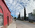
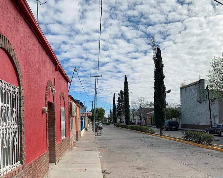
Walk the streets of the center, lined with painted façades and cypress trees.
Head out to the old Hacienda de Sombreretillo, from 1868, a kilometer from the village.
Look for the Hacienda El Mirador, from 1879, at the Ciénaga de Ceniceros turnoff.
Come on May 15 for the feast of San Isidro Labrador, the village patron.
Try carne con chile pasado with asadero cheese, and dried beef with chile.
Plan your trip
Places to stay in Villa Matamoros
Compare hotels, posadas, and rentals in and around Villa Matamoros.
Tours & activities
Day trips and guided outings from Hidalgo del Parral often include Villa Matamoros; with a local guide you can get there without a car.
Rental cars
Pick up a car at CUU (Chihuahua): about 3 h 43 min by road to Hidalgo del Parral, then 20 km more to Villa Matamoros, on your own schedule.
Flights
The nearest airport with scheduled flights is Chihuahua (CUU), about 3 h 43 min by road from Hidalgo del Parral, the base for Villa Matamoros.
Mobile data
Signal can drop away from Hidalgo del Parral: download a map of the way to Villa Matamoros before you set out, or carry an eSIM with data.
Links open a partner site. We may earn a commission if you book, at no cost to you.
When to go to Villa Matamoros mild
Villa Matamoros shares the climate of Hidalgo del Parral, 20 km away. The best months to visit are January, February, March, and April.
See the month-by-month climate of Hidalgo del Parral
Weather in Villa Matamoros now and the next 7 days
Live forecast from Open-Meteo. Chance of rain is the day's highest.
The closest Pueblo Mágico: Hidalgo del Parral

Hidalgo del Parral is the Pueblo Mágico closest to Villa Matamoros, with places to stay, food, and more to see.
Closest to Villa Matamoros
-
Santa Bárbara · Town · 24 km away
-
Valle de Allende · Town · 27 km away
-
San Francisco del Oro · Village · 28 km away
-
Hacienda de Canutillo · Landmark · 48 km away
Near Villa Matamoros


Drive times by road from OpenStreetMap, without traffic. Times marked ~ are estimated from the straight-line distance.
Location from OpenStreetMap. Written by Puebloteca.