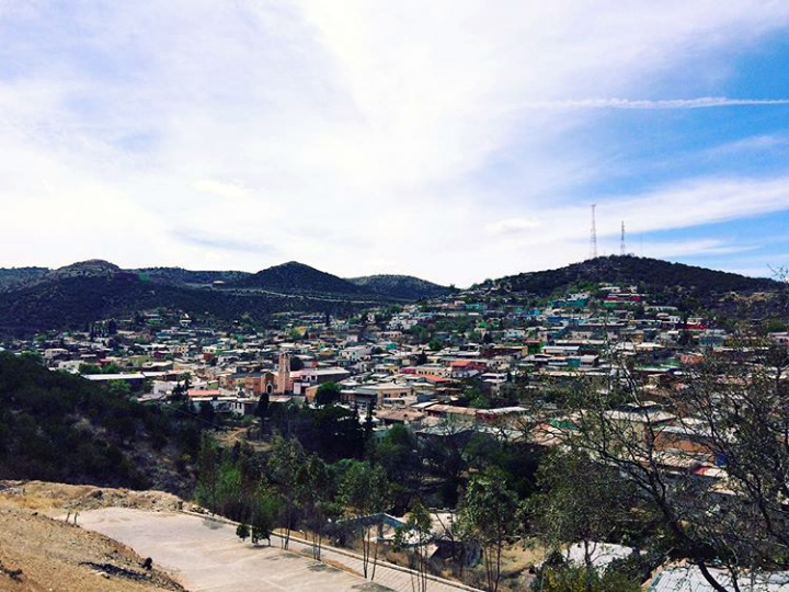
Village San Francisco del Oro, Chihuahua
Mining camp in the Parral valley dating from 1658: houses on rolling hills, an ore cableway over town and a miners' fair every July.
From Hidalgo del Parral: about 20 min by road (~25 km) How to get there ↓
Near here
See everything nearby ↓


Plan your visit to San Francisco del Oro
Where to stay near San Francisco del Oro
Compare hotels, posadas and guest houses in San Francisco del Oro.
Tours to San Francisco del Oro
Day trips and guided outings from Hidalgo del Parral often include San Francisco del Oro; with a local guide you can get there without a car.
How to get to San Francisco del Oro
- From Hidalgo del Parral: about 20 min by road (~25 km)
- Nearest airport: Chihuahua (CUU), 3 h 43 min by car to Hidalgo del Parral
Links open a partner site. We may earn a commission if you book, at no cost to you.
About San Francisco del Oro
San Francisco del Oro is the seat of one of Chihuahua's smallest municipalities, at the far south of the state close to the Durango line. The town spreads over low hills at 1,942 meters in the Parral valley, ringed by the Santa Bárbara, El Astillero and La Sauceda ranges, and the creeks that cross the municipality are among the first headwaters of the Parral River. About 4,400 people live here.
The place began as a mine. In 1658 a Spanish miner named Francisco Molina struck the vein that the settlement grew around, and the town carries his first name. For close to three centuries it was governed from Santa Bárbara, until it became a municipality in its own right in 1927. On July 11, 1934, Section 20 of the national miners' union was founded here, and the date still anchors the local calendar: the Feria Minera runs from July 11 to 18. Mining never stopped; the mine is one of Minera Frisco's producing units today, and the municipal coat of arms shows its two main mines, Francisco and Clarines, along with the buckets that carry the ore.
What visitors notice first is the aerial cableway that runs right over town, its buckets carrying metal from the mine above the rooftops. In the center stands the parish church of San Francisco de Asís, whose saint is honored on October 4, and the first week of November brings an autumn festival. This is a baseball town: its team, Frisco, has stood out in regional, state and national tournaments and produced players such as Abraham Pérez Villegas and Alfredo "Indio" Mejía.
Food follows northern mining-town lines: beef barbacoa, frijoles charros stewed with chorizo, bacon, ham and sausage, beef puchero, tamales, enchiladas and burritos. Local crafts include stone and wood carving, embossed aluminum, little baskets made from eggshell, macramé and sugar figures. The climate is temperate, averaging 16 °C, with summer highs that can touch 39 °C and winter frosts down to −12 °C.
How to get to San Francisco del Oro
San Francisco del Oro is 25 km from Hidalgo del Parral, about 25 minutes by car on paved road the whole way. From central Parral, leave on Avenida Niños Héroes and take Federal Highway 24 (the Parral–El Granillo stretch) for about 5 km; at El Granillo take Chihuahua state highway 110, which covers the last 12 km to the edge of town, where the El Chapulín recreation park sits. From Chihuahua city it is about 247 km: drive south on Highway 24 to Parral and continue the same way.
By bus, the practical route is to reach Parral first: Estrella Blanca runs three departures a day on its Valle de Guadiana line from Chihuahua's Central de Autobuses (about 3 hours), and Ómnibus de México and Chihuahuenses (Grupo Senda) also serve Parral, each from its own terminal. Second-class buses leave Parral for the smaller towns of the region; we found no published timetable for San Francisco del Oro, so ask at the terminal or take a taxi.
Directions to San Francisco del Oro on Google Maps
Distances are in a straight line; the road is usually longer.
Links open a partner site. We may earn a commission if you book, at no cost to you.
From the nearest cities to San Francisco del Oro
- Hidalgo del Parral · about 25 km by road, ~20 min
- Delicias · about 200 km by road, ~2 h 55 min
- Chihuahua · about 255 km by road, ~3 h 50 min
Drive times by road from OpenStreetMap, without traffic or stops. Times marked ~ are estimated from the straight-line distance.
Before you go to San Francisco del Oro: hours, prices and tips
- Best season
- Feria Minera, July 11–18; feast of the patron saint, San Francisco de Asís, on October 4; autumn festival in the first week of November. Enciclopedia de los Municipios de México (INAFED) · checked Oct 2026
- What to bring
- Warm layers from November to February, when frosts reach −12 °C; summer days can hit 39 °C. Enciclopedia de los Municipios de México (INAFED) · checked Oct 2026
Hours and prices change, especially around holidays. Each fact links to where we checked it.
Visiting San Francisco del Oro: what to see and do
Watch the ore buckets travel along the cableway that crosses town.
Visit the parish church of San Francisco de Asís in the center.
Climb the hills for a view over the rooftops and the Parral valley ranges.
Catch the Feria Minera, July 11 to 18.
Spend an afternoon at the El Chapulín recreation park at the town entrance.
Take a picnic up into the Los Azules range.
Try the beef barbacoa and frijoles charros.
Look for eggshell baskets and carved stone pieces.
Plan your trip
Places to stay in San Francisco del Oro
Compare hotels, posadas, and rentals in and around San Francisco del Oro.
Tours & activities
Day trips and guided outings from Hidalgo del Parral often include San Francisco del Oro; with a local guide you can get there without a car.
Rental cars
Pick up a car at CUU (Chihuahua): about 3 h 43 min by road to Hidalgo del Parral, then 20 km more to San Francisco del Oro, on your own schedule.
Flights
The nearest airport with scheduled flights is Chihuahua (CUU), about 3 h 43 min by road from Hidalgo del Parral, the base for San Francisco del Oro.
Mobile data
Signal can drop away from Hidalgo del Parral: download a map of the way to San Francisco del Oro before you set out, or carry an eSIM with data.
Links open a partner site. We may earn a commission if you book, at no cost to you.
When to go to San Francisco del Oro mild
San Francisco del Oro shares the climate of Hidalgo del Parral, 20 km away. The best months to visit are January, February, March, and April.
See the month-by-month climate of Hidalgo del Parral
Weather in San Francisco del Oro now and the next 7 days
Live forecast from Open-Meteo. Chance of rain is the day's highest.
The closest Pueblo Mágico: Hidalgo del Parral

Hidalgo del Parral is the Pueblo Mágico closest to San Francisco del Oro, with places to stay, food, and more to see.
Closest to San Francisco del Oro
-
Santa Bárbara · Town · 7 km away
-
Villa Matamoros · Village · 28 km away
-
Valle de Allende · Town · 46 km away
Near San Francisco del Oro
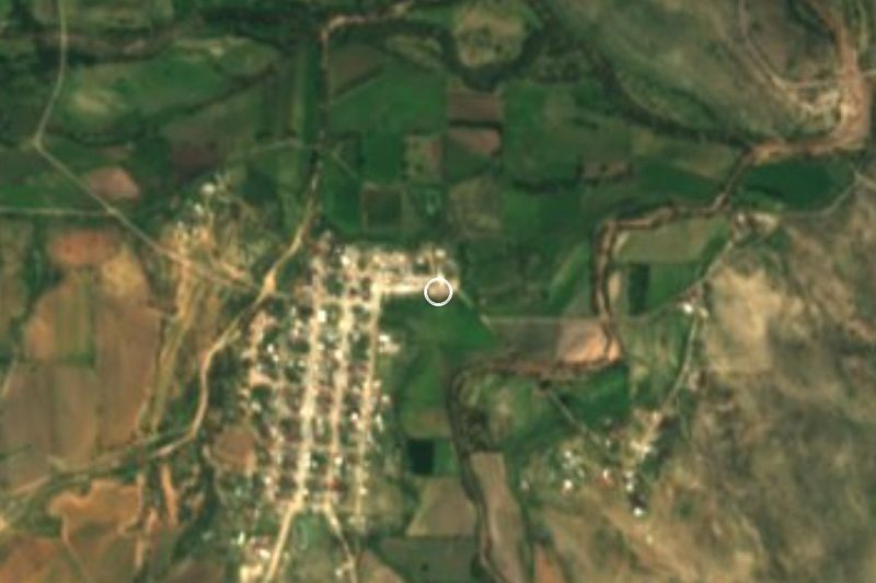


Drive times by road from OpenStreetMap, without traffic. Times marked ~ are estimated from the straight-line distance.
Location from OpenStreetMap. Written by Puebloteca.