

City Puerto Peñasco, Sonora Sonora coast
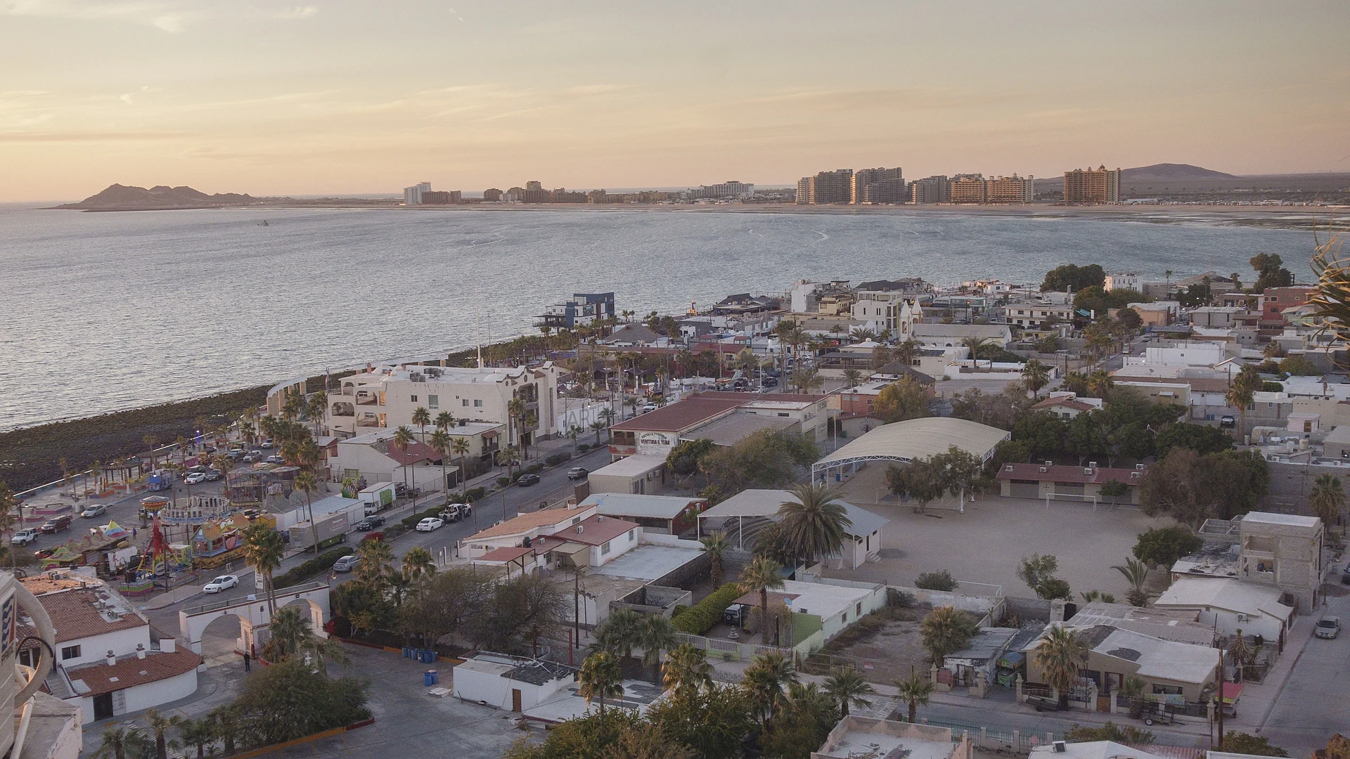
Rocky Point, the beach town closest to Arizona: a shrimp-boat harbor, a seafront malecón, long sandy beaches and the Pinacate desert inland.
From Caborca: 2 h 40 min by car (180 km by road) How to get there ↓
Plan your visit to Puerto Peñasco
Where to stay near Puerto Peñasco
Compare hotels, posadas and guest houses in Puerto Peñasco.
Tours to Puerto Peñasco
Day trips and guided outings from Sonora often include Puerto Peñasco; with a local guide you can get there without a car.
How to get to Puerto Peñasco
- From Caborca: about 2 h 40 min by road (~180 km)
Links open a partner site. We may earn a commission if you book, at no cost to you.
About Puerto Peñasco
Puerto Peñasco is a beach and fishing city in the north-west corner of Sonora, on the northern shore of the Gulf of California, roughly 100 kilometers south of the Arizona border. It had 62,689 people at the 2020 census. It sits in the Altar Desert, one of the driest and hottest parts of the Sonoran Desert, on the narrow strip of land that joins the Baja California peninsula to the rest of Mexico. In English it is Rocky Point, a name given by a British naval officer, Robert William Hale Hardy, who sailed here looking for pearls in 1826; the Spanish name refers to the same thing, the dark volcanic rock where old lava flows ran into the sea. Phoenix and Tucson are both about 350 kilometers away, which is why it is often called Arizona's beach.
For a long time this was only a seasonal camp for fishermen from Guaymas, Bahía de Kino and other ports, who came for the totoaba; with no drinking water, nobody stayed. Things changed in the 1930s, when the railway linking Baja California with the rest of Mexico passed through, and the town and port were laid out in the 1940s as shrimp fishing took off. Puerto Peñasco split from the municipality of Caborca in 1952. In 1993 government and private investors set out to turn it into a resort, and the area was included in the border free zone, so visitors from the US can drive down without a visa (a passport is still needed). Condominiums and hotels now line much of the coast, and many residents are American or Canadian.
The old town lies between the sea and the Cerro de la Ballena, a hill by the port whose lookout gives the classic view north over the harbor, the waterfront and the resort towers of Sandy Beach. Below it, the Malecón Fundadores runs along the water with shops and seafood restaurants, the shrimp fleet ties up in the fishing harbor, and the Monumento al Camaronero honors the men who work the boats. The tides here are big, rising and falling up to 8 meters, and low tide uncovers rock pools along the shore. The beaches spread out on both sides of town: Sandy Beach and La Choya to the north-west, Las Conchas and the Estero Morúa, a bird-filled estuary, to the south-east.
Inland, the Reserva de la Biosfera El Pinacate y Gran Desierto de Altar, a UNESCO World Heritage site of more than 714,000 hectares, protects dunes, old lava fields and giant craters such as El Elegante, where NASA astronauts once trained; its main entrance is at km 52 of Highway 8. Back in town, the CET-MAR aquarium shows turtles, octopus and fish of the gulf, and boats leave for fishing, snorkeling and sunset cruises. The fishing festival starts on Navy Day, June 1, with mariachis, folk dance and a festival queen.
How to get to Puerto Peñasco
Drive from Caborca: 2 h 40 min, 180 km
Most visitors drive. From Phoenix or Tucson it is about 350 km, roughly 3½ hours: Arizona Route 85 leads south through Gila Bend and Ajo to the Lukeville border crossing, and from Sonoyta, Mexican Highway 8 runs straight to Puerto Peñasco, about an hour from the border. From Southern California, cross at San Luis Río Colorado and take Highway 3 along the coast via El Golfo de Santa Clara. Albatros buses connect Puerto Peñasco with Hermosillo and other Sonoran cities. The Mar de Cortés International Airport has no regular scheduled flights.
Directions to Puerto Peñasco on Google Maps
Distances are in a straight line; the road is usually longer.
Links open a partner site. We may earn a commission if you book, at no cost to you.
From the nearest cities to Puerto Peñasco
- Caborca · 180 km by road, 2 h 40 min
- San Luis Río Colorado · 238 km by road, 3 h 25 min
- Mexicali · 319 km by road, 4 h 25 min
Drive times by road from OpenStreetMap, without traffic or stops. Times marked ~ are estimated from the straight-line distance.
Before you go to Puerto Peñasco: hours, prices and tips
- Best season
- The fishing festival opens on Navy Day, June 1, with mariachis, folk dance and a festival queen; Memorial Day weekend can bring more than 30,000 visitors. Wikipedia / Uno TV · checked Oct 2026
- Rules
- Driving in from the US, you need a passport and Mexican auto insurance (US policies are not valid), but no visa: the town is in the border free zone. Lukeville crossing is open 6:00 to midnight. Wikivoyage · checked Oct 2026
Hours and prices change, especially around holidays. Each fact links to where we checked it.
Visiting Puerto Peñasco: what to see and do
Climb the Cerro de la Ballena for the view over the harbor and the coast.
Walk the Malecón Fundadores and eat shrimp and fish by the fishing harbor.
Explore the rock pools at low tide, when the sea pulls back up to 8 meters.
Spend a beach day at Sandy Beach, La Choya or Las Conchas.
Visit the CET-MAR aquarium for turtles, octopus and gulf fish.
Drive to El Pinacate biosphere reserve for lava fields, dunes and the El Elegante crater.
Plan your trip
Places to stay in Puerto Peñasco
Compare hotels, posadas, and rentals in and around Puerto Peñasco.
Tours & activities
Day trips and guided outings from Sonora often include Puerto Peñasco; with a local guide you can get there without a car.
Mobile data
Signal can drop away from Sonora: download a map of the way to Puerto Peñasco before you set out, or carry an eSIM with data.
Links open a partner site. We may earn a commission if you book, at no cost to you.
Photos
Location from OpenStreetMap. Written by Puebloteca.