Lake Chihuahua Municipality of Chihuahua
A 1908 dam on the Río Chuvíscar at the western edge of Chihuahua City, next to El Rejón; a small reservoir that still stores drinking water.
From Chihuahua: about 5 min by road (~10 km) How to get there ↓
Near here
See everything nearby ↓


Plan your visit to Presa Chuvíscar
Where to stay near Presa Chuvíscar
Compare hotels, posadas and guest houses in Presa Chuvíscar.
Tours to Presa Chuvíscar
Day trips and guided outings from Chihuahua often include Presa Chuvíscar; with a local guide you can get there without a car.
How to get to Presa Chuvíscar
- From Chihuahua: about 5 min by road (~10 km)
Links open a partner site. We may earn a commission if you book, at no cost to you.
About Presa Chuvíscar
The Chuvíscar Dam is the reservoir Chihuahua City built in the early 1900s to secure its water supply. It opened on September 16, 1908, held five million cubic meters and cost one million pesos at the time. An engineer named Aguilar drew up the preliminary study, Manuel Marroquín y Rivera produced the final design, and the contractors Shepherd and McQuatters built it.
The dam holds back the Río Chuvíscar, which rises to the west in the Cañada del Chivato and runs about 120 km east. Just before the city the river is stopped twice: first by the Chihuahua Dam, then by the Chuvíscar, right on the urban edge. From there it runs in a concrete channel straight through the capital, splitting it in two, picks up the Río Sacramento on the way out, passes Aldama and San Diego de Alcalá, and joins the Conchos at a spot called Babisas.
Today it is a minor storage basin for drinking water, a few meters from the El Rejón dam, and it is usually left off the state's reservoir reports. It fills quickly in heavy rain: it began spilling during the June 2021 downpours and spilled again in August 2022, weeks before the city's other reservoirs came close.
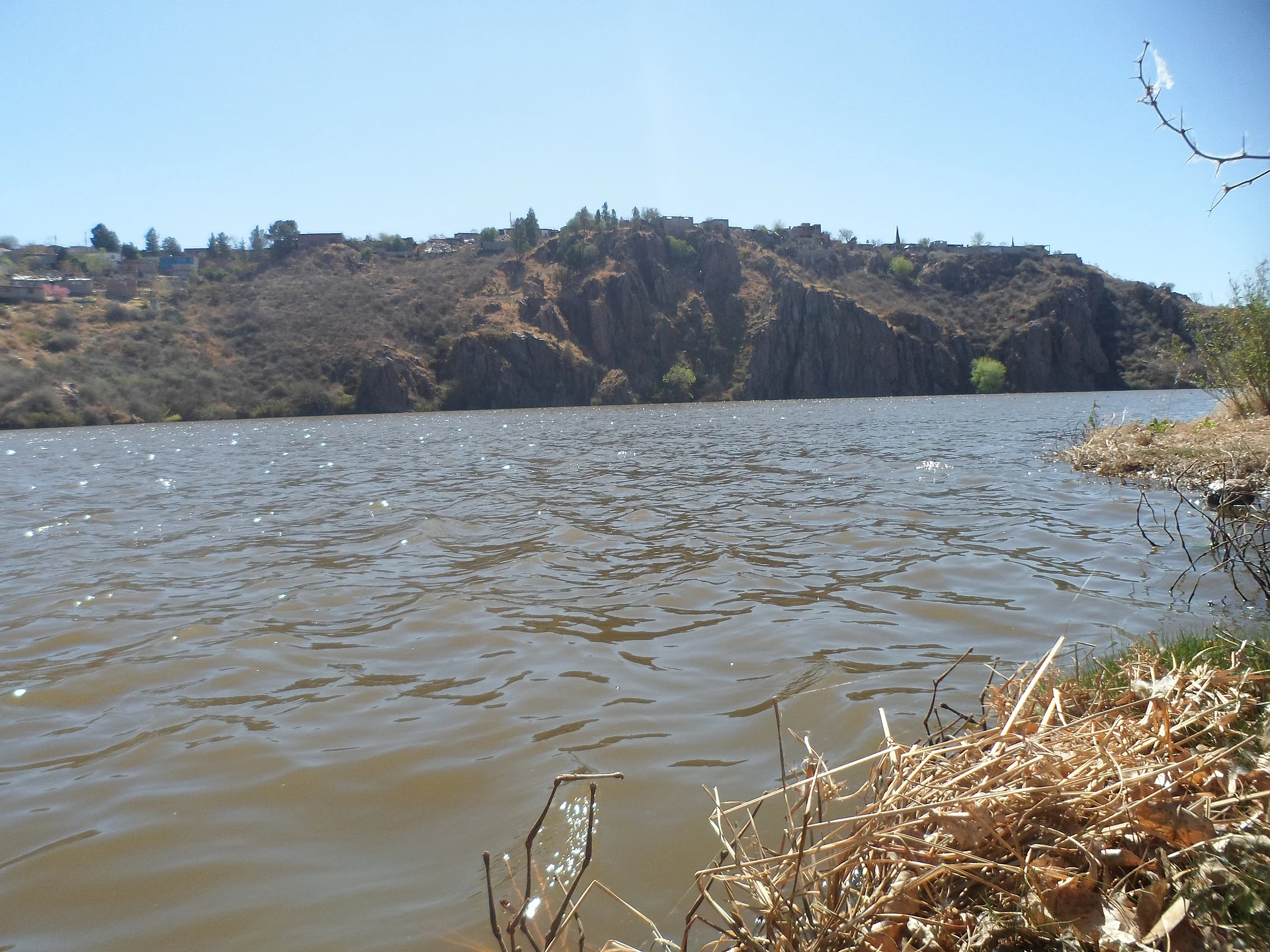
The shore is lined with brown rock bluffs topped by houses, and the water is usually muddy. Come to see a full reservoir after the summer rains and the waterworks that kept the city going more than a century ago; it is not a swimming spot.
How to get to Presa Chuvíscar
The dam sits on the western edge of Chihuahua City, about 10 minutes and 8 km by road from downtown, right next to the El Rejón dam. Follow the Río Chuvíscar upstream, west: the river runs in a channel through the whole city and the dam is the first reservoir you reach as you leave the built-up area. The whole way is paved city streets.
Without a car, the simplest option is a taxi or ride-hail car to El Rejón from downtown or from Chihuahua's Central de Autobuses. The Chihuahua Dam, the other reservoir on the same river, lies farther upstream to the southwest.
Creel, the nearest Pueblo Mágico, is about 176 km away, out past Cuauhtémoc in the sierra.
Directions to Presa Chuvíscar on Google Maps
Distances are in a straight line; the road is usually longer.
Links open a partner site. We may earn a commission if you book, at no cost to you.
From the nearest cities to Presa Chuvíscar
- Chihuahua · about 10 km by road, ~5 min
- Delicias · about 100 km by road, ~1 h 30 min
- Cuauhtémoc · about 100 km by road, ~1 h 30 min
Drive times by road from OpenStreetMap, without traffic or stops. Times marked ~ are estimated from the straight-line distance.
Visiting Presa Chuvíscar: what to see and do
The reservoir brimming after the July and August rains
The spillway when the dam overflows
The rock bluffs that hem in the water
The neighboring El Rejón dam, a few meters away
The Chuvíscar's concrete channel running down toward downtown
Plan your trip
Places to stay in Presa Chuvíscar
Compare hotels, posadas, and rentals in and around Presa Chuvíscar.
Tours & activities
Day trips and guided outings from Chihuahua often include Presa Chuvíscar; with a local guide you can get there without a car.
Travel insurance
If you plan on swimming or kayaking at Presa Chuvíscar, check that your policy covers it: some plans leave adventure activities out.
Mobile data
Signal can drop away from Chihuahua: download a map of the way to Presa Chuvíscar before you set out, or carry an eSIM with data.
Links open a partner site. We may earn a commission if you book, at no cost to you.
Closest to Presa Chuvíscar
-
Centro Histórico de Chihuahua · Landmark · 6 km away
-
Chihuahua · City · 6 km away
-
Grutas Nombre de Dios · Cave · 13 km away
-
Santa Eulalia · Town · 22 km away
-
Juan Aldama · Town · 33 km away
-
Parque Nacional Cumbres de Majalca · Nature reserve · 42 km away
Near Presa Chuvíscar
-
Cuauhtémoc · City
~1 h 30 min drive · 77 km -
Delicias · City
~1 h 30 min drive · 78 km


Drive times by road from OpenStreetMap, without traffic. Times marked ~ are estimated from the straight-line distance.
Lists with Presa Chuvíscar
Lakes and Lagoons in Chihuahua · 4Location from OpenStreetMap. Written by Puebloteca.