

Island Manzanillo, Colima Municipality of Manzanillo Colima coast
Four remote volcanic islands in the Pacific, part of Colima: a UNESCO site and huge marine park reached only by liveaboard dive boats from Cabo San Lucas.
Reached by boat from Cabo San Lucas: 26 h each way. How to get there ↓
Plan your visit to Islas Revillagigedo
Where to stay near Islas Revillagigedo
Compare hotels, posadas and guest houses in Islas Revillagigedo.
Tours to Islas Revillagigedo
Day trips and guided outings from Colima often include Islas Revillagigedo; with a local guide you can get there without a car.
How to get to Islas Revillagigedo
- Reached by boat from Cabo San Lucas: 26 h each way.
- From San José del Cabo: about 30 min by road (~32 km)
Links open a partner site. We may earn a commission if you book, at no cost to you.
About Islas Revillagigedo
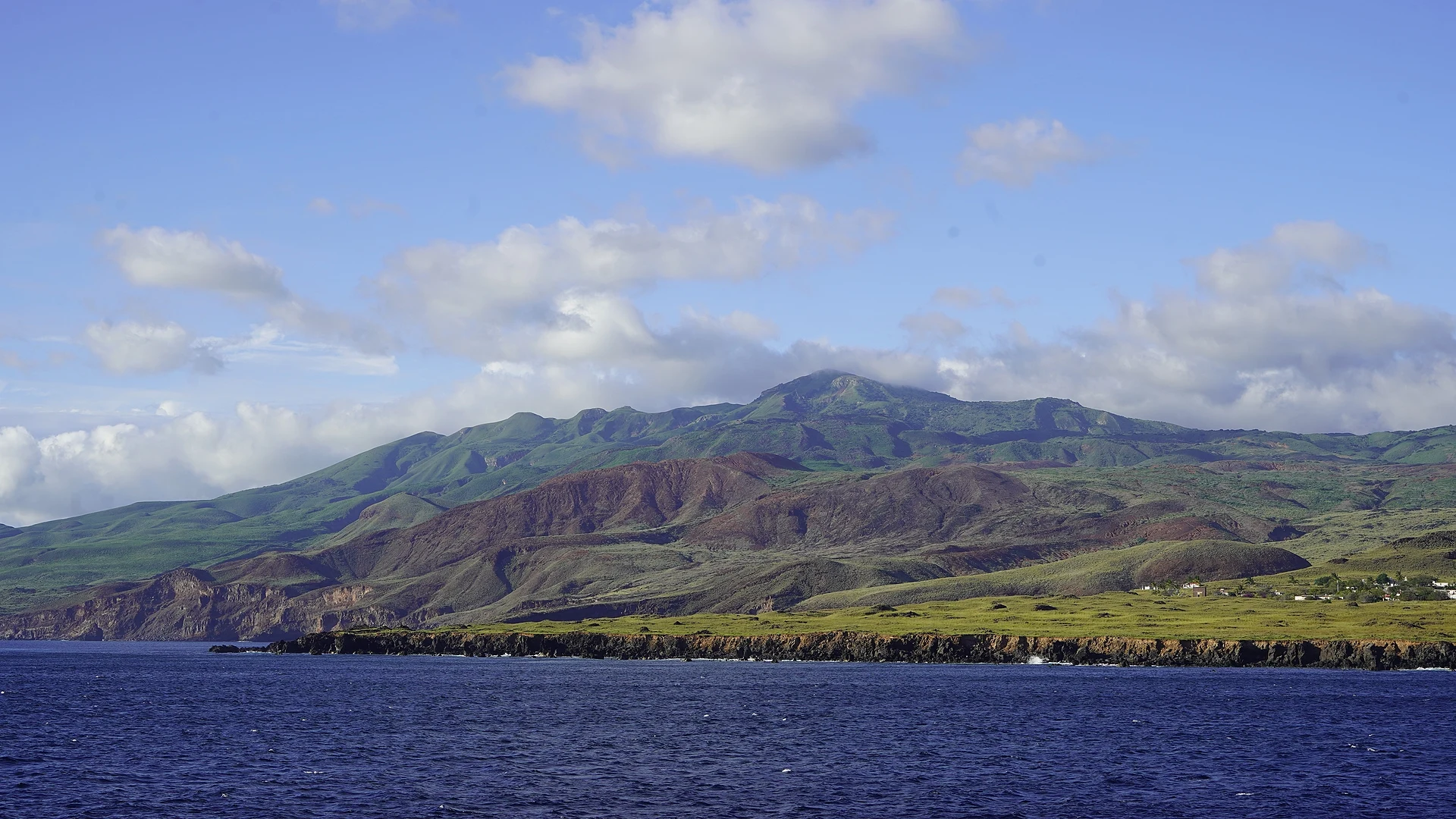
The Revillagigedo Islands are a group of four volcanic islands in the open Pacific: Socorro, San Benedicto, Roca Partida and Clarión. They lie about 460 km south and southwest of Cabo San Lucas and between about 700 and 1,100 km west of Manzanillo, spread over some 420 km from east to west, with a total land area of about 158 km². Socorro is by far the largest, at 132 km², and rises to 1,130 m at Cerro Evermann; San Benedicto (6 km²) is crowned by the Bárcena volcano, Clarión (20 km²) lies more than 200 km to the west, and Roca Partida is a bare rock 34 m high. The islands are federal territory, but a decree signed by Benito Juárez in 1861 gave them to the state of Colima, originally for a penal colony that was never built, and they are counted as part of the municipality of Manzanillo.
Spanish sailors from Hernando de Grijalva's expedition sighted Socorro and San Benedicto in December 1533, and Ruy López de Villalobos passed again in 1542 and first reported Roca Partida. The group takes its name from the Count of Revillagigedo, viceroy of New Spain in the 1790s. The islands are still volcanically active: on 1 August 1952 Bárcena erupted and almost wiped out life on San Benedicto, and Socorro last erupted in 1993. The only residents are Mexican Navy personnel, at a base on Socorro set up in 1957 and a smaller post on Clarión. Isolation has produced a distinctive wildlife, which has earned the islands the nickname of Mexico's little Hawaii: 14 of the 16 resident land-bird taxa are endemic, the Socorro dove survives only in captivity, and the Socorro mockingbird numbers fewer than 400 birds.
The islands became a biosphere reserve in 1994, were inscribed as a UNESCO World Heritage Site in July 2016, and in November 2017 Mexico declared the Revillagigedo National Park, a marine protected area of about 150,000 km² where all fishing, mining and tourism development are banned. For visitors, the islands are one of the world's great big-animal dive sites: giant manta rays at the cleaning stations of San Benedicto, sharks around Roca Partida, and dolphins and other cetaceans. There are no tourist facilities and no reliable fresh water on the islands, so trips are made on liveaboard boats that cross from Cabo San Lucas in about 24 to 30 hours and stay at sea for a week or more, with dives rotating between Socorro, San Benedicto and Roca Partida.
How to get to Islas Revillagigedo
Drive from San José del Cabo to Cabo San Lucas: 30 min, 32 km
The islands can only be visited by sea, on liveaboard dive boats that sail from Cabo San Lucas, about 460 km away; the crossing takes about 24 to 30 hours each way and most trips last 8 to 10 days. A few expeditions also leave from Manzanillo, a much longer crossing. There are no flights for visitors (Socorro has only a small military airstrip) and no accommodation on land.
Reached by boat from Cabo San Lucas: 26 h each way.
Directions to Islas Revillagigedo on Google Maps
Distances are in a straight line; the road is usually longer.
Links open a partner site. We may earn a commission if you book, at no cost to you.
From the nearest cities to Islas Revillagigedo
- San José del Cabo · 32 km by road, 30 min to Cabo San Lucas, then 26 h by boat
- La Paz · 161 km by road, 2 h 15 min to Cabo San Lucas, then 26 h by boat
- Culiacán · about 435 km by road, ~6 h 25 min to Cabo San Lucas, then 26 h by boat
Drive times by road from OpenStreetMap, without traffic or stops. Times marked ~ are estimated from the straight-line distance.
Before you go to Islas Revillagigedo: hours, prices and tips
- Entry
- Federal park fee of MXN 3,622.02 per person per diving day under the Ley Federal de Derechos, usually collected in advance by the dive boat; one 2026 report quotes MXN 3,760. Students and teachers may get 50% off with prior CONANP approval. Bluewater Dive Travel · checked Oct 2026
- Best season
- Liveaboard trips run only from November to June. ZuBlu · checked Oct 2026
- Rules
- There are no tourist facilities or reliable fresh water on the islands; visitors stay aboard their vessel. Fishing, mining and tourism development are banned throughout the national park. Wikipedia · checked Oct 2026
Hours and prices change, especially around holidays. Each fact links to where we checked it.
Visiting Islas Revillagigedo: what to see and do
Dive with giant manta rays at the cleaning stations of San Benedicto.
See sharks around Roca Partida, a lone rock in open ocean.
Look for dolphins and other cetaceans between dives.
See the bare ash cone of the Bárcena volcano, which erupted in 1952, from the boat.
Watch Socorro's green volcanic slopes rise to Cerro Evermann, the archipelago's high point.
Plan your trip
Places to stay in Islas Revillagigedo
Compare hotels, posadas, and rentals in and around Islas Revillagigedo.
Tours & activities
Day trips and guided outings from Colima often include Islas Revillagigedo; with a local guide you can get there without a car.
Mobile data
Signal can drop away from Colima: download a map of the way to Islas Revillagigedo before you set out, or carry an eSIM with data.
Links open a partner site. We may earn a commission if you book, at no cost to you.
Photos
Location from OpenStreetMap. Written by Puebloteca.