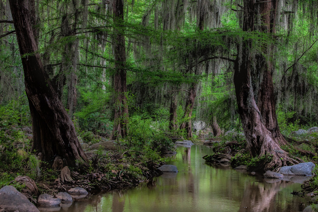
Nature reserve Victoria, Tamaulipas Municipality of Victoria
The mountain canyon ten minutes from Ciudad Victoria: a river of pools, the El Nacimiento waterfall and a 20 km climb into pine forest.
From Ciudad Victoria: 15 min by car (11 km by road) How to get there ↓
Near here
See everything nearby ↓


Plan your visit to Cañón de la Peregrina
Where to stay near Cañón de la Peregrina
Compare hotels, posadas and guest houses in Cañón de la Peregrina.
Tours to Cañón de la Peregrina
Day trips and guided outings from General Zaragoza often include Cañón de la Peregrina; with a local guide you can get there without a car.
How to get to Cañón de la Peregrina
- From Ciudad Victoria: about 15 min by road (~11 km)
- Nearest airport: Ciudad Victoria (CVM), 4 h 14 min by car to General Zaragoza
Links open a partner site. We may earn a commission if you book, at no cost to you.
About Cañón de la Peregrina
The Cañón de la Peregrina is the ravine that opens into the Sierra Madre Oriental right behind Ciudad Victoria, inside the Altas Cumbres protected area, which since 1997 has conserved more than 30,000 hectares of mountains around the state capital. Along its floor runs a river some call the Troncones and others the San Felipe, through riverside woodland that changes as you gain height, and the way in is through the Los Troncones ecological park at the foot of the range, beyond the village of La Libertad.
The park has a family area with barbecue grills and shaded tables by the river. From there a dirt track and footpath head up the canyon, crossing the water several times. About 5.5 km in is the waterfall many people call La Playita and locals have always known as El Nacimiento: the water falls in a curtain into a pool with a sandy edge, shallow enough for small children to paddle safely. It is the most popular spot and gets crowded on long weekends and holidays. Beyond 6 or 7 km the pools are cleaner and quieter; around kilometre 8 is El Santito, the usual rest stop, and around kilometre 11 the last pools.
There the trail leaves the river and the hard part begins: about 10 km more of climbing, as the vegetation changes, up to Rancho El Molino among pines with high-mountain views. Visitors are asked to carry out all their rubbish and leave the place better than they found it.
How to get to Cañón de la Peregrina
Drive from Ciudad Victoria: 15 min, 11 km
From downtown Ciudad Victoria head north on the carretera interejidal; at kilometre 3.5 turn left toward the village of La Libertad, pass its main square and the entrance to Los Troncones park comes right after, 10 to 15 minutes in all. Leave the car there and continue on foot up the canyon. Victoria's bus station has services from Tampico, Monterrey, Matamoros and San Luis Potosí (Transpaís, Estrella Blanca), but no intercity buses reach the park. The nearest Pueblo Mágico is Tula, about 155 km (2.5 hours) away on federal highway 101.
Directions to Cañón de la Peregrina on Google Maps
Distances are in a straight line; the road is usually longer.
Links open a partner site. We may earn a commission if you book, at no cost to you.
From the nearest cities to Cañón de la Peregrina
- Ciudad Victoria · 11 km by road, 15 min
- Linares · 152 km by road, 2 h
- Ciudad Mante · 147 km by road, 2 h 25 min
Drive times by road from OpenStreetMap, without traffic or stops. Times marked ~ are estimated from the straight-line distance.
Before you go to Cañón de la Peregrina: hours, prices and tips
- Best time of day
- The El Nacimiento pool fills up on long weekends and in holiday periods; on weekdays it is much quieter. POSTA México · checked Oct 2026
Hours and prices change, especially around holidays. Each fact links to where we checked it.
Visiting Cañón de la Peregrina: what to see and do
Have a riverside barbecue in Los Troncones park.
Walk 5.5 km up the canyon to the El Nacimiento waterfall and pool, also called La Playita.
Keep going to the quieter pools beyond 7 km and rest at El Santito.
If you are fit, climb to Rancho El Molino among the pines, about 20 km from the park.
Plan your trip
Places to stay in Cañón de la Peregrina
Compare hotels, posadas, and rentals in and around Cañón de la Peregrina.
Tours & activities
Day trips and guided outings from General Zaragoza often include Cañón de la Peregrina; with a local guide you can get there without a car.
Rental cars
Pick up a car at CVM (Ciudad Victoria): about 4 h 14 min by road to General Zaragoza, then 57 km more to Cañón de la Peregrina, on your own schedule.
Flights
The nearest airport with scheduled flights is Ciudad Victoria (CVM), about 4 h 14 min by road from General Zaragoza, the base for Cañón de la Peregrina.
Travel insurance
If you plan on hiking at Cañón de la Peregrina, check that your policy covers it: some plans leave adventure activities out.
Mobile data
Signal can drop away from General Zaragoza: download a map of the way to Cañón de la Peregrina before you set out, or carry an eSIM with data.
Links open a partner site. We may earn a commission if you book, at no cost to you.
When to go to Cañón de la Peregrina cool
Cañón de la Peregrina shares the climate of General Zaragoza, 57 km away. The best months to visit are April, May, and June.
See the month-by-month climate of General Zaragoza
Weather in Cañón de la Peregrina now and the next 7 days
Live forecast from Open-Meteo. Chance of rain is the day's highest.
The closest Pueblo Mágico: General Zaragoza

General Zaragoza is the Pueblo Mágico closest to Cañón de la Peregrina, with places to stay, food, and more to see.
Closest to Cañón de la Peregrina
-
Centro Histórico de Ciudad Victoria · Landmark · 8 km away
-
Zona Arqueológica Balcón de Montezuma · Archaeological site · 22 km away
-
Nueva Villa de Padilla · Town · 41 km away
-
Jaumave · Town · 47 km away
Near Cañón de la Peregrina


Drive times by road from OpenStreetMap, without traffic. Times marked ~ are estimated from the straight-line distance.
Location from OpenStreetMap. Written by Puebloteca.