Village Chenalhó, Chiapas Chiapas Highlands
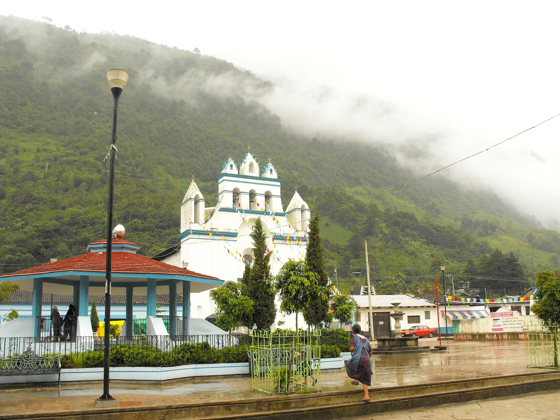
Tsotsil municipal seat at 1,615 m in the Highlands, with the San Pedro Apóstol parish, about 27 km by road from San Cristóbal.
From San Cristóbal de las Casas: 30 min by car (27 km by road) How to get there ↓
Near here
See everything nearby ↓


Plan your visit to Chenalhó
Where to stay near Chenalhó
Compare hotels, posadas and guest houses in Chenalhó.
Tours to Chenalhó
Day trips and guided outings from San Cristóbal de Las Casas often include Chenalhó; with a local guide you can get there without a car.
 Tours from San Cristóbal de las Casas
Customs of indigenous villages of Chiapas
★ 4.9 (83) · From US$71
How to get to Chenalhó
- From San Cristóbal de las Casas: about 30 min by road (~27 km)
- Nearest airport: Tuxtla Gutiérrez (TGZ), 1 h 17 min by car to San Cristóbal de Las Casas
Links open a partner site. We may earn a commission if you book, at no cost to you.
Tours from San Cristóbal de las Casas, near Chenalhó


Tours, prices and ratings from Viator, checked weekly. We may earn a commission if you book.
About Chenalhó
Chenalhó is the seat of the municipality of the same name, in the Chiapas Highlands at roughly 1,615 metres. The name is Tsotsil and means “water of the cave”. In 2020 the town had 4,369 residents, about 96 percent of them indigenous, and it is the biggest of 145 localities in a municipality of 47,371 people; Polhó (2,176) and Belisario Domínguez (1,636) come next. The municipality was created on 8 May 1935 and shares borders with Chamula, Mitontic, Pantelhó, Chalchihuitán, Larráinzar, Aldama, Tenejapa and Cancuc.
The land is steep sierra, about 90 percent of it very rugged, covered in pine-oak forest and soaked by 2,000 to 3,000 mm of rain a year, so pack a jacket and rain gear. Chenalhó Tsotsil is counted as its own variety of the language. The Catholic parish in the seat is San Pedro Apóstol, part of the diocese of San Cristóbal de las Casas.
This is a working community, not a place set up for tourists: you come for the centre, the church and the mountain scenery. The municipality also carries a painful recent history that visitors should know about. In Acteal, inside the municipality, 45 Tsotsil people were killed on 22 December 1997; a boundary dispute with Chalchihuitán displaced thousands of people from 2017; and in September 2022 about 200 people from Santa Martha fled another armed land conflict. Checking conditions before you travel is part of the trip.
How to get to Chenalhó
Drive from San Cristóbal de las Casas: 30 min, 27 km
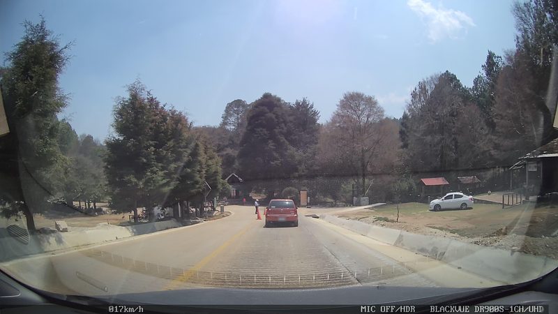
From San Cristóbal de las Casas it is about 27 km and roughly 30 to 35 minutes by car, climbing into the Highlands through the Chamula and Mitontic area, two municipalities that border Chenalhó. There is no airport nearby; the closest for this region is Tuxtla Gutiérrez, and you continue from there to San Cristóbal.
By public transport the trip is made by colectivo and combi from San Cristóbal. I could not find a published timetable, line name or exact departure point, and I could not confirm any first-class coach (OCC, ADO) that runs here directly. The safest bet is to ask in San Cristóbal, at the market or your hotel, when the next one leaves; allow about an hour of travel and expect vans to wait until they fill.
Before you go, ask about current road and area conditions, especially if you plan to continue to Chalchihuitán, Pantelhó or Polhó.
Directions to Chenalhó on Google Maps
Distances are in a straight line; the road is usually longer.
Links open a partner site. We may earn a commission if you book, at no cost to you.
From the nearest cities to Chenalhó
- San Cristóbal de las Casas · 27 km by road, 30 min
- Tuxtla Gutiérrez · 88 km by road, 1 h 25 min
- Comitán · 115 km by road, 1 h 55 min
Drive times by road from OpenStreetMap, without traffic or stops. Times marked ~ are estimated from the straight-line distance.
Visiting Chenalhó: what to see and do
The San Pedro Apóstol parish and the square of the seat.
Chenalhó Tsotsil, this municipality's own variety of the language; ask permission before photographing people.
The pine-oak hills around the town, at 1,615 metres.
Polhó, the municipality's second-largest locality (2,176 people).
Acteal, in the same municipality, a place of remembrance for the 1997 massacre; go with respect and, ideally, with someone from the area.
Plan your trip
Places to stay in Chenalhó
Compare hotels, posadas, and rentals in and around Chenalhó.
Tours & activities
Day trips and guided outings from San Cristóbal de Las Casas often include Chenalhó; with a local guide you can get there without a car.
Rental cars
Pick up a car at TGZ (Tuxtla Gutiérrez): about 1 h 17 min by road to San Cristóbal de Las Casas, then 17 km more to Chenalhó, on your own schedule.
Flights
The nearest airport with scheduled flights is Tuxtla Gutiérrez (TGZ), about 1 h 17 min by road from San Cristóbal de Las Casas, the base for Chenalhó.
Mobile data
Signal can drop away from San Cristóbal de Las Casas: download a map of the way to Chenalhó before you set out, or carry an eSIM with data.
Links open a partner site. We may earn a commission if you book, at no cost to you.
When to go to Chenalhó cool
Chenalhó shares the climate of San Cristóbal de Las Casas, 17 km away. The best months to visit are January, February, March, and December.
See the month-by-month climate of San Cristóbal de Las Casas
Weather in Chenalhó now and the next 7 days
Live forecast from Open-Meteo. Chance of rain is the day's highest.
The closest Pueblo Mágico: San Cristóbal de Las Casas

San Cristóbal de Las Casas is the Pueblo Mágico closest to Chenalhó, with places to stay, food, and more to see.
Also close to
- Chiapa de Corzo · Chiapas · 46 km away
- Tapijulapa · Tabasco · 65 km away
- Copainalá · Chiapas · 66 km away
Closest to Chenalhó
-
Chalchihuitán · Village · 8 km away
-
San Juan Chamula · Town · 13 km away
-
Romerillo · Town · 15 km away
-
Tenejapa · Town · 15 km away
-
Reserva Ecológica Huitepec · Nature reserve · 16 km away
-
Zinacantán · Town · 18 km away
-
El Arcotete · Nature reserve · 19 km away
-
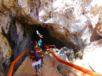
Grutas de Rancho Nuevo · Cave · 25 km away
Near Chenalhó


Drive times by road from OpenStreetMap, without traffic. Times marked ~ are estimated from the straight-line distance.
Location from OpenStreetMap. Written by Puebloteca.