Landmark Barrio Mágico Churches and shrines Indigenous roots Pyramids and ruins Markets and crafts Ocosingo, Chiapas Municipality of Ocosingo Palenque and Northern Chiapas
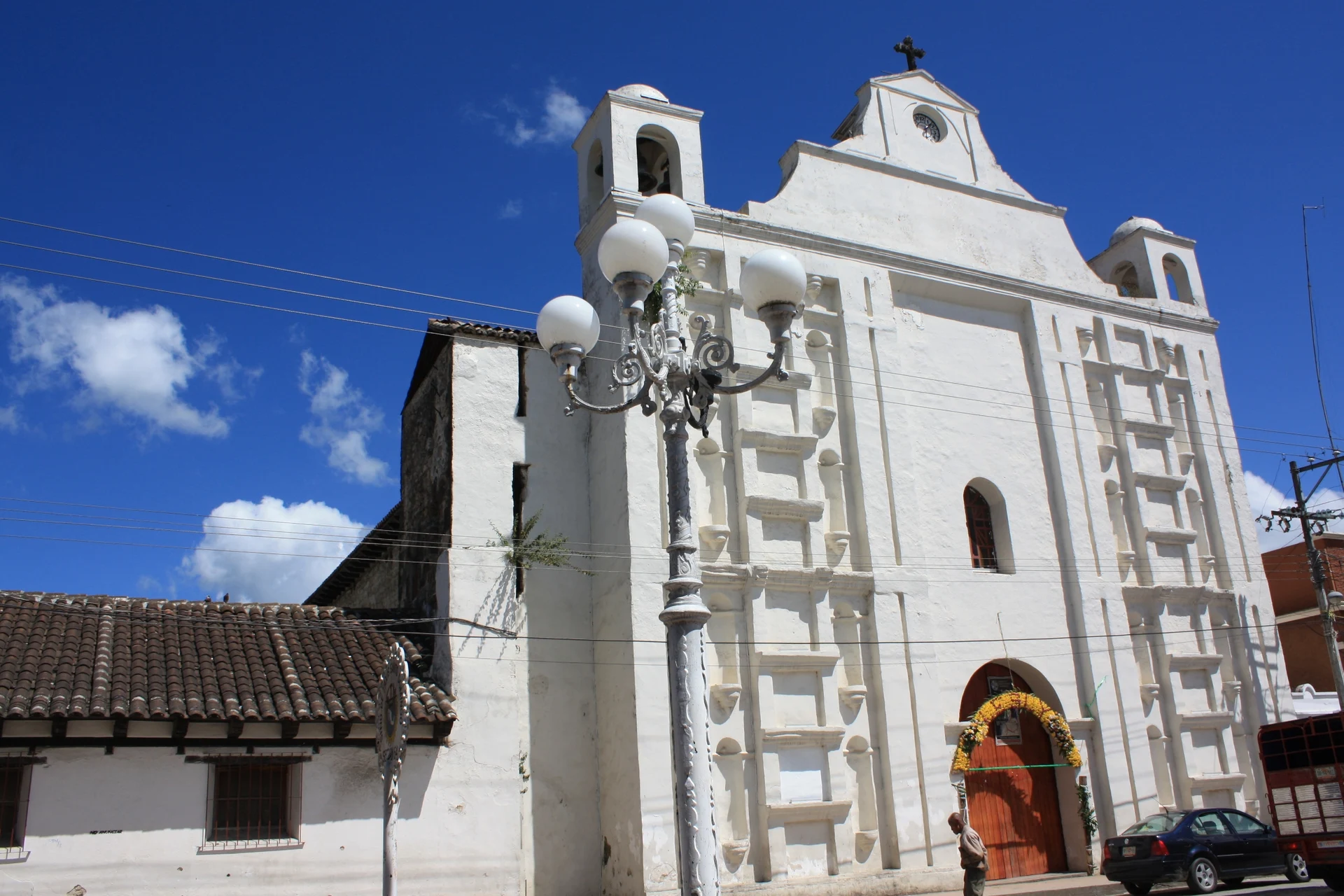
Ocosingo's Tseltal town centre, with the Andador Guadalupano and a 1569 church: Chiapas's first Barrio Mágico (2023), next to Toniná.
From San Cristóbal de las Casas: about 1 h 10 min by road (~80 km) How to get there ↓
Near here
See everything nearby ↓



Plan your visit to Andador Guadalupano (Ocosingo)
Where to stay near Andador Guadalupano (Ocosingo)
Compare hotels, posadas and guest houses in Andador Guadalupano (Ocosingo).
Tours to Andador Guadalupano (Ocosingo)
Look for tours of the area around San Cristóbal de Las Casas that stop at Andador Guadalupano (Ocosingo).
 Tours from San Cristóbal de las Casas
Customs of indigenous villages of Chiapas
★ 4.9 (83) · From US$71
How to get to Andador Guadalupano (Ocosingo)
- From San Cristóbal de las Casas: about 1 h 10 min by road (~80 km)
- Nearest airport: Tuxtla Gutiérrez (TGZ), 1 h 17 min by car to San Cristóbal de Las Casas
Links open a partner site. We may earn a commission if you book, at no cost to you.
Tours from San Cristóbal de las Casas, near Andador Guadalupano (Ocosingo)


Tours, prices and ratings from Viator, checked weekly. We may earn a commission if you book.
About Andador Guadalupano (Ocosingo)
Ocosingo is a town of about 47,700 people (2020 census), many of them Tseltal Maya, set at 893 metres in a valley between the Chiapas highlands and the Lacandon Jungle. It is the seat of the largest municipality in the state. In July 2023 Mexico's federal Tourism Secretariat (SECTUR) gave the Barrio Mágico designation to the Ocosingo district, the first in Chiapas; it centres on the Andador Guadalupano, the pedestrian street downtown, and the area around the main square.
The name comes from Tseltal and is usually translated as "place of the ocote", after the resinous pines of the valley. It was already a sizeable Tseltal settlement before the Spanish arrived, and in the mid-16th century the friar Pedro Lorenzo resettled villages from the jungle here. The church of San Jacinto de Polonia, built in 1569 as the seat of a Dominican convent, faces the central park next to the Porfirian-style town hall, and a public water basin from 1890 survives nearby. In 1994 the Zapatista army occupied the town, and unlike most of the places it took, Ocosingo saw several days of heavy fighting when the federal army arrived.
The Andador Guadalupano runs under arched trellises of climbing plants, lined with painted facades, murals, small restaurants serving regional food and craft shops; it is a quiet stroll by day and lit up at night. About 500 metres east of the park, the Belisario Domínguez market fills several blocks, and the Mercado Nuevo de la Selva stands on the southern edge of town. The local product is queso de bola, made here since 1927, when it started on the Laltic ranch: a double-cream centre inside a rind of skimmed-milk cheese that keeps without refrigeration. It is crumbled over beans, stuffed with spiced pork, or its rind is fried into cheese crackling. The main festival is the fair of San Jacinto de Polonia in August.
Ocosingo is also the base for the Toniná archaeological site, about 10 km east, whose stepped acropolis rises some 75 metres; it was closed from September 2023 and reopened on 21 March 2026. The dry season runs from November to April, and from May to October it rains often, mostly in the afternoon. Cash machines are few, so bring cash.
How to get to Andador Guadalupano (Ocosingo)
Ocosingo sits on Federal Highway 199 between San Cristóbal de las Casas and Palenque: 94 km and about 1 h 30 min by car from San Cristóbal, and around 120 km of curves from Palenque. Air travellers usually fly into Tuxtla Gutiérrez and continue overland to San Cristóbal. Shared vans (colectivos) run from San Cristóbal in about 2 to 2.5 hours for 120 pesos, and there are colectivos from Palenque and from Comitán via Altamirano, about 2 hours. OCC has a terminal in Ocosingo, on the Carretera Internacional at Avenida Cuarta Norte Poniente, with departures to San Cristóbal, Palenque and Mexico City; check times first, as bus service on this road has been interrupted at times. The centre is walkable, and colectivos to Toniná leave from beside the municipal market.
Directions to Andador Guadalupano (Ocosingo) on Google Maps
Distances are in a straight line; the road is usually longer.
Links open a partner site. We may earn a commission if you book, at no cost to you.
From the nearest cities to Andador Guadalupano (Ocosingo)
- San Cristóbal de las Casas · about 80 km by road, ~1 h 10 min
- Palenque · about 90 km by road, ~1 h 20 min
- Comitán · about 95 km by road, ~1 h 25 min
Drive times by road from OpenStreetMap, without traffic or stops. Times marked ~ are estimated from the straight-line distance.
Visiting Andador Guadalupano (Ocosingo): what to see and do
The Andador Guadalupano, the pedestrian street with trellised arches, murals and eateries, best at night
The church of San Jacinto de Polonia (1569) on the central park
The Porfirian town hall and the fountain in the central park
The public water basin of 1890
The Belisario Domínguez market, several blocks long
Queso de bola at the market or on the farms of the cheese route
The Toniná archaeological site, about 10 km east
The fair of San Jacinto de Polonia in August
Plan your trip
Places to stay in Andador Guadalupano (Ocosingo)
Compare hotels, posadas, and rentals in and around Andador Guadalupano (Ocosingo).
Tours & activities
Look for tours of the area around San Cristóbal de Las Casas that stop at Andador Guadalupano (Ocosingo).
Rental cars
Pick up a car at TGZ (Tuxtla Gutiérrez): about 1 h 17 min by road to San Cristóbal de Las Casas, then 61 km more to Andador Guadalupano (Ocosingo), on your own schedule.
Flights
The nearest airport with scheduled flights is Tuxtla Gutiérrez (TGZ), about 1 h 17 min by road from San Cristóbal de Las Casas, the base for Andador Guadalupano (Ocosingo).
Mobile data
Signal can drop away from San Cristóbal de Las Casas: download a map of the way to Andador Guadalupano (Ocosingo) before you set out, or carry an eSIM with data.
Links open a partner site. We may earn a commission if you book, at no cost to you.
When to go to Andador Guadalupano (Ocosingo) cool
Andador Guadalupano (Ocosingo) shares the climate of San Cristóbal de Las Casas, 61 km away. The best months to visit are January, February, March, and December.
See the month-by-month climate of San Cristóbal de Las Casas
Weather in Andador Guadalupano (Ocosingo) now and the next 7 days
Live forecast from Open-Meteo. Chance of rain is the day's highest.
The closest Pueblo Mágico: San Cristóbal de Las Casas

San Cristóbal de Las Casas is the Pueblo Mágico closest to Andador Guadalupano (Ocosingo), with places to stay, food, and more to see.
Also close to
Closest to Andador Guadalupano (Ocosingo)
-
Toniná · Archaeological site · 9 km away
-
Agua Azul · Waterfall · 39 km away
-
Agua Clara · Nature reserve · 40 km away
-
Tenejapa · Town · 45 km away
-
Tumbalá · Village · 47 km away
-
Cascadas de Roberto Barrios · Waterfall · 50 km away
-
Profesor Roberto Barrios · Village · 50 km away

Near Andador Guadalupano (Ocosingo)




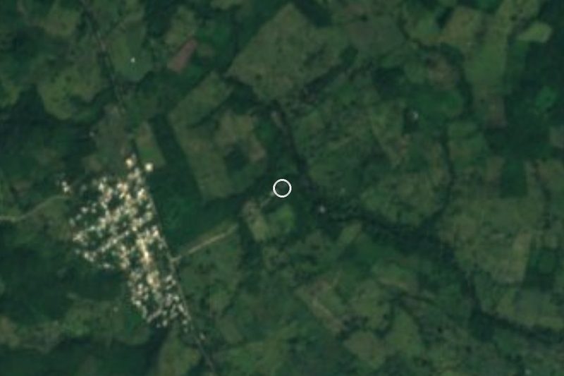


Drive times by road from OpenStreetMap, without traffic. Times marked ~ are estimated from the straight-line distance.
Location from OpenStreetMap. Written by Puebloteca.