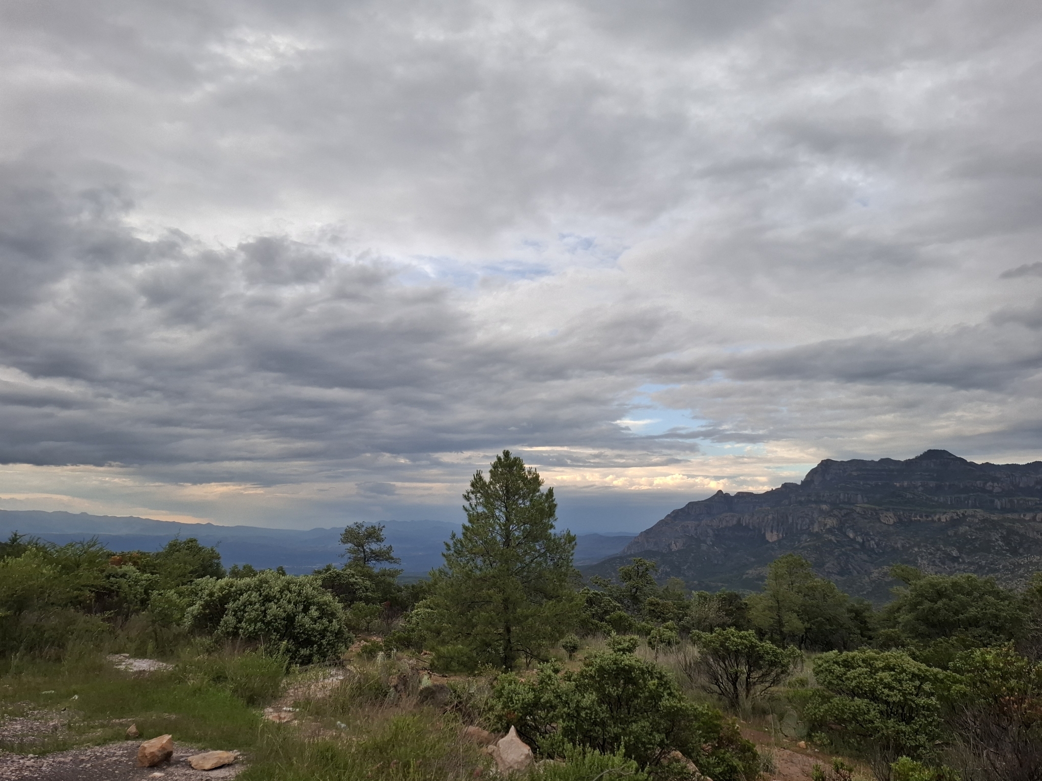
Nature reserve Súchil, Durango
Pine and oak forest between the Michis and Urica ranges, one of Mexico's first biosphere reserves, where Mexican wolves and black bears were brought back.
From Durango: 3 h 10 min by car (145 km by road) How to get there ↓
Plan your visit to Reserva de la Biosfera La Michilía
Where to stay near Reserva de la Biosfera La Michilía
Compare hotels, posadas and guest houses in Reserva de la Biosfera La Michilía.
Tours to Reserva de la Biosfera La Michilía
Day trips and guided outings from Nombre de Dios often include Reserva de la Biosfera La Michilía; with a local guide you can get there without a car.
How to get to Reserva de la Biosfera La Michilía
- From Durango: about 3 h 10 min by road (~145 km)
- Nearest airport: Durango (DGO), 1 h 3 min by car to Nombre de Dios
Links open a partner site. We may earn a commission if you book, at no cost to you.
About Reserva de la Biosfera La Michilía
In southeastern Durango, where the Sierra Madre Occidental breaks up into smaller ranges, the Sierra de Michis and the Sierra Urica enclose a valley of rolling hills, mesas and ravines. This is La Michilía, one of Mexico's first biosphere reserves. UNESCO added it to its Man and the Biosphere program in 1977; the federal government created the reserve in 1979 to protect about 35,000 hectares of dry temperate forest, and it became a national biosphere reserve in 2000. It is managed by CONANP, the national protected areas commission, and lies in the municipalities of Súchil and Mezquital, with villages such as Ejido San Juan de Michis and Ejido Alemán in its buffer zone. The core zone is Cerro Blanco. In late 2024 Semarnat presented the reserve's management plan and an advisory council was sworn in, and the scientists who pushed for its creation, among them Gonzalo Halffter and Jerzy Rzedowski, were honored along with former governor Héctor Mayagoitia.
The forest shifts with elevation, mostly between 2,000 and 3,000 meters. Above about 2,700 meters pines dominate, with stands of Douglas-fir, cypress and juniper; lower down pine and oak mix, and the lowest ground holds open oak woodland and grassland, manzanita scrub and wet meadows where the streams gather. Botanists have counted some 770 species of vascular plants. The Laurel and Temascal rivers and a number of creeks run through the reserve, and its forests feed two watersheds that the region's farms depend on.
The wildlife has North American roots: Coues white-tailed deer, puma, coyote, pronghorn, wild turkey, golden eagle and thick-billed parrot, along with woodpeckers and nuthatches. The imperial woodpecker, the largest in the world, lived here and is now considered extinct. Mexican gray wolves and black bears had vanished from these mountains and have been reintroduced, and the reserve has a captive breeding center for Mexican wolves and deer. The Institute of Ecology (INECOL) runs its Piedra Herrada field station here, and studies here have looked at Coues deer, coyote movements and the howling of Mexican wolves. It is a research reserve more than a tourist park: there are no formal campgrounds or services, travel inside is on foot along dirt tracks, and hiring a guide in one of the edge villages is the sensible way in.
How to get to Reserva de la Biosfera La Michilía
Drive from Durango: 3 h 10 min, 145 km
The reserve is about 160 km from the city of Durango by road and has no public transport, so rent a 4x4. From the capital take Highway 45 southeast toward Vicente Guerrero and go in through Súchil (52 km from the reserve) or Vicente Guerrero (55 km); there is also an entrance via Mezquital. Beyond those towns the road becomes a winding mountain route and then dirt. The turnoff to Nombre de Dios, the nearest Pueblo Mágico, is on the same Highway 45 about 53 km from the capital, a good place to eat or sleep before heading into the hills.
Directions to Reserva de la Biosfera La Michilía on Google Maps
Distances are in a straight line; the road is usually longer.
Links open a partner site. We may earn a commission if you book, at no cost to you.
From the nearest cities to Reserva de la Biosfera La Michilía
- Durango · 145 km by road, 3 h 10 min
- Fresnillo · 210 km by road, 3 h 55 min
- Tepic · about 270 km by road, ~4 h
Drive times by road from OpenStreetMap, without traffic or stops. Times marked ~ are estimated from the straight-line distance.
Before you go to Reserva de la Biosfera La Michilía: hours, prices and tips
- Entry
- CONANP does not charge an entry fee. Wikivoyage · checked Oct 2026
- Best season
- Temperate and cooler than most of Durango; afternoon storms are common from June to October, and winter nights are cold with occasional snow. Wikivoyage · checked Oct 2026
- Guide or tour
- A local guide is recommended; they can be hired in the towns on the edge of the reserve. Tours: Viator GetYourGuide Wikivoyage · checked Oct 2026
- Rules
- Backcountry camping is allowed, but bring all supplies and pack out your trash. Wikivoyage · checked Oct 2026
Hours and prices change, especially around holidays. Each fact links to where we checked it.
Visiting Reserva de la Biosfera La Michilía: what to see and do
Walk through the pine and oak of the Sierra de Michis with a local guide.
Look for white-tailed deer, wild turkey and thick-billed parrots.
Learn about the Mexican gray wolf reintroduction program.
Follow the creeks and wet meadows of the valley.
See Cerro Blanco, the reserve's core zone.
Plan your trip
Places to stay in Reserva de la Biosfera La Michilía
Compare hotels, posadas, and rentals in and around Reserva de la Biosfera La Michilía.
Tours & activities
Day trips and guided outings from Nombre de Dios often include Reserva de la Biosfera La Michilía; with a local guide you can get there without a car.
Rental cars
Pick up a car at DGO (Durango): about 1 h 3 min by road to Nombre de Dios, then 65 km more to Reserva de la Biosfera La Michilía, on your own schedule.
Flights
The nearest airport with scheduled flights is Durango (DGO), about 1 h 3 min by road from Nombre de Dios, the base for Reserva de la Biosfera La Michilía.
Travel insurance
If you plan on hiking at Reserva de la Biosfera La Michilía, check that your policy covers it: some plans leave adventure activities out.
Mobile data
Signal can drop away from Nombre de Dios: download a map of the way to Reserva de la Biosfera La Michilía before you set out, or carry an eSIM with data.
Links open a partner site. We may earn a commission if you book, at no cost to you.
When to go to Reserva de la Biosfera La Michilía mild
Reserva de la Biosfera La Michilía shares the climate of Nombre de Dios, 65 km away. The best months to visit are January, March, April, and December.
See the month-by-month climate of Nombre de Dios
Weather in Reserva de la Biosfera La Michilía now and the next 7 days
Live forecast from Open-Meteo. Chance of rain is the day's highest.
The closest Pueblo Mágico: Nombre de Dios

Nombre de Dios is the Pueblo Mágico closest to Reserva de la Biosfera La Michilía, with places to stay, food, and more to see.
Also close to
- Sombrerete · Zacatecas · 69 km away
Closest to Reserva de la Biosfera La Michilía
-
Altavista · Archaeological site · 33 km away

Lists with Reserva de la Biosfera La Michilía
Nature Parks in Durango · 4Location from OpenStreetMap. Written by Puebloteca.