Village Bolaños, Jalisco
Wixárika (Huichol) community (Kuruxi Manuwe) in Bolaños municipality, its most populous locality, in the Sierra Madre Occidental.
From Tepatitlán: about 3 h 20 min by road (~230 km) How to get there ↓
Near here
See everything nearby ↓


Plan your visit to Tuxpan de Bolaños
Where to stay near Tuxpan de Bolaños
Compare hotels, posadas and guest houses in Tuxpan de Bolaños.
Tours to Tuxpan de Bolaños
Day trips and guided outings from Teúl de González Ortega often include Tuxpan de Bolaños; with a local guide you can get there without a car.
How to get to Tuxpan de Bolaños
- From Tepatitlán: about 3 h 20 min by road (~230 km)
- Nearest airport: Guadalajara (GDL), 2 h 22 min by car to Teúl de González Ortega
Links open a partner site. We may earn a commission if you book, at no cost to you.
About Tuxpan de Bolaños
Tuxpan de Bolaños is a Wixárika (Huichol) settlement in Bolaños municipality, in northern Jalisco, at about 1,120 metres above sea level. At the 2020 census it had 1,355 inhabitants, more than the municipal seat itself, and over 93% of the population is Indigenous; the Wixaritari themselves put the figure nearer 2,000. In Wixárika it is known as Tutsipa, and the community uses the name Kuruxi Manuwe when it wants to stress its autonomy; kuruxi refers to the staffs of office and the deities of a communal seat. The Spanish name comes from Nahuatl and means "place of rabbits".
Within the Wixárika world Tuxpan is one of five traditional governances, alongside San Sebastián Teponahuaxtlán, San Andrés Cohamiata, Santa Catarina Cuexcomatitlán and Guadalupe Ocotán. Anthropological studies treat it as an annex of the agrarian community of San Sebastián, with its own civil and religious authorities and a territory registered with the National Agrarian Registry. The community has faced pressure from cattle ranchers encroaching on its land.
This is a place to visit with respect and by invitation: ceremonial life follows its own calendar. In April 2025, during the Wixárika Holy Week (Weyaik+), students and authorities of the University of Guadalajara's Northern University Centre (CUNorte) took part here in a ceremony with a collective fast, vigil, offerings and the sacrifice of a bull, asking the deities' blessing on the campus planned for the community.
How to get to Tuxpan de Bolaños
Tuxpan de Bolaños lies in an area of low road connectivity in northern Jalisco. From Bolaños town it is about 67 km by road, roughly 1 hour 30 minutes per route calculators. From Guadalajara it is about 245 km (153 miles) by road, around 4 hours 35 minutes by car. By public transport, Rome2rio suggests a bus from the Guadalajara Nueva Central Camionera to Villa Guerrero (about 4 hours, two departures a day, Estrella Blanca group lines) and then a taxi of nearly 2 hours to Tuxpan; there is also one daily bus to Bolaños, about 7 hours. Colotlán to Bolaños is about 103 km. Confirm road conditions and schedules before setting out.
Directions to Tuxpan de Bolaños on Google Maps
Distances are in a straight line; the road is usually longer.
Links open a partner site. We may earn a commission if you book, at no cost to you.
From the nearest cities to Tuxpan de Bolaños
- Tepatitlán · about 230 km by road, ~3 h 20 min
- Aguascalientes · about 230 km by road, ~3 h 25 min
- Tepic · 212 km by road, 4 h 55 min
Drive times by road from OpenStreetMap, without traffic or stops. Times marked ~ are estimated from the straight-line distance.
Before you go to Tuxpan de Bolaños: hours, prices and tips
- Guide or tour
- This is an Indigenous community with its own protocols; go by invitation or with someone from the region, and confirm with the communal authorities before visiting. Tours: Viator GetYourGuide Wikipedia: Municipio de Bolaños · checked Oct 2026
Hours and prices change, especially around holidays. Each fact links to where we checked it.
Visiting Tuxpan de Bolaños: what to see and do
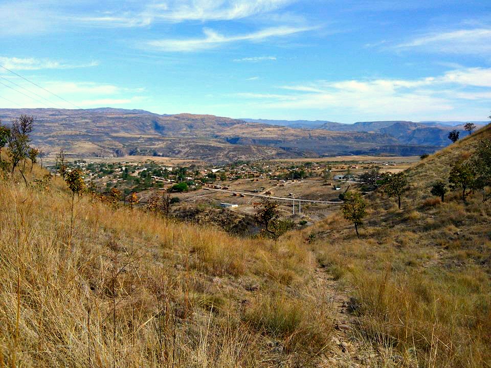
The Wixárika village of Tuxpan (Kuruxi Manuwe) and its Sierra Madre Occidental canyon landscape
The Ruta Wixárika through the Bolaños region
The Bolaños canyon and river, in the municipality
The mining town of Bolaños, whose vein was discovered in 1548
Plan your trip
Places to stay in Tuxpan de Bolaños
Compare hotels, posadas, and rentals in and around Tuxpan de Bolaños.
Tours & activities
Day trips and guided outings from Teúl de González Ortega often include Tuxpan de Bolaños; with a local guide you can get there without a car.
Rental cars
Pick up a car at GDL (Guadalajara): about 2 h 22 min by road to Teúl de González Ortega, then 73 km more to Tuxpan de Bolaños, on your own schedule.
Flights
The nearest airport with scheduled flights is Guadalajara (GDL), about 2 h 22 min by road from Teúl de González Ortega, the base for Tuxpan de Bolaños.
Mobile data
Signal can drop away from Teúl de González Ortega: download a map of the way to Tuxpan de Bolaños before you set out, or carry an eSIM with data.
Links open a partner site. We may earn a commission if you book, at no cost to you.
When to go to Tuxpan de Bolaños mild
Tuxpan de Bolaños shares the climate of Teúl de González Ortega, 73 km away. The best months to visit are March, April, May, and November.
See the month-by-month climate of Teúl de González Ortega
Weather in Tuxpan de Bolaños now and the next 7 days
Live forecast from Open-Meteo. Chance of rain is the day's highest.
The closest Pueblo Mágico: Teúl de González Ortega

Teúl de González Ortega is the Pueblo Mágico closest to Tuxpan de Bolaños, with places to stay, food, and more to see.
Closest to Tuxpan de Bolaños
-
Bolaños · Village · 24 km away
-
Chimaltitán · Village · 26 km away
-
San Martín de Bolaños · Town · 30 km away
Near Tuxpan de Bolaños

Drive times by road from OpenStreetMap, without traffic. Times marked ~ are estimated from the straight-line distance.
Location from OpenStreetMap. Written by Puebloteca.