

Town Uruapan, Michoacán Municipality of Uruapan Meseta Purépecha
Purépecha-speaking village and base for Paricutín, with an early colonial church and guides with horses for hire.
From Uruapan: 35 min by car (36 km by road) How to get there ↓
Near here
See everything nearby ↓



Plan your visit to Angahuan
Where to stay near Angahuan
Paracho, 22 km away, is the closest town with places to stay.
Compare hotels, posadas and guest houses in Angahuan.
Tours to Angahuan
Day trips around Paracho sometimes stop in Angahuan; a tour is the easy way to see it without a car.
How to get to Angahuan
- From Uruapan: about 35 min by road (~36 km)
- 22 km southwest of Paracho
- Nearest airport: Uruapan (UPN), 42 min by car to Paracho
Links open a partner site. We may earn a commission if you book, at no cost to you.
About Angahuan
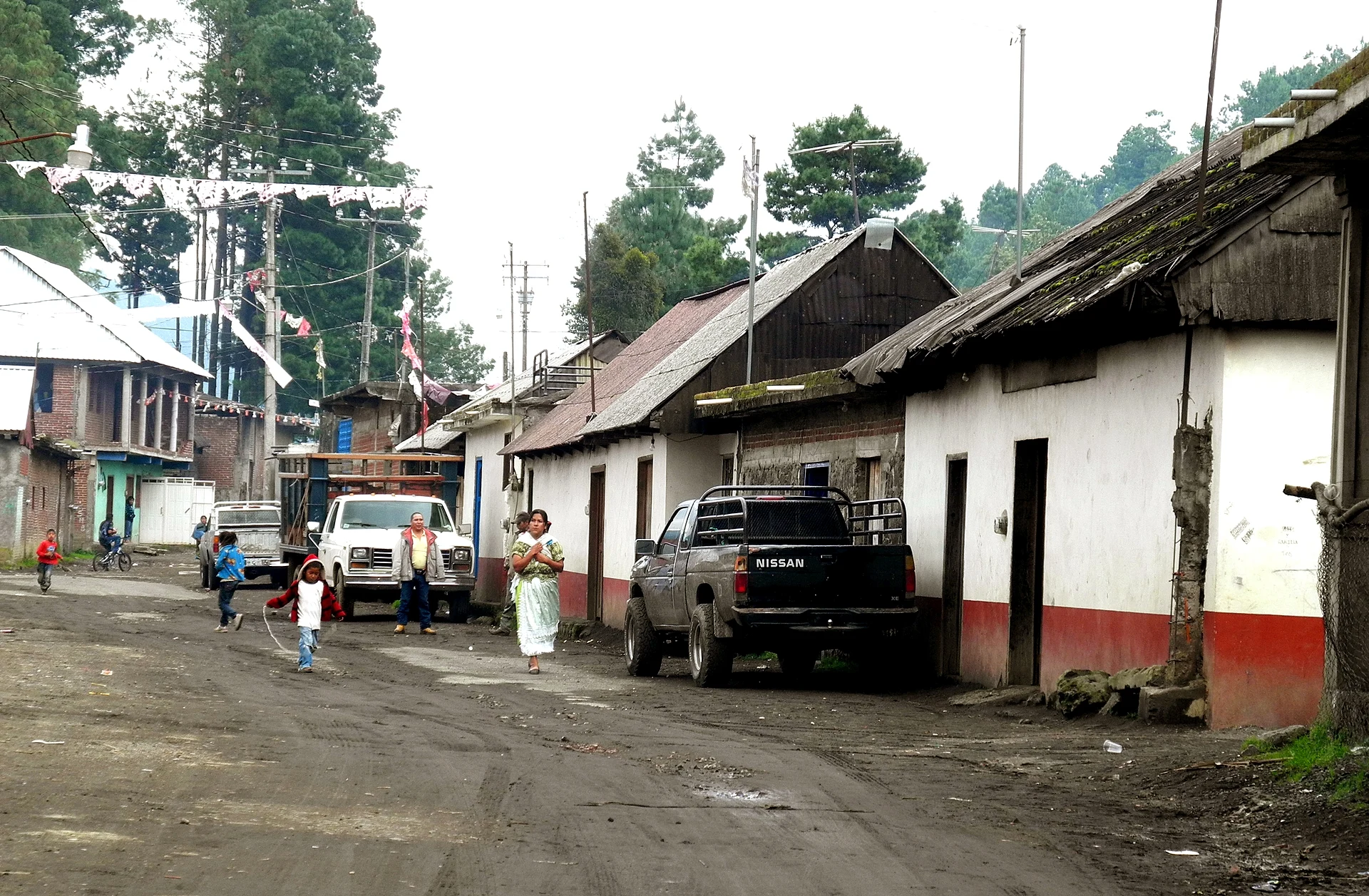
Angahuan is a Purépecha community on the western edge of the Meseta Purépecha, and for most travelers it is the doorway to the Paricutín volcano and the buried church of San Juan Parangaricutiro, which lie across the lava fields just beyond the village. Its name is usually translated as "place after the slope," and Purépecha is still the first language you hear in its streets of wooden houses, troje granaries and fenced yards.
The village itself is worth a stop before you head out. The church of Santiago Apóstol, one of the early churches of the region, has a finely carved stone doorway with a strong Moorish, mudéjar flavor. Nearby stands the Huatápera or Yurhixo chapel, a 16th-century hospital chapel that still serves as a gathering place for the community. A mosaic mural in town tells the legend of Paricutín's birth as a struggle between good and evil.
Angahuan has grown a small tourist zone with lodging, parking, craft stalls and local guides who rent horses for the ride to the church ruins and the volcano. Many families have relatives in California and other parts of the United States, so you will notice two worlds meeting here.
How to get to Angahuan
Drive from Uruapan: 35 min, 36 km
From Paracho, drive south on Highway 37 toward Uruapan to Capácuaro, then turn west on the road to Angahuan; allow about 40 minutes to an hour. Guides usually wait at the village entrance and at the lookout; agree on the route and price before setting out.
22 km southwest of Paracho
Directions from Paracho on Google Maps
Distances are in a straight line; the road is usually longer.
Links open a partner site. We may earn a commission if you book, at no cost to you.
From the nearest cities to Angahuan
- Uruapan · 36 km by road, 35 min
- Zamora · 66 km by road, 1 h 20 min
- Pátzcuaro · 91 km by road, 1 h 20 min
Drive times by road from OpenStreetMap, without traffic or stops. Times marked ~ are estimated from the straight-line distance.
Before you go to Angahuan: hours, prices and tips
- Guide or tour
- Locals rent horses with a guide for Paricutín and the buried church, about 600 pesos per person. Tours: Viator GetYourGuide Nomads Beyond · checked Oct 2026
Hours and prices change, especially around holidays. Each fact links to where we checked it.
Visiting Angahuan: what to see and do
See the carved mudéjar-style doorway of the church of Santiago Apóstol.
Visit the 16th-century Yurhixo hospital chapel (Huatápera).
Find the mosaic mural of the legend of Paricutín.
Hire a local guide and horse to ride to the buried church and the volcano.
Plan your trip
Places to stay in Angahuan
Compare hotels, posadas, and rentals in and around Angahuan.
Tours & activities
Day trips around Paracho sometimes stop in Angahuan; a tour is the easy way to see it without a car.
Rental cars
Pick up a car at UPN (Uruapan): about 42 min by road to Paracho, then 22 km more to Angahuan, on your own schedule.
Flights
The nearest airport with scheduled flights is Uruapan (UPN), about 42 min by road from Paracho, the base for Angahuan.
Mobile data
Signal can drop away from Paracho: download a map of the way to Angahuan before you set out, or carry an eSIM with data.
Links open a partner site. We may earn a commission if you book, at no cost to you.
Photos
When to go to Angahuan cool
Angahuan shares the climate of Paracho, 22 km away. The best months to visit are January, March, April, and November.
See the month-by-month climate of Paracho
Weather in Angahuan now and the next 7 days
Live forecast from Open-Meteo. Chance of rain is the day's highest.
Make Paracho your base

Angahuan is an easy trip from Paracho, a Pueblo Mágico with places to stay, food, and more to see.
Also close to
- Cotija · Michoacán · 58 km away
- Santa Clara del Cobre · Michoacán · 64 km away
- Pátzcuaro · Michoacán · 65 km away
- Tzintzuntzan · Michoacán · 68 km away
- Jiquilpan · Michoacán · 72 km away
Closest to Angahuan
-
Templo de San Juan Parangaricutiro · Landmark · 3 km away
-
Volcán Paricutín · Mountain · 7 km away
-
Zacán · Town · 7 km away
-
Nurío · Town · 16 km away
-
Cocucho · Town · 17 km away
-
Capácuaro · Town · 18 km away
-
Parque Nacional Barranca del Cupatitzio · Nature reserve · 21 km away · Michoacán
-
Barrio de San Pedro · Landmark · 22 km away · Michoacán


Near Angahuan


Drive times by road from OpenStreetMap, without traffic. Times marked ~ are estimated from the straight-line distance.
Something wrong or missing on this page? Suggest a fix or addition
Location from OpenStreetMap. Written by Puebloteca.