

Town Tocumbo, Michoacán
The birthplace of La Michoacana ice pops, with a giant paleta monument and a paleta fair in December.
From Zamora: 55 min by car (55 km by road) How to get there ↓
Near here
See everything nearby ↓



Plan your visit to Tocumbo
Where to stay near Tocumbo
Cotija, 23 km away, is the closest town with places to stay.
Compare hotels, posadas and guest houses in Tocumbo.
Tours to Tocumbo
Day trips around Cotija sometimes stop in Tocumbo; a tour is the easy way to see it without a car.
How to get to Tocumbo
- From Zamora: about 55 min by road (~55 km)
- 23 km southeast of Cotija
- Nearest airport: Uruapan (UPN), 2 h 5 min by car to Cotija
Links open a partner site. We may earn a commission if you book, at no cost to you.
About Tocumbo
Tocumbo is a small town in the hills southeast of Cotija with an unlikely claim to fame: it is where the paleterías known as La Michoacana began. In the late 1930s and early 1940s, local paleta makers sold ice pops packed with chunks of seasonal fruit, and young men from Tocumbo learned the trade. In the 1940s some of them took it to Mexico City, and the idea spread across the country and abroad. Accounts differ on who deserves the credit; Rafael Malfavón and the Alcázar brothers are the names most often mentioned.
The money that came back changed the town. Paleteros lent to their neighbors to start their own shops, and Tocumbo became known for its large houses, built with earnings from ice-cream shops all over Mexico.
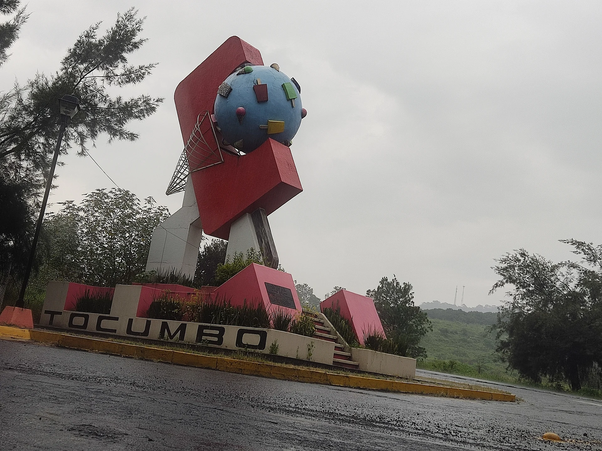
The town celebrates its trade with a huge concrete paleta monument, several stories high, and with the Feria de la Paleta, held every December since 1989 around the feast of the Virgin of Guadalupe, when many paleteros come home for the holidays.
How to get to Tocumbo
Drive from Zamora: 55 min, 55 km
From Cotija, Tocumbo is about 24 km along Michoacán state road 4, roughly 30 minutes by car. From Zamora it is about 55 km on state road 16, roughly an hour. By bus, hourly services run from Zamora to Tingüindín, the neighbouring municipality to the north (about 1 h 10 min); for the last stretch, ask in Zamora or Cotija about combis to Tocumbo. From Morelia the drive is about 187 km, close to 3 hours.
23 km southeast of Cotija
Directions from Cotija on Google Maps
Distances are in a straight line; the road is usually longer.
Links open a partner site. We may earn a commission if you book, at no cost to you.
From the nearest cities to Tocumbo
- Zamora · 55 km by road, 55 min
- Sahuayo · 70 km by road, 1 h 15 min
- Uruapan · 88 km by road, 1 h 35 min
Drive times by road from OpenStreetMap, without traffic or stops. Times marked ~ are estimated from the straight-line distance.
Visiting Tocumbo: what to see and do
Take a photo with the giant paleta monument.
Try fruit paletas and nieves in the town where La Michoacana began.
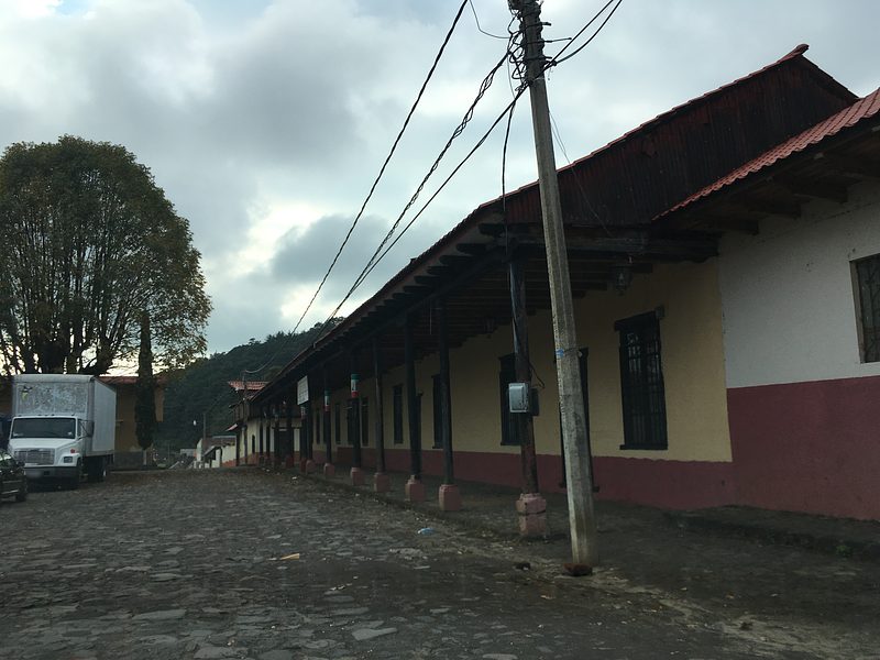
Walk the streets to see the big houses built with paletería money.
Come in December for the Feria de la Paleta, when the town is at its liveliest.
Plan your trip
Places to stay in Tocumbo
Compare hotels, posadas, and rentals in and around Tocumbo.
Tours & activities
Day trips around Cotija sometimes stop in Tocumbo; a tour is the easy way to see it without a car.
Rental cars
Pick up a car at UPN (Uruapan): about 2 h 5 min by road to Cotija, then 23 km more to Tocumbo, on your own schedule.
Flights
The nearest airport with scheduled flights is Uruapan (UPN), about 2 h 5 min by road from Cotija, the base for Tocumbo.
Mobile data
Signal can drop away from Cotija: download a map of the way to Tocumbo before you set out, or carry an eSIM with data.
Links open a partner site. We may earn a commission if you book, at no cost to you.
Photos
When to go to Tocumbo mild
Tocumbo shares the climate of Cotija, 23 km away. The best months to visit are January, March, April, and November.
See the month-by-month climate of Cotija
Weather in Tocumbo now and the next 7 days
Live forecast from Open-Meteo. Chance of rain is the day's highest.
Make Cotija your base

Tocumbo is an easy trip from Cotija, a Pueblo Mágico with places to stay, food, and more to see.
Also close to
Closest to Tocumbo
-
Tarecuato · Town · 17 km away
-
Chorros del Varal · Waterfall · 21 km away
-
Zacán · Town · 29 km away · Near Paracho
-
Ocumicho · Town · 33 km away · Near Paracho
-
Templo de San Juan Parangaricutiro · Landmark · 34 km away · Near Paracho
-
Cocucho · Town · 35 km away · Near Paracho
-
Angahuan · Town · 36 km away · Near Paracho
-
Volcán Paricutín · Mountain · 37 km away · Near Paracho


Near Tocumbo


Drive times by road from OpenStreetMap, without traffic. Times marked ~ are estimated from the straight-line distance.
Something wrong or missing on this page? Suggest a fix or addition
Location from OpenStreetMap. Written by Puebloteca.