

City Zamora, Michoacán Ciénega de Chapala and Zamora
Michoacán's third city and Mexico's strawberry capital, home of chongos zamoranos and the Santuario Guadalupano, the country's tallest church.
From La Piedad: 1 h by car (59 km by road) How to get there ↓
Near here
See everything nearby ↓


Plan your visit to Zamora
Where to stay near Zamora
Compare hotels, posadas and guest houses in Zamora.
Tours to Zamora
Day trips and guided outings from Paracho often include Zamora; with a local guide you can get there without a car.
How to get to Zamora
- From La Piedad: about 1 h by road (~59 km)
- Nearest airport: Uruapan (UPN), 42 min by car to Paracho
Links open a partner site. We may earn a commission if you book, at no cost to you.
About Zamora
Zamora de Hidalgo is the third-largest city in Michoacán, with about 155,000 people in 2020, and it has grown together with neighbouring Jacona into a metropolitan area of more than 270,000. It sits at about 1,560 m on the flat, fertile Tziróndaro valley in the northwest of the state, 144 km from Morelia. Spanish settlers founded the town on 18 January 1574 on the orders of Viceroy Martín Enríquez and named it after Zamora in Spain. Miguel Hidalgo declared it a city on 21 November 1810, during the War of Independence, and 'de Hidalgo' was added to its name in his honour in 1953. It became the seat of a Catholic diocese in 1862.
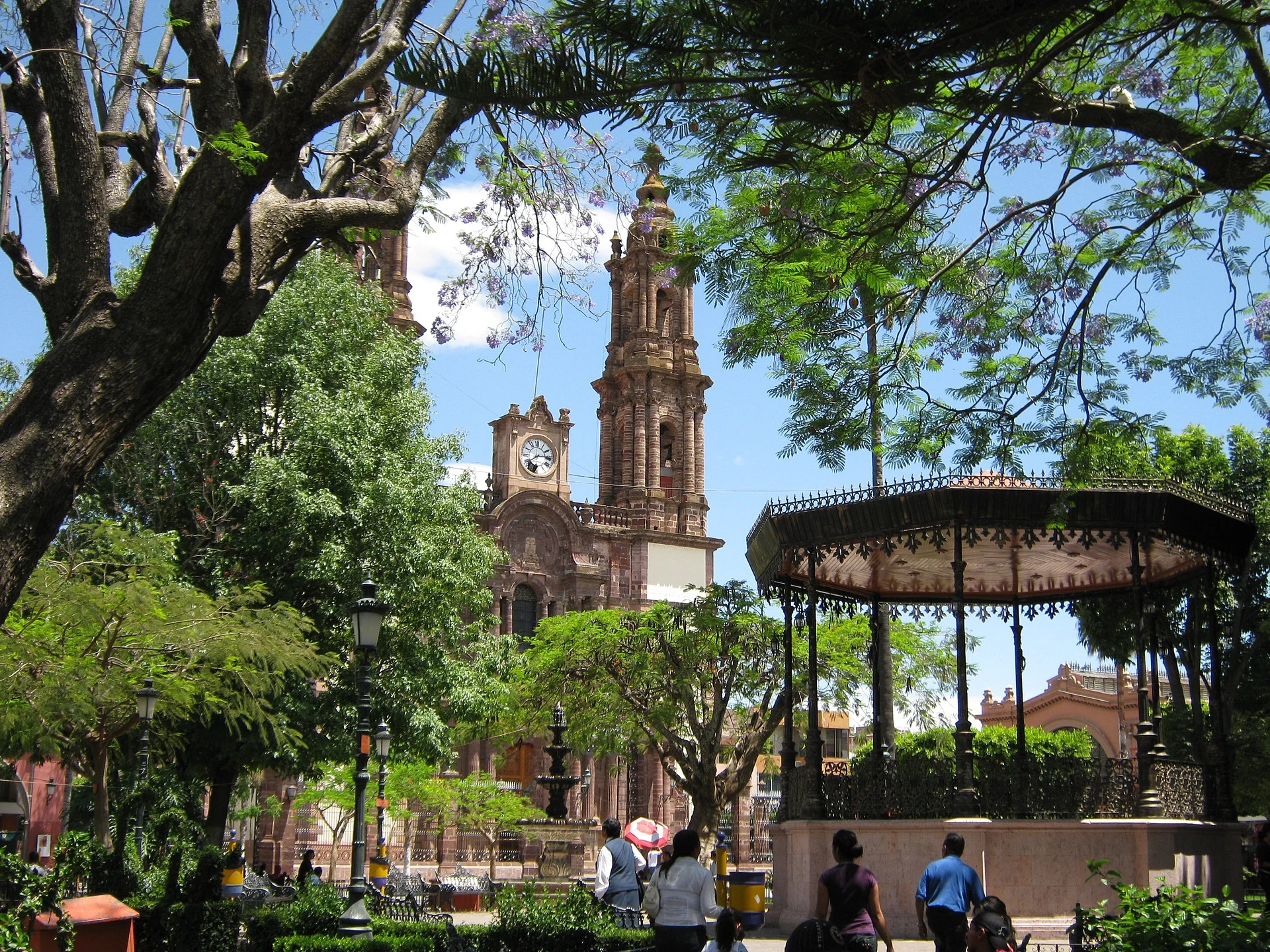
The city's best years came under the Porfiriato, when the railway arrived in 1899 and the elite built eclectic and neoclassical buildings and mansions in French and Victorian taste. Around the Plaza de Armas stand the neoclassical cathedral, the former bishop's palace and the Mercado Morelos, an iron-framed market built from 1907 to 1913 where a couple of stalls still sell chongos zamoranos. The Teatro Obrero, restored in 2006, is part of the Centro Regional de las Artes de Michoacán, next to the Santuario Guadalupano, the neo-Gothic church whose 107.5 m towers are the tallest of any church in Mexico. El Colegio de Michoacán, a research centre founded by the historian Luis González y González in 1979, is also here.
The valley is farm country: Zamora is Mexico's leading strawberry producer, with 2,055 hectares planted and almost 113,000 tonnes harvested in 2023, and a major exporter of raspberries, blackberries and blueberries. The city's own sweet is the chongo zamorano, curdled milk cooked slowly in syrup with cinnamon, made commercially since 1934; other local dishes are papas zamoranas, potatoes with dark or cucumber-and-jalapeño salsa, and carne en su jugo. The Virgin of Guadalupe is celebrated from 1 to 12 December with processions and pilgrims, and on Good Friday the Procession of Silence crosses the centre. Lago de Camécuaro is close enough that day tours from Morelia combine the two.
How to get to Zamora
Drive from La Piedad: 1 h, 59 km
Zamora is 144 km from Morelia, on the free highway through Zacapu, and is the usual stop between Morelia and Guadalajara; other roads run to La Barca, Los Reyes, Jiquilpan and La Piedad. Primera Plus runs buses from Morelia in about 2 hours 20 minutes (from about 465 pesos), and buses from Guadalajara take around 2 hours 40 minutes, arriving at the Central de Autobuses. The 14D toll road links Zamora with Uruapan.
Directions to Zamora on Google Maps
Distances are in a straight line; the road is usually longer.
Links open a partner site. We may earn a commission if you book, at no cost to you.
From the nearest cities to Zamora
Drive times by road from OpenStreetMap, without traffic or stops. Times marked ~ are estimated from the straight-line distance.
Before you go to Zamora: hours, prices and tips
- Time needed
- Day tours from Morelia spend about an hour in Zamora and the Santuario after three hours at Lago de Camécuaro (10 hours in all, from 1,300 pesos). Civitatis · checked Oct 2026
- Best time of day
- Holy Week: the Procession of Silence crosses the main streets on Good Friday, and the Señor de la Salud procession follows on Holy Saturday. Wikipedia (es) · checked Oct 2026
- Best season
- The Virgin of Guadalupe festivities run from 1 to 12 December, with mañanitas, processions and pilgrims from all over the region. Wikipedia (es) · checked Oct 2026
Hours and prices change, especially around holidays. Each fact links to where we checked it.
Visiting Zamora: what to see and do
Visit the Santuario Guadalupano, Mexico's tallest church, and its stained glass and German-built organ.
Walk the Plaza de Armas past the neoclassical cathedral and the old bishop's palace.
Buy chongos zamoranos at the iron-framed Mercado Morelos.
Catch a play or concert at the restored Teatro Obrero.
Try papas zamoranas and carne en su jugo.
Combine the city with a swim at nearby Lago de Camécuaro.
Plan your trip
Places to stay in Zamora
Compare hotels, posadas, and rentals in and around Zamora.
Tours & activities
Day trips and guided outings from Paracho often include Zamora; with a local guide you can get there without a car.
Rental cars
Pick up a car at UPN (Uruapan): about 42 min by road to Paracho, then 45 km more to Zamora, on your own schedule.
Flights
The nearest airport with scheduled flights is Uruapan (UPN), about 42 min by road from Paracho, the base for Zamora.
Mobile data
Signal can drop away from Paracho: download a map of the way to Zamora before you set out, or carry an eSIM with data.
Links open a partner site. We may earn a commission if you book, at no cost to you.
Photos
When to go to Zamora cool
Zamora shares the climate of Paracho, 45 km away. The best months to visit are January, March, April, and November.
See the month-by-month climate of Paracho
Weather in Zamora now and the next 7 days
Live forecast from Open-Meteo. Chance of rain is the day's highest.
The closest Pueblo Mágico: Paracho

Paracho is the Pueblo Mágico closest to Zamora, with places to stay, food, and more to see.
Also close to
Closest to Zamora
-
Santuario Guadalupano de Zamora · Landmark · 0 km away
-
Lago de Camécuaro · Lake · 12 km away
-
Ocumicho · Town · 22 km away
-
Tarecuato · Town · 24 km away
-
Cocucho · Town · 34 km away
-
Nurío · Town · 40 km away
-
Tocumbo · Town · 40 km away
-
La Barca · City · 43 km away


Near Zamora


Drive times by road from OpenStreetMap, without traffic. Times marked ~ are estimated from the straight-line distance.
Location from OpenStreetMap. Written by Puebloteca.