Village Zapotlán del Rey, Jalisco
Village in Zapotlán del Rey where the Morisma, a Moors-and-Christians battle over the Virgin of Candelaria, is staged on 1-2 February.
From Ocotlán: 20 min by car (17 km by road) How to get there ↓
Near here
See everything nearby ↓


Plan your visit to Otatlán
Where to stay near Otatlán
Compare hotels, posadas and guest houses in Otatlán.
Tours to Otatlán
Day trips and guided outings from Ajijic often include Otatlán; with a local guide you can get there without a car.
 Tours from Guadalajara
Full Day Tour to Tequila and Amatitán with Fun and Culture
★ 4.9 (751) · From US$44
How to get to Otatlán
- From Ocotlán: about 20 min by road (~17 km)
- Nearest airport: Guadalajara (GDL), 39 min by car to Ajijic
Links open a partner site. We may earn a commission if you book, at no cost to you.
Tours from Guadalajara, near Otatlán


Tours, prices and ratings from Viator, checked weekly. We may earn a commission if you book.
About Otatlán
Otatlán is a village in the municipality of Zapotlán del Rey, in southeastern Jalisco, a little over an hour from Guadalajara. The name is Nahuatl and means "place where otates abound", otate being a tough cane used in the countryside. The municipality sits at about 1,550 metres above sea level, on low hills and flat farmland, with the Santiago River as its southern boundary. In 1995 the census counted 1,117 people here, one of the five largest localities in the municipality.
The village is known for its devotion to the Virgen de la Candelaria and for the Morisma, a Moors-and-Christians play staged jointly by Otatlán, La Noria and El Sáuz. It is passed down by oral tradition and its organisers reckon it is more than a hundred years old. Around 15 January a group of "Moors" on horseback, in capes and paper-flower crowns, arrives at the main temple and stages the theft of the Virgin's image, carrying it off to La Noria or El Sáuz. On 1 February the Christians of Otatlán come to rescue it and trade lines with the Moors in a theatrical dialogue; on 2 February the battle is fought on a sports field in Otatlán. The Moors fight on horseback and the Christians on foot, and the aim is to unhorse a Moor and take his crown, which is handed to the Virgin as a sign of conversion. Some years the Moors win.
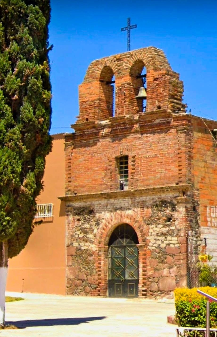
The rest of the year the village is quiet. An old chapel of brick and stone with a bell gable, which appears in photographs of the village, is among the oldest structures in view. The fair that accompanies the festival brings rides, snacks and cold drinks, as at any patron-saint fiesta.
How to get to Otatlán
Drive from Ocotlán: 20 min, 17 km
From Guadalajara leave through Tonalá (MEX 80) and continue on toll motorway 15D toward Ocotlán; Coralillos, El Sabino, Otatlán and Zapotlán del Rey are listed along that route. It is about 60 km and roughly an hour and a quarter by car (approx.), with tolls on the motorway. Without a car, Flecha Amarilla runs from the Nueva Central Camionera in Guadalajara (module 1) to Ocotlán about hourly, 1 h 20 min, and from there a taxi to Zapotlán del Rey takes about 28 minutes. There is no published direct bus schedule to Otatlán, so for the Morisma it is easiest to drive or combine bus and taxi.
Directions to Otatlán on Google Maps
Distances are in a straight line; the road is usually longer.
Links open a partner site. We may earn a commission if you book, at no cost to you.
From the nearest cities to Otatlán
- Ocotlán · 17 km by road, 20 min
- Tepatitlán · 55 km by road, 1 h
- Guadalajara · 65 km by road, 1 h
Drive times by road from OpenStreetMap, without traffic or stops. Times marked ~ are estimated from the straight-line distance.
Before you go to Otatlán: hours, prices and tips
- Best season
- Morisma: around 15 January (theft of the image), 1 February (dialogue between Moors and Christians) and 2 February (battle on the sports field, Candlemas). Dates can change; confirm with the municipality. Ciudad Olinka · checked Oct 2026
Hours and prices change, especially around holidays. Each fact links to where we checked it.
Visiting Otatlán: what to see and do
The Morisma, from 15 January to 2 February, with the theft of the Virgin's image and the final battle on the sports field.
Otatlán's main temple and the image of the Virgen de la Candelaria.
The old chapel of brick and stone with a bell gable.
The festival fair, with Mexican snacks, rides and cold drinks.
In Zapotlán del Rey, the parish of Nuestra Señora del Socorro and the Sabinos de Chila.
Plan your trip
Places to stay in Otatlán
Compare hotels, posadas, and rentals in and around Otatlán.
Tours & activities
Day trips and guided outings from Ajijic often include Otatlán; with a local guide you can get there without a car.
Rental cars
Pick up a car at GDL (Guadalajara): about 39 min by road to Ajijic, then 50 km more to Otatlán, on your own schedule.
Flights
The nearest airport with scheduled flights is Guadalajara (GDL), about 39 min by road from Ajijic, the base for Otatlán.
Mobile data
Signal can drop away from Ajijic: download a map of the way to Otatlán before you set out, or carry an eSIM with data.
Links open a partner site. We may earn a commission if you book, at no cost to you.
When to go to Otatlán mild
Otatlán shares the climate of Ajijic, 50 km away. The best months to visit are January, March, April, and November.
See the month-by-month climate of Ajijic
Weather in Otatlán now and the next 7 days
Live forecast from Open-Meteo. Chance of rain is the day's highest.
The closest Pueblo Mágico: Ajijic

Ajijic is the Pueblo Mágico closest to Otatlán, with places to stay, food, and more to see.
Also close to
- Jiquilpan · Michoacán · 50 km away
- Tlaquepaque · Jalisco · 57 km away
- Mazamitla · Jalisco · 63 km away
- Cotija · Michoacán · 71 km away
Closest to Otatlán
-
Ocotlán · City · 11 km away
-
Zapotlán del Rey · Village · 13 km away
-
Poncitlán · Town · 14 km away
-
Jamay · Town · 19 km away
-
Isla de Mezcala · Landmark · 28 km away
-
La Barca · City · 32 km away
-
Petatán · Town · 32 km away
-
Atotonilco el Alto · Town · 33 km away

Near Otatlán


Drive times by road from OpenStreetMap, without traffic. Times marked ~ are estimated from the straight-line distance.
Location from OpenStreetMap. Written by Puebloteca.