Town Degollado, Jalisco
Pink-stone town in Jalisco's Ciénega near Michoacán: a Gothic parish church, 1960s arcades, stone-carving workshops and agave fields.
From La Piedad: 20 min by car (20 km by road) How to get there ↓
Near here
See everything nearby ↓


Plan your visit to Degollado
Where to stay near Degollado
Compare hotels, posadas and guest houses in Degollado.
Tours to Degollado
Day trips around Jalpa de Cánovas sometimes stop in Degollado; a tour is the easy way to see it without a car.
 Guadalajara Private Walking Tour
★ 5.0 (190) · From US$44
How to get to Degollado
- From La Piedad: about 20 min by road (~20 km)
- Nearest airport: León (Bajío) (BJX), 1 h 5 min by car to Jalpa de Cánovas
Links open a partner site. We may earn a commission if you book, at no cost to you.
Popular tours to Degollado


Tours, prices and ratings from Viator, checked weekly. We may earn a commission if you book.
About Degollado
Degollado is the seat of a municipality in eastern Jalisco, in the Ciénega region just south of Los Altos and close to the borders with Michoacán and Guanajuato. It sits at about 1,800 metres, and the 2020 census counted 11,612 people; since 2000 the town has absorbed neighbouring settlements such as Los Cuatro Vientos and El Tecolote. It is a farming town ringed by blue agave fields grown for tequila, and known around the region for its stone carving.
The town is young. It grew on land called Los Encinos owned by Ignacio de la Peña, east of Ayo el Chico (today Ayotlán), where the Ayo priest Clemente Pérez blessed a chapel to San Ignacio de Loyola on 29 July 1856. When it became a ranchería in 1857, with just eight families, it was named San Ignacio de Morelos, also known as San Ignacio de los Encinos. A group of residents led by the engineer Jesús Navarro Castellanos pushed for municipal status, granted by decree on 31 December 1861 along with the present name, honouring the liberal general Santos Degollado; the first town council took office on 2 February 1862. On 24 December 1917 the town was besieged by the bandit J. Inés García Chávez, and in the 1920s the area saw fighting in the Cristero War.
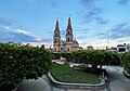
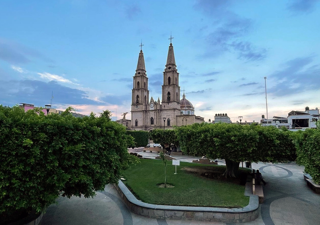
What strikes visitors first is the pink cantera stone. It was used for the Gothic-style Parroquia de la Virgen de Guadalupe, built between 1862 and 1914, its interior covered in gilded plant motifs; the Baroque Santuario de San Miguel from around 1898; the 1904 town hall with its portico and central courtyard; the neoclassical Navarro family house from about 1890; the old Hernán cinema of 1948; and the arcades around the main square, built in 1964. On the square stand the Monument to the Martyrs of 1917 and a statue of Santos Degollado cast from coins collected by townspeople in the early 1960s. The local sculptor Francisco Aguayo made several of the monuments in the centre.
The stone workshops are still busy, selling carved images of the Virgin of Guadalupe, fountains, animal figures and columns. Local crafts also include rustic and glazed pottery, drawn-thread work and embroidery. Typical food is river-fish broth, red pozole, tamales and guasanas (green chickpeas), with leche quemada and candied fruit for dessert.
How to get to Degollado
Drive from La Piedad: 20 min, 20 km
Degollado lies on federal Highway 90 between Atotonilco el Alto and La Piedad. From Guadalajara it is about 155 km, roughly 2 hours by car, on Highway 90 via Atotonilco el Alto (about 52 km from Degollado, around 50 minutes). La Piedad, Michoacán, is about 24 km southeast, around 25 minutes, and Ayotlán about 32 km. The nearest Pueblo Mágico is Jalpa de Cánovas, in Guanajuato, about 89 km by road, roughly 1 h 25 min.
Degollado's bus station is at Calle Hidalgo 98 in the centre and is used by the Flecha Amarilla and Primera Plus group; check schedules in their app or on 477 710 0060. There are no published timetables for a direct bus from Guadalajara: from the Nueva Central Camionera (module 1), Flecha Amarilla runs about hourly and Coordinados every two hours to Atotonilco el Alto (about 90 minutes), and Primera Plus goes to La Piedad (about 2 h 30 min); continue from there by local bus or taxi.
Directions to Degollado on Google Maps
Distances are in a straight line; the road is usually longer.
Links open a partner site. We may earn a commission if you book, at no cost to you.
From the nearest cities to Degollado
- La Piedad · 20 km by road, 20 min
- Arandas · 62 km by road, 1 h 10 min
- Zamora · 76 km by road, 1 h 15 min
Drive times by road from OpenStreetMap, without traffic or stops. Times marked ~ are estimated from the straight-line distance.
Before you go to Degollado: hours, prices and tips
- Best season
- San Miguel on 29 September, Santa Cecilia on 22 November and the patroness, Our Lady of Guadalupe, on 12 December, with pilgrimages, serenades and fireworks; nativity plays (pastorelas) in December. Enciclopedia de los Municipios de México (INAFED) · checked Oct 2026
Hours and prices change, especially around holidays. Each fact links to where we checked it.
Visiting Degollado: what to see and do
The Gothic pink-stone Parroquia de la Virgen de Guadalupe (1862–1914), with its gilded interior.
The Baroque Santuario de San Miguel, from around 1898, with its altar canopy and statue of St Michael.
The main square with its 1964 stone arcades, the 1904 town hall and the Monument to the Martyrs of 1917.
Stone-carving workshops selling Virgins, fountains and columns.
El Salto on the Lerma River and the warm Ojo de Agua spring, in the municipality.
River-fish broth, red pozole, guasanas and leche quemada.
Plan your trip
Places to stay in Degollado
Compare hotels, posadas, and rentals in and around Degollado.
Tours & activities
Day trips around Jalpa de Cánovas sometimes stop in Degollado; a tour is the easy way to see it without a car.
Rental cars
Pick up a car at BJX (León (Bajío)): about 1 h 5 min by road to Jalpa de Cánovas, then 51 km more to Degollado, on your own schedule.
Flights
The nearest airport with scheduled flights is León (Bajío) (BJX), about 1 h 5 min by road from Jalpa de Cánovas, the base for Degollado.
Mobile data
Signal can drop away from Jalpa de Cánovas: download a map of the way to Degollado before you set out, or carry an eSIM with data.
Links open a partner site. We may earn a commission if you book, at no cost to you.
When to go to Degollado mild
Degollado shares the climate of Jalpa de Cánovas, 51 km away. The best months to visit are January, February, March, and April.
See the month-by-month climate of Jalpa de Cánovas
Weather in Degollado now and the next 7 days
Live forecast from Open-Meteo. Chance of rain is the day's highest.
The closest Pueblo Mágico: Jalpa de Cánovas

Jalpa de Cánovas is the Pueblo Mágico closest to Degollado, with places to stay, food, and more to see.
Also close to
- Jiquilpan · Michoacán · 79 km away
Closest to Degollado
-
Huáscato · Village · 12 km away
-
Jesús María · Town · 20 km away
-
Ayotlán · Town · 22 km away
-
Zona Arqueológica de Plazuelas · Archaeological site · 32 km away
-
Arandas · Town · 36 km away
-
Ciudad Manuel Doblado · Town · 36 km away
-
Atotonilco el Alto · Town · 41 km away
-
Pénjamo · Town · 43 km away


Near Degollado




Drive times by road from OpenStreetMap, without traffic. Times marked ~ are estimated from the straight-line distance.
Location from OpenStreetMap. Written by Puebloteca.