Village Degollado, Jalisco
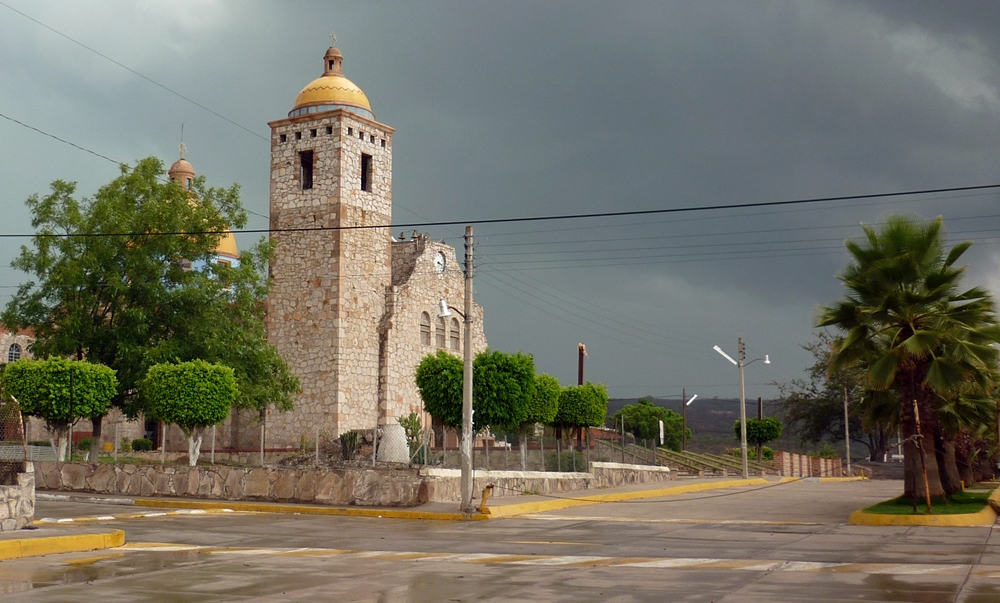
Degollado delegation on highway 90, a former orange-growing hacienda with La Pólvora dam and a stone parish church.
From La Piedad: 30 min by car (33 km by road) How to get there ↓
Near here
See everything nearby ↓


Plan your visit to Huáscato
Where to stay near Huáscato
Compare hotels, posadas and guest houses in Huáscato.
Tours to Huáscato
Day trips and guided outings from Jalpa de Cánovas often include Huáscato; with a local guide you can get there without a car.
How to get to Huáscato
- From La Piedad: about 30 min by road (~33 km)
- Nearest airport: León (Bajío) (BJX), 1 h 5 min by car to Jalpa de Cánovas
Links open a partner site. We may earn a commission if you book, at no cost to you.
About Huáscato
Huáscato is a delegation of Degollado municipality and its second most populous locality, with 1,391 residents at the 2020 census. It sits at about 1,600 metres above sea level in the Lerma-Chapala-Santiago basin, and federal highway 90 (Irapuato–Guadalajara) runs through it. Administratively it belongs to the Ciénega region, though it is traditionally counted as part of the Altos de Jalisco.
Founding is attributed to the conquistador Juan de Villaseñor y Orozco; a document of 2 July 1544 added Huáscato to his holdings. The Hacienda Huáscato, 'El Molino', depended on the Hacienda de Santa Ana Pacueco, and old papers call the place Guascato or Guazcato. Under the hacendado Ignacio Castellanos orange trees were planted and citrus became nationally known during the Porfiriato; in 1910 Porfirio Díaz visited the hacienda to hunt deer. In 1937, under President Lázaro Cárdenas, the Ejido Huáscato was granted 6,675 hectares.
The plaza holds two stone sculptures unveiled in December 2009, 'La Cruz de Huáscato' and 'El Naranjo'. The parish church of Nuestra Señora de Guadalupe was built between 1950 and 1953 on the site of the hacienda chapel, rebuilt around 1882. The Huáscato River feeds the Presa Ing. Guillermo Lugo Sanabria, 'La Pólvora', which holds 63 million cubic metres, was finished in 1988 and inaugurated on 1 December 1989.
How to get to Huáscato
Drive from La Piedad: 30 min, 33 km
Huáscato lies on free federal highway 90, between Atotonilco el Alto and the municipal seat Degollado. From Guadalajara, leave by Calzada Revolución to the junction with toll road 90D toward Zapotlanejo, then take free federal highway 90 toward Tototlán, Atotonilco el Alto, Ayotlán and Degollado: about 112 km and two hours to Degollado. There is no direct bus from Guadalajara to Degollado: from the Nueva Central Camionera, buses run to Atotonilco el Alto (Flecha Amarilla hourly, Coordinados every two hours, about 1 h 30 min), and from there you continue by taxi. Some buses to La Piedad (Primera Plus, Omnibus de México) also leave the same terminal. Confirm schedules and stops before you go.
Directions to Huáscato on Google Maps
Distances are in a straight line; the road is usually longer.
Links open a partner site. We may earn a commission if you book, at no cost to you.
From the nearest cities to Huáscato
- La Piedad · 33 km by road, 30 min
- Arandas · 49 km by road, 55 min
- Zamora · 89 km by road, 1 h 25 min
Drive times by road from OpenStreetMap, without traffic or stops. Times marked ~ are estimated from the straight-line distance.
Before you go to Huáscato: hours, prices and tips
- Best season
- Fiesta of the Virgin of Guadalupe on the last Sunday of January, with a novena; Holy Cross on 3 May; Holy Week; 15-16 September and 20 November. Wikipedia · checked Oct 2026
Hours and prices change, especially around holidays. Each fact links to where we checked it.
Visiting Huáscato: what to see and do
The stone parish church of Nuestra Señora de Guadalupe, built 1950-1953.
The plaza with the sculptures 'La Cruz de Huáscato' and 'El Naranjo'.
The ex-hacienda Huáscato, 'El Molino'.
La Pólvora dam, fed by the Huáscato River.
The Parque Arroyo de la Salud and the Huáscato River.
Plan your trip
Places to stay in Huáscato
Compare hotels, posadas, and rentals in and around Huáscato.
Tours & activities
Day trips and guided outings from Jalpa de Cánovas often include Huáscato; with a local guide you can get there without a car.
Rental cars
Pick up a car at BJX (León (Bajío)): about 1 h 5 min by road to Jalpa de Cánovas, then 52 km more to Huáscato, on your own schedule.
Flights
The nearest airport with scheduled flights is León (Bajío) (BJX), about 1 h 5 min by road from Jalpa de Cánovas, the base for Huáscato.
Mobile data
Signal can drop away from Jalpa de Cánovas: download a map of the way to Huáscato before you set out, or carry an eSIM with data.
Links open a partner site. We may earn a commission if you book, at no cost to you.
When to go to Huáscato mild
Huáscato shares the climate of Jalpa de Cánovas, 52 km away. The best months to visit are January, February, March, and April.
See the month-by-month climate of Jalpa de Cánovas
Weather in Huáscato now and the next 7 days
Live forecast from Open-Meteo. Chance of rain is the day's highest.
The closest Pueblo Mágico: Jalpa de Cánovas

Jalpa de Cánovas is the Pueblo Mágico closest to Huáscato, with places to stay, food, and more to see.
Also close to
- Jiquilpan · Michoacán · 73 km away
Closest to Huáscato
-
Ayotlán · Town · 10 km away
-
Degollado · Town · 12 km away
-
Jesús María · Town · 14 km away
-
Arandas · Town · 27 km away
-
Atotonilco el Alto · Town · 28 km away
-
La Barca · City · 38 km away
-
Ciudad Manuel Doblado · Town · 41 km away
-
Zona Arqueológica de Plazuelas · Archaeological site · 44 km away


Near Huáscato


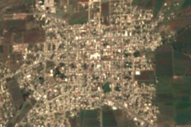

Drive times by road from OpenStreetMap, without traffic. Times marked ~ are estimated from the straight-line distance.
Location from OpenStreetMap. Written by Puebloteca.