Town Tepatitlán de Morelos, Jalisco Municipality of Tepatitlán de Morelos
Tepatitlán's largest delegación in Los Altos de Jalisco: tequila distilleries, dairy sweets and a December Guadalupe fair with parade floats.
From Tepatitlán: 25 min by car (25 km by road) How to get there ↓
Near here
See everything nearby ↓


Plan your visit to Capilla de Guadalupe
Where to stay near Capilla de Guadalupe
Compare hotels, posadas and guest houses in Capilla de Guadalupe.
Tours to Capilla de Guadalupe
Day trips around Temacapulín sometimes stop in Capilla de Guadalupe; a tour is the easy way to see it without a car.
 Tours from Guadalajara
Full Day Tour to Tequila and Amatitán with Fun and Culture
★ 4.9 (751) · From US$44
How to get to Capilla de Guadalupe
- From Tepatitlán: about 25 min by road (~25 km)
- Nearest airport: Aguascalientes (AGU), 2 h 1 min by car to Temacapulín
Links open a partner site. We may earn a commission if you book, at no cost to you.
Tours from Guadalajara, near Capilla de Guadalupe


Tours, prices and ratings from Viator, checked weekly. We may earn a commission if you book.
About Capilla de Guadalupe
Capilla de Guadalupe is a small city in the Altos Sur region of Jalisco, about 2,020 metres up in a valley ringed by hills northeast of Tepatitlán de Morelos. It is not a municipal seat but a delegación of Tepatitlán, the largest and busiest one, and together with San José de Gracia it has long campaigned to break away and become Jalisco's 126th municipality. The 2020 census counted 15,640 people, and the town now runs into the neighbouring communities of Los Sauces, El Cinco, El Espino and San Antonio, as well as Cerro Gordo and Los Dolores across the line in San Ignacio Cerro Gordo.
The town was founded in 1820, almost at the moment Mexico won independence, by Antonio de Aceves y Casillas, a criollo from the Mirandillas hacienda in San Miguel el Alto who served as police commissioner for the outposts of La Tinaja, Las Encinillas, El Cacalote, El Aguacate and La Presa de Gómez. Local tradition says he built the first chapel to keep a vow: thrown from his horse with one foot caught in the stirrup, he called on the Virgin of Guadalupe before he could be dragged. That gave the town its name and its church, which became a parish in 1910. The area was deeply involved in the Cristero War and lies on the Ruta Cristera.
Agave and farming keep the town going. Capilla sits inside the tequila denomination-of-origin zone and has tequila distilleries and plants making inulin and agave syrup, alongside cattle ranching, poultry farms, flower growing and textile factories. Local dairies supply the fresh cheese, requesón, butter, cajeta and milk sweets sold around town; everyday food runs to mole de olla, pozole and tacos de carnaza or al pastor, and the chocomilk ice pops from "El Feo" are a local favourite.
The climate is mild most of the year, with summer rains and dry heat in April and May; winters are cold and it has occasionally snowed. Cerro Gordo, Cerro Carnicero, Cerro Güilote, Cerro del Maguey and Cerro del Pandillo surround the valley, and the little hill of El Cacalote gives a view over the whole town. The big event is the Guadalupe fair from 3 to 12 December, with daily processions through the streets and parades of decorated floats.
How to get to Capilla de Guadalupe
Drive from Tepatitlán: 25 min, 25 km
From Guadalajara it is about 97 km by road, roughly 1 hour 20 minutes by car: take the highway to Tepatitlán, then continue about 25 km, around 30 minutes, on the paved Tepatitlán–Arandas road. Arandas is about 32 km further east on the same road.
There are no published timetables for a direct bus from Guadalajara. The practical route is via Tepatitlán: Coordinados and Flecha Amarilla leave from Guadalajara's Nueva Central Camionera (module 1), and Omnibus de Oriente runs about every 30 minutes; the ride takes 1 h 10 min to 1 h 45 min. From Tepatitlán's bus station, Omnibus de Oriente continues to the Capilla de Guadalupe bus station (about 30 minutes, around 54 pesos) with few departures a day, so ask at the ticket window; otherwise take a taxi from Tepatitlán. Capilla's bus station is at Avenida Vicente Guerrero 148 in the centre. The nearest Pueblo Mágico, Temacapulín, is about 73 km by road, roughly 1 h 30 min.
Directions to Capilla de Guadalupe on Google Maps
Distances are in a straight line; the road is usually longer.
Links open a partner site. We may earn a commission if you book, at no cost to you.
From the nearest cities to Capilla de Guadalupe
- Tepatitlán · 25 km by road, 25 min
- Arandas · 31 km by road, 30 min
- San Juan de los Lagos · 76 km by road, 1 h
Drive times by road from OpenStreetMap, without traffic or stops. Times marked ~ are estimated from the straight-line distance.
Before you go to Capilla de Guadalupe: hours, prices and tips
- Best season
- Guadalupe fair and feast 3–12 December; San José Obrero 29 April–1 May; Sacred Heart in the first half of June; San Pedro 27–29 June; Our Lady of Carmen 14–16 July; San Francisco 2–4 October. Wikipedia (es) · checked Oct 2026
Hours and prices change, especially around holidays. Each fact links to where we checked it.
Visiting Capilla de Guadalupe: what to see and do
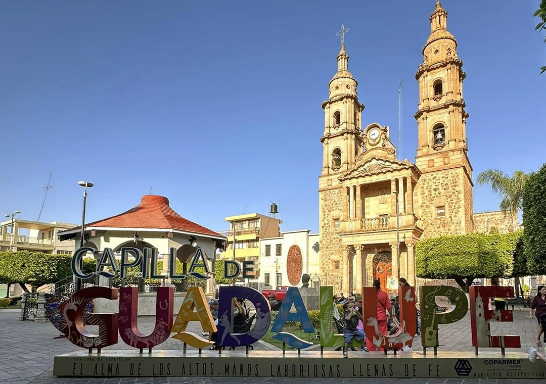
The Parish of Our Lady of Guadalupe and the Plaza de Armas in the centre.
Parque del Charro and the Esteban Vera M. and La Guadalupana charro rings.
The hill of El Cacalote for a view over the town, and the woods of Cerro Gordo.
The Santuario del Señor del Perdón in Los Sauces and the church of San Pedro Apóstol.
The tequila distilleries and agave fields around town.
Local fresh cheese, requesón, cajeta and milk sweets.
Plan your trip
Places to stay in Capilla de Guadalupe
Compare hotels, posadas, and rentals in and around Capilla de Guadalupe.
Tours & activities
Day trips around Temacapulín sometimes stop in Capilla de Guadalupe; a tour is the easy way to see it without a car.
Rental cars
Pick up a car at AGU (Aguascalientes): about 2 h 1 min by road to Temacapulín, then 42 km more to Capilla de Guadalupe, on your own schedule.
Flights
The nearest airport with scheduled flights is Aguascalientes (AGU), about 2 h 1 min by road from Temacapulín, the base for Capilla de Guadalupe.
Mobile data
Signal can drop away from Temacapulín: download a map of the way to Capilla de Guadalupe before you set out, or carry an eSIM with data.
Links open a partner site. We may earn a commission if you book, at no cost to you.
When to go to Capilla de Guadalupe mild
Capilla de Guadalupe shares the climate of Temacapulín, 42 km away. The best months to visit are January, March, April, and November.
See the month-by-month climate of Temacapulín
Weather in Capilla de Guadalupe now and the next 7 days
Live forecast from Open-Meteo. Chance of rain is the day's highest.
The closest Pueblo Mágico: Temacapulín

Temacapulín is the Pueblo Mágico closest to Capilla de Guadalupe, with places to stay, food, and more to see.
Also close to
- Jalpa de Cánovas · Guanajuato · 64 km away
- Nochistlán · Zacatecas · 65 km away
- Tlaquepaque · Jalisco · 78 km away
Closest to Capilla de Guadalupe
-
Mirandillas · Village · 14 km away
-
Pegueros · Village · 16 km away
-
Tepatitlán de Morelos · City · 17 km away
-
Valle de Guadalupe · Village · 21 km away
-
Arandas · Town · 29 km away
-
Atotonilco el Alto · Town · 32 km away
-
Acatic · Town · 34 km away
-
El Refugio · Village · 34 km away


Near Capilla de Guadalupe


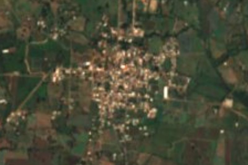

Drive times by road from OpenStreetMap, without traffic. Times marked ~ are estimated from the straight-line distance.
Location from OpenStreetMap. Written by Puebloteca.