
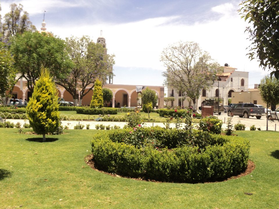
Village San Miguel el Alto, Jalisco
Dairy and cattle village in the Altos de Jalisco, settled by families from Extremadura; San Isidro church and a May festival.
From Tepatitlán: 50 min by car (32 km by road) How to get there ↓
Near here
See everything nearby ↓


Plan your visit to Mirandillas
Where to stay near Mirandillas
Compare hotels, posadas and guest houses in Mirandillas.
Tours to Mirandillas
Day trips and guided outings from Temacapulín often include Mirandillas; with a local guide you can get there without a car.
 Tours from Guadalajara
Full Day Tour to Tequila and Amatitán with Fun and Culture
★ 4.9 (751) · From US$44
How to get to Mirandillas
- From Tepatitlán: about 50 min by road (~32 km)
- Nearest airport: Aguascalientes (AGU), 2 h 1 min by car to Temacapulín
Links open a partner site. We may earn a commission if you book, at no cost to you.
Tours from Guadalajara, near Mirandillas


Tours, prices and ratings from Viator, checked weekly. We may earn a commission if you book.
About Mirandillas
Mirandillas is a delegación (sub-municipal district) of San Miguel el Alto in the Altos Sur region of Jalisco, sitting at about 1,950 metres. The village itself had 714 residents at the 2020 census, but the delegación covers some 200 km² of farmland and hamlets such as San José del Cuarto, La Mata and La Trinidad. Locals call it Mirandilla, singular; the state government adds the s when naming the whole district.
The name comes from the village of Mirandilla in the Spanish province of Badajoz, home of its first Spanish settlers. Tradition credits José Dolores de la Barba with founding it in the late 17th century, and it is known as "the navel of the Altos" because families with some of the region's most common surnames, Martín del Campo, Casillas, Franco and Jiménez, trace their roots here. This was cattle-hacienda country, and an old local saying claims its families married their cousins to keep the bloodline unmixed.
The village grew up around the church of San Isidro Labrador, begun in 1907 and finished around the 1950s, a Latin-cross building with a dome and a pink cantera stone front with twin towers. In 1983 the old comisaría was raised to a municipal delegación. Milk drives the economy today: the community counts itself the national leader in fluid milk production per person and is known across the region for its fresh cheeses.
How to get to Mirandillas
Drive from Tepatitlán: 50 min, 32 km
Mirandillas is about 18 km in a straight line from the municipal seat, San Miguel el Alto, and about 11 km southeast of Valle de Guadalupe. San Miguel el Alto links to Valle de Guadalupe on state highway 311, which crosses the 80D Guadalajara–Lagos de Moreno toll road and ends at federal highway 80; Mirandillas is reached by the road to San Miguel el Alto, which passes San José del Cuarto, 5 km from the village. By bus, Coordinados runs from Module 1 of Guadalajara's Nueva Central Camionera to Valle de Guadalupe (about 1 h 45 min), and San Miguel el Alto has its own bus station. The last stretch to the villages is by hired car, minibus or your own vehicle. Guadalajara to San Miguel el Alto is about 1 h 25 min by car.
Directions to Mirandillas on Google Maps
Distances are in a straight line; the road is usually longer.
Links open a partner site. We may earn a commission if you book, at no cost to you.
From the nearest cities to Mirandillas
- Tepatitlán · 32 km by road, 50 min
- San Juan de los Lagos · 55 km by road, 1 h
- Arandas · 47 km by road, 1 h 10 min
Drive times by road from OpenStreetMap, without traffic or stops. Times marked ~ are estimated from the straight-line distance.
Before you go to Mirandillas: hours, prices and tips
- Best season
- San Isidro Labrador patron festival 7–15 May; Jesús Resucitado festival on Easter Sunday; Harvest Fair 10–12 October; anniversary of the delegación on 26 October. Wikipedia (es) · checked Oct 2026
Hours and prices change, especially around holidays. Each fact links to where we checked it.
Visiting Mirandillas: what to see and do
The parish church of San Isidro Labrador, pink cantera stone with twin towers, begun in 1907.
The Josefa Hernández main square, with gardens in front of the church.
The church of Jesús Resucitado, four blocks from the square, with a gabled roof and pink stone figures, first Mass in 2015.
Old haciendas and mansions such as Hacienda del Burral, the Casona de las Diligencias and the Mirandilla bridge.
The shrine of the Niño de los Afligidos, a small chapel 4 km from the village.
Fresh cheeses from this dairy district.
Plan your trip
Places to stay in Mirandillas
Compare hotels, posadas, and rentals in and around Mirandillas.
Tours & activities
Day trips and guided outings from Temacapulín often include Mirandillas; with a local guide you can get there without a car.
Rental cars
Pick up a car at AGU (Aguascalientes): about 2 h 1 min by road to Temacapulín, then 32 km more to Mirandillas, on your own schedule.
Flights
The nearest airport with scheduled flights is Aguascalientes (AGU), about 2 h 1 min by road from Temacapulín, the base for Mirandillas.
Mobile data
Signal can drop away from Temacapulín: download a map of the way to Mirandillas before you set out, or carry an eSIM with data.
Links open a partner site. We may earn a commission if you book, at no cost to you.
When to go to Mirandillas mild
Mirandillas shares the climate of Temacapulín, 32 km away. The best months to visit are January, March, April, and November.
See the month-by-month climate of Temacapulín
Weather in Mirandillas now and the next 7 days
Live forecast from Open-Meteo. Chance of rain is the day's highest.
The closest Pueblo Mágico: Temacapulín

Temacapulín is the Pueblo Mágico closest to Mirandillas, with places to stay, food, and more to see.
Also close to
- Nochistlán · Zacatecas · 56 km away
- Jalpa de Cánovas · Guanajuato · 59 km away
- Lagos de Moreno · Jalisco · 79 km away
Closest to Mirandillas
-
Valle de Guadalupe · Village · 11 km away
-
Pegueros · Village · 13 km away
-
Capilla de Guadalupe · Town · 14 km away
-
Jalostotitlán · Town · 26 km away
-
Tepatitlán de Morelos · City · 27 km away
-
Cañadas de Obregón · Town · 28 km away
-
Arandas · Town · 33 km away
-
Presa El Zapotillo · Landmark · 35 km away

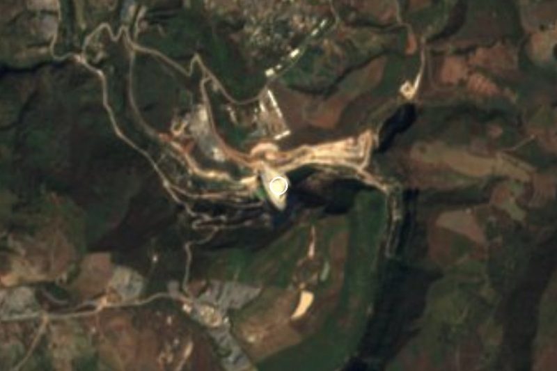
Near Mirandillas


Drive times by road from OpenStreetMap, without traffic. Times marked ~ are estimated from the straight-line distance.
Location from OpenStreetMap. Written by Puebloteca.