


Town Lázaro Cárdenas, Michoacán Municipality of Lázaro Cárdenas Michoacán coast
Clifftop fishing town above the calm Bahía Bufadero, with palapa restaurants on the sand, a working lighthouse and the Nexpa surf ten minutes away.
From Lázaro Cárdenas: 50 min by car (69 km by road) How to get there ↓
Plan your visit to Caleta de Campos
Where to stay near Caleta de Campos
Compare hotels, posadas and guest houses in Caleta de Campos.
Tours to Caleta de Campos
Day trips around Michoacán sometimes stop in Caleta de Campos; a tour is the easy way to see it without a car.
How to get to Caleta de Campos
- From Lázaro Cárdenas: about 50 min by road (~69 km)
Links open a partner site. We may earn a commission if you book, at no cost to you.
About Caleta de Campos
Caleta de Campos is a small town and tenencia of the municipality of Lázaro Cárdenas, about 50 km up the coast from Playa Azul, home to just under 3,000 people. Officially the locality is called Bahía Bufadero, after the bay below it, and some maps show only that name. The bay takes its name from the snorting sound (bufido) the waves make as they hit its cliffs. The town sits on the high ground above the water, and on the point stands the Faro Bufadero, a Navy lighthouse whose light, with a range of 18 nautical miles, was restored to normal service in September 2023.
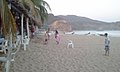
What brings people down to the shore is how calm the water is. Unlike the open, pounding beaches on either side, the bay is sheltered, with yellow sand and deep blue water, so families swim here, go out in boats, snorkel and fish at dawn, and some windsurf. Palapa restaurants line the sand serving fish and seafood, there are bungalows looking out to sea, and it is common to see families camping on the beach. The landscape is classic Michoacán coast: reddish hills and large rocks surrounded by sea. The climate is hot and humid all year, warmest in July, with most of the rain falling in late summer and September the wettest month.
Caleta is also the practical base for this stretch of coast. It has shops and services that the surf camps and villages nearby lack, and the long left at the mouth of the Nexpa river, one of the best-known surf breaks in Mexico, is about ten minutes' drive away. Travellers heading north-west to Maruata and the beaches of Aquila often spend a night here or in Lázaro Cárdenas to split the long drive. Nearby you can also visit the El Atrancón waterfall and Playa Huahua, an undeveloped beach about 30 km away where people camp, surf and kayak.
How to get to Caleta de Campos
Drive from Lázaro Cárdenas: 50 min, 69 km
Caleta de Campos is just off coastal Federal Highway 200, north-west of Lázaro Cárdenas and about 50 km past Playa Azul. Long-distance buses (Autovías and Parhikuni, among others) run from Morelia, Uruapan and Mexico City to Lázaro Cárdenas, and from there minibuses and colectivos continue up the coast to Caleta. Lázaro Cárdenas also has the nearest airport and the last big supply stop for fuel and cash.
Directions to Caleta de Campos on Google Maps
Distances are in a straight line; the road is usually longer.
Links open a partner site. We may earn a commission if you book, at no cost to you.
From the nearest cities to Caleta de Campos
- Lázaro Cárdenas · 69 km by road, 50 min
- Zihuatanejo · 163 km by road, 2 h
- Apatzingán · about 155 km by road, ~2 h 20 min
Drive times by road from OpenStreetMap, without traffic or stops. Times marked ~ are estimated from the straight-line distance.
Before you go to Caleta de Campos: hours, prices and tips
- Best time of day
- Hot all year (about 26 °C on average); February is the coolest month, July the warmest and September the rainiest. PueblosAmérica · checked Oct 2026
- What to bring
- Cash: many communities on this coast have no ATMs or card terminals, so stock up in Lázaro Cárdenas. México Desconocido · checked Oct 2026
Hours and prices change, especially around holidays. Each fact links to where we checked it.
Visiting Caleta de Campos: what to see and do
Swim, snorkel or take a boat out in the sheltered water of Bahía Bufadero.
Dive the former Mexican Navy ship sunk in the cove, at 15 to 33 m.
Eat fresh fish at the palapa restaurants on the sand.
Walk out to the Faro Bufadero lighthouse on the point.
Drive ten minutes to watch the surfers at the mouth of the Nexpa river.
Visit the El Atrancón waterfall, or camp and kayak at Playa Huahua, about 30 km away.
Plan your trip
Places to stay in Caleta de Campos
Compare hotels, posadas, and rentals in and around Caleta de Campos.
Tours & activities
Day trips around Michoacán sometimes stop in Caleta de Campos; a tour is the easy way to see it without a car.
Mobile data
Signal can drop away from Michoacán: download a map of the way to Caleta de Campos before you set out, or carry an eSIM with data.
Links open a partner site. We may earn a commission if you book, at no cost to you.
Photos
Closest to Caleta de Campos
-
Nexpa · Beach · 4 km away
-
Playa Azul · Town · 44 km away


Near Caleta de Campos


Drive times by road from OpenStreetMap, without traffic. Times marked ~ are estimated from the straight-line distance.
Location from OpenStreetMap. Written by Puebloteca.