
17 archaeological sites · within 60 km
There are 17 archaeological sites within 60 km of Teotihuacán in a straight line, an hour or a little more by road. The closest is Zona Arqueológica de Teotihuacan, 0 km away; the farthest, Los Cerritos de Tepatlaxco, is 59 km. They are listed under the Pueblos Mágicos of Teotihuacán, Tepotzotlán, Otumba, and Zempoala, which make good bases.
Most archaeological sites are run by INAH and open from about 8 or 9 a.m. to 5 p.m. for a small fee. Midday is the hottest and busiest time, so go early.
Best months, when most of these towns are dry with comfortable afternoons: Jan, Feb, Mar, Dec.
The Ruins 17
-
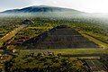
Zona Arqueológica de Teotihuacan · Archaeological site · 0 km from Teotihuacán
The great pyramid city next door: the Avenue of the Dead, the Pyramids of the Sun and Moon, and painted palaces. -
Baños de Nezahualcóyotl · Archaeological site · 22 km from Teotihuacán
The hilltop gardens and rock-cut baths of Texcoco's poet-king Nezahualcóyotl on the Tetzcotzinco hill, with wide views. -
Zona Arqueológica de Huexotla · Archaeological site · 24 km from Teotihuacán
An old Acolhua city south of Texcoco with a rare surviving defensive wall and a Franciscan church on its ancient center. -
Zona Arqueológica de Tecoaque · Archaeological site · 26 km from Teotihuacán · Near Otumba
A small Acolhua site in Tlaxcala where a Spanish caravan was captured and sacrificed in 1520. -
Zona Arqueológica de Xihuingo · Archaeological site · 33 km from Teotihuacán · Near Zempoala
A Teotihuacan-era site below Cerro Xihuingo, known for its cliffs of petroglyphs and astronomical dotted crosses. -
Pirámide de Tenayuca · Archaeological site · 38 km from Teotihuacán · Near Tepotzotlán
A Chichimec and Aztec pyramid rebuilt over itself many times, ringed by a wall of 138 carved stone serpents. -
Santa Cecilia Acatitlan · Archaeological site · 38 km from Teotihuacán · Near Tepotzotlán
A small Mexica pyramid with its temple rebuilt on top, the best idea of how Aztec shrines looked, plus a little museum. -
Acozac · Archaeological site · 41 km from Teotihuacán · Estado de México
Acolhua ruins in Ixtapaluca with a round temple to Ehécatl and a great platform facing the volcanoes; free entry. -
Tlatelolco · Archaeological site · 41 km from Teotihuacán · Ciudad de México
Aztec temples, a 1609 Franciscan church and modernist towers on one square: the Plaza de las Tres Culturas, site of the last stand of 1521 and of 1968. -
Templo Mayor · Archaeological site · 42 km from Teotihuacán · Ciudad de México
The Aztecs' great twin temple, unearthed after 1978 beside the Zócalo: walk through seven building stages, then see the Coyolxauhqui stone inside. -
Baños de Moctezuma · Archaeological site · 47 km from Teotihuacán · Ciudad de México
Pre-Hispanic water tank at the foot of Chapultepec hill plus the remains of an 1870 bathhouse; Moctezuma never bathed here, but the name stuck. -
Tlatilco · Archaeological site · 48 km from Teotihuacán · Estado de México
A Preclassic village famous for its figurines, now under the streets and factories of San Luis Tlatilco; there is no site to visit. -
Copilco · Archaeological site · 53 km from Teotihuacán · Ciudad de México
A Preclassic village buried under Xitle's lava, tunnelled into by Manuel Gamio in 1917; its site museum closed to the public in the early 1980s. -
Tlalancaleca (zona arqueológica) · Archaeological site · 53 km from Teotihuacán · Puebla
Formative-period city at the foot of the Sierra Nevada, among central Mexico's largest before Teotihuacan; it outlived a Popocatépetl eruption. -
Cuahilama · Archaeological site · 55 km from Teotihuacán · Ciudad de México
Hill with 15th-century petroglyphs in Santa Cruz Acalpixca, Xochimilco: free entry, a half-hour climb and views over the canals. -
Cuicuilco · Archaeological site · 56 km from Teotihuacán · Ciudad de México
A round, terraced pyramid more than 2,000 years old, half-swallowed by lava from the Xitle volcano, free to visit beside Insurgentes Sur. -
Los Cerritos de Tepatlaxco · Archaeological site · 59 km from Teotihuacán · Puebla
Nine pyramid bases on the rims of ravines on the slopes of Cerro Totolqueme, inhabited from 300 BC to 600 AD, just outside Texmelucan.




On the map
Distances are in a straight line; roads add about a third.
Where to stay
The Pueblos Mágicos these places are closest to, each with hotels, food and getting-there notes.


More places like these
More around Teotihuacán
Ruins elsewhere
Names and locations from OpenStreetMap; notes and write-ups are our own.