
Archaeological site San Martín Texmelucan, Puebla Municipality of San Martín Texmelucan Volcano Route Monasteries on the slopes of Popocatépetl Puebla Valley
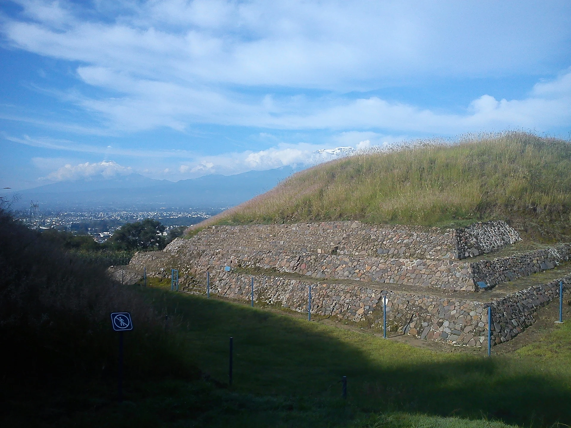
Nine pyramid bases on the rims of ravines on the slopes of Cerro Totolqueme, inhabited from 300 BC to 600 AD, just outside Texmelucan.
From San Martín Texmelucan: 10 min by car (5 km by road) How to get there ↓
Near here
See everything nearby ↓


Plan your visit to Los Cerritos de Tepatlaxco
Where to stay near Los Cerritos de Tepatlaxco
Compare hotels, posadas and guest houses in Los Cerritos de Tepatlaxco.
Tours to Los Cerritos de Tepatlaxco
A guide brings Los Cerritos de Tepatlaxco to life: look for tours from Huejotzingo that include the site and the ride there.
How to get to Los Cerritos de Tepatlaxco
- From San Martín Texmelucan: about 10 min by road (~5 km)
- Nearest airport: Puebla (PBC), 7 min by car to Huejotzingo
Links open a partner site. We may earn a commission if you book, at no cost to you.
About Los Cerritos de Tepatlaxco
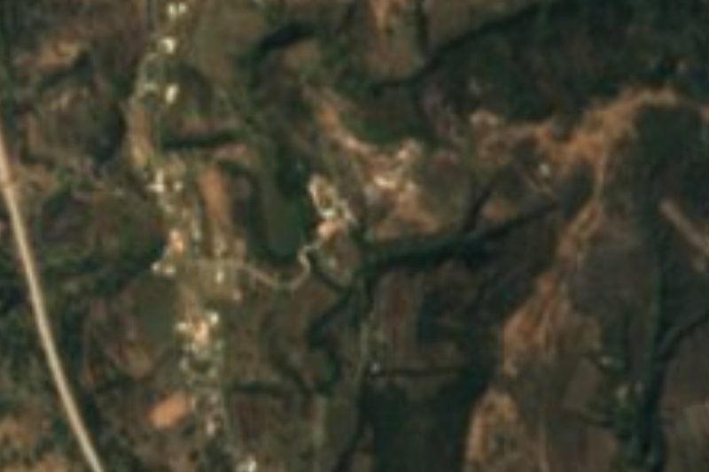
Locals simply call them the little hills of San Cristóbal Tepatlaxco: nine pyramid bases between 2.5 and 9 metres high that look taller than they are because they rise right on the edges of ravines. The site sits on the lower southwestern slopes of Cerro Totolqueme, about 2 km from San Martín Texmelucan and less than a kilometre north of the Atoyac River; gullies hem it in on the south, east, west and northwest, growing deeper toward the north. Beside the zone is the hamlet of San José, with 38 residents in 2020, at roughly 2,290 metres.
According to INAH, the place was occupied from roughly 300 BC to 600 AD. Nobody knows where its first settlers came from, but it is thought to have been a fortified site with strong Olmec influence. The materials found resemble those of Tlalancaleca, Texmelucan, Moyotzingo and other settlements of the Puebla-Tlaxcala Valley, which suggests trade and family ties among them. The name comes from the neighbouring village and has two Nahuatl readings: "in the ballcourt of the palace" or "plain of stony ground".
The buildings were made of irregular blocks of tepetate, faced with river cobbles and coated with a crushed-lime stucco that gave them a smooth, shiny finish. The highlights are Mound A, a pyramid base of about 7 metres standing on a 1.70 m platform, and the East Slope, built straight onto the hill's uneven ground on a north-south line, where five volcanic-stone steps of its stairway survive. There is also a smaller mound and an attached base. The zone is national heritage, and in December 2025 INAH marked 45 years since it opened.
How to get to Los Cerritos de Tepatlaxco
Drive from San Martín Texmelucan: 10 min, 5 km
It is 39 km from Puebla city and 18 km from Huejotzingo. Take federal highway 190 (Mexico-Puebla) to San Cristóbal Tepatlaxco, before Texmelucan; head east on Avenida del Trabajo and then follow the dirt road along the western edge. At the fork keep to the middle road and, about 800 m on, take the left-hand track with INAH signs; the last 200 m northwest are on foot.
Directions to Los Cerritos de Tepatlaxco on Google Maps
Distances are in a straight line; the road is usually longer.
Links open a partner site. We may earn a commission if you book, at no cost to you.
From the nearest cities to Los Cerritos de Tepatlaxco
- San Martín Texmelucan · 5 km by road, 10 min
- Chiautempan · 36 km by road, 35 min
- Puebla · 44 km by road, 45 min
Drive times by road from OpenStreetMap, without traffic or stops. Times marked ~ are estimated from the straight-line distance.
Before you go to Los Cerritos de Tepatlaxco: hours, prices and tips
- Hours
- Thursday to Sunday, 9 am to 6 pm. INAH Lugares · checked Oct 2026
Hours and prices change, especially around holidays. Each fact links to where we checked it.
Visiting Los Cerritos de Tepatlaxco: what to see and do
Mound A on its platform, the East Slope with its five volcanic-stone steps, the smaller mound and the attached base. Look for the remains of the cobble and stucco facing. From the ravine edges you overlook the Texmelucan valley and, on clear days, the volcanoes.
Plan your trip
Places to stay in Los Cerritos de Tepatlaxco
Compare hotels, posadas, and rentals in and around Los Cerritos de Tepatlaxco.
Tours & activities
A guide brings Los Cerritos de Tepatlaxco to life: look for tours from Huejotzingo that include the site and the ride there.
Rental cars
Pick up a car at PBC (Puebla): about 7 min by road to Huejotzingo, then 18 km more to Los Cerritos de Tepatlaxco, on your own schedule.
Flights
The nearest airport with scheduled flights is Puebla (PBC), about 7 min by road from Huejotzingo, the base for Los Cerritos de Tepatlaxco.
Mobile data
Signal can drop away from Huejotzingo: download a map of the way to Los Cerritos de Tepatlaxco before you set out, or carry an eSIM with data.
Links open a partner site. We may earn a commission if you book, at no cost to you.
When to go to Los Cerritos de Tepatlaxco mild
Los Cerritos de Tepatlaxco shares the climate of Huejotzingo, 18 km away. The best months to visit are January, February, March, and November.
See the month-by-month climate of Huejotzingo
Weather in Los Cerritos de Tepatlaxco now and the next 7 days
Live forecast from Open-Meteo. Chance of rain is the day's highest.
The closest Pueblo Mágico: Huejotzingo

Huejotzingo is the Pueblo Mágico closest to Los Cerritos de Tepatlaxco, with places to stay, food, and more to see.
Also close to
Closest to Los Cerritos de Tepatlaxco
-
San Cristóbal Tepatlaxco · Village · 2 km away
-
Hacienda de Chautla · Landmark · 3 km away
-
San Rafael Tlanalapan · Town · 3 km away
-
Exconvento de Santa María Magdalena · Landmark · 4 km away
-
San Lucas el Grande · Village · 4 km away
-
San Martín Texmelucan · City · 5 km away
-
Villa Alta · Town · 5 km away
-
Alpotzonga de Lira y Ortega · Village · 6 km away

Near Los Cerritos de Tepatlaxco






Drive times by road from OpenStreetMap, without traffic. Times marked ~ are estimated from the straight-line distance.
Lists with Los Cerritos de Tepatlaxco
Ruins in Puebla · 8 Ruins near San Martín Texmelucan · 13 Ruins near Huejotzingo · 12 Ruins near Chiautempan · 9 Ruins near Puebla · 8 Ruins near Atlixco · 11 Ruins near Tlaxco · 9 Ruins near Otumba · 15Location from OpenStreetMap. Written by Puebloteca.