Town General Plutarco Elías Calles, Sonora
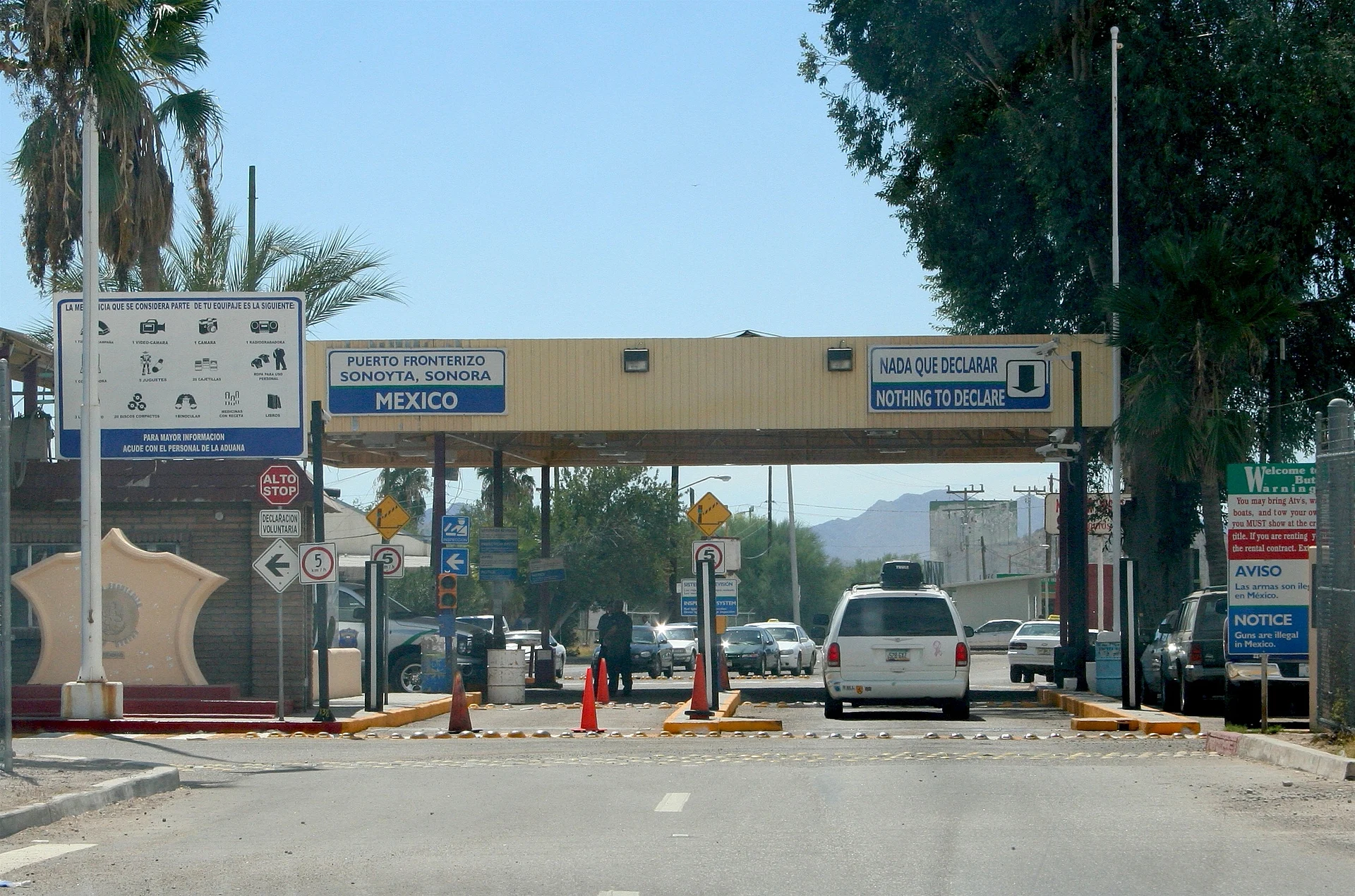
The crossing facing Lukeville, Arizona: where Highways 2 and 8 meet on the way to Puerto Peñasco, on a spring the Jesuits turned into a mission.
From Puerto Peñasco: about 1 h 40 min by road (~115 km) How to get there ↓
Plan your visit to Sonoyta
Where to stay near Sonoyta
Compare hotels, posadas and guest houses in Sonoyta.
Tours to Sonoyta
Day trips around Sonora sometimes stop in Sonoyta; a tour is the easy way to see it without a car.
How to get to Sonoyta
- From Puerto Peñasco: about 1 h 40 min by road (~115 km)
Links open a partner site. We may earn a commission if you book, at no cost to you.
About Sonoyta
Sonoyta is the seat of General Plutarco Elías Calles municipality in north-western Sonora, built right up against the international line opposite Lukeville, Arizona. It counted 11,440 people in the 2020 census and sits about 390 meters up in the Altar Desert. The town makes its living as a junction. Federal Highway 2, which follows the border from Mexicali to Caborca, runs through the middle, and Highway 8 starts here for the coast, so nearly everyone driving down from Arizona to the beach passes its small shops, markets and gas stations.
The name comes from a spring at the foot of Loma Alta that the Tohono O'odham, also called Pápagos, knew as Ṣon Oidag, roughly "base of the water". O'odham bands ranged over the Pinacate, Quitovac and Sonoyta when Jesuit missionaries turned the spring into a mission settlement in the 1690s under the name San Marcelo, and a group of Sobaipuri Pima settled there too. Eusebio Francisco Kino came through in October 1698 and noted it as a fine site for a large town. The German Jesuit Enrique Ruhen arrived in 1751 and was killed that November in the Pima Revolt, a day after Tomás Tello died at Caborca. Nothing of the old mission survives; a replica stands in its memory.
Mines were found nearby in 1836. Sonoyta was a municipality of the Altar district at times in the 19th century, later fell under Caborca and, from 1952, under Puerto Peñasco, until the present municipality was created in August 1989. Cross-border import and export trade thrived until Mexican customs rules changed, and from the late 1980s to the mid-1990s many families left for other cities. On the US side, Lukeville lies entirely inside Organ Pipe Cactus National Monument. Sonora keeps no daylight saving time, so clocks match Arizona's all year.
How to get to Sonoyta
Sonoyta lies where Federal Highways 2 and 8 meet, just south of the Lukeville crossing. From Puerto Peñasco, the nearest city, it is 1 h 35 min and 98 km by road, all of it north on Highway 8 across the desert. From Arizona, State Route 85 runs 27 miles (about 43 km) south from Why to the port of entry, open 6:00 a.m. to 8:00 p.m. Highway 2 continues east to Caborca and west to San Luis Río Colorado. By bus, TUFESA serves Sonoyta: about 2 hours from Caborca and roughly 6 h 12 min from Hermosillo.
Directions to Sonoyta on Google Maps
Distances are in a straight line; the road is usually longer.
Links open a partner site. We may earn a commission if you book, at no cost to you.
From the nearest cities to Sonoyta
- Puerto Peñasco · about 115 km by road, ~1 h 40 min
- Caborca · about 185 km by road, ~2 h 45 min
- Nogales · about 245 km by road, ~3 h 40 min
Drive times by road from OpenStreetMap, without traffic or stops. Times marked ~ are estimated from the straight-line distance.
Before you go to Sonoyta: hours, prices and tips
- Hours
- The Lukeville port of entry is open daily 6:00 a.m. to 8:00 p.m. Arizona time (the same as Sonora's). U.S. Customs and Border Protection · checked Oct 2026
Hours and prices change, especially around holidays. Each fact links to where we checked it.
Visiting Sonoyta: what to see and do
The Sonoyta-Lukeville port of entry, the gateway from Arizona
The replica of the Jesuit mission of San Marcelo
The town centre on Highway 2, with small shops and markets
Highway 8 south towards El Pinacate reserve and Puerto Peñasco
Organ Pipe Cactus National Monument on the Arizona side, around Lukeville
Flautas and tacos dorados at Cenaduría El Zope, Benito Juárez 817
Plan your trip
Places to stay in Sonoyta
Compare hotels, posadas, and rentals in and around Sonoyta.
Tours & activities
Day trips around Sonora sometimes stop in Sonoyta; a tour is the easy way to see it without a car.
Mobile data
Signal can drop away from Sonora: download a map of the way to Sonoyta before you set out, or carry an eSIM with data.
Links open a partner site. We may earn a commission if you book, at no cost to you.
Closest to Sonoyta
-
Quitovac · Village · 40 km away
Near Sonoyta
-
Reserva de la Biosfera El Pinacate y Gran Desierto de Altar · Nature reserve · Sonora
~1 h 35 min drive · 81 km


Drive times by road from OpenStreetMap, without traffic. Times marked ~ are estimated from the straight-line distance.
Location from OpenStreetMap. Written by Puebloteca.