Nature reserve Puerto Peñasco, Sonora Municipality of Puerto Peñasco
World Heritage desert between Sonoyta and Puerto Peñasco: lava fields, dunes up to 200 m tall and El Elegante, a crater 1.6 km across.
From Puerto Peñasco: about 1 h 20 min by road (~90 km) How to get there ↓
Plan your visit to Reserva de la Biosfera El Pinacate y Gran Desierto de Altar
Where to stay near Reserva de la Biosfera El Pinacate y Gran Desierto de Altar
Compare hotels, posadas and guest houses in Reserva de la Biosfera El Pinacate y Gran Desierto de Altar.
Tours to Reserva de la Biosfera El Pinacate y Gran Desierto de Altar
Day trips and guided outings from Sonora often include Reserva de la Biosfera El Pinacate y Gran Desierto de Altar; with a local guide you can get there without a car.
How to get to Reserva de la Biosfera El Pinacate y Gran Desierto de Altar
- From Puerto Peñasco: about 1 h 20 min by road (~90 km)
Links open a partner site. We may earn a commission if you book, at no cost to you.
About Reserva de la Biosfera El Pinacate y Gran Desierto de Altar
El Pinacate is a black volcanic shield ringed by active sand dunes, in far northwestern Sonora between Sonoyta, Puerto Peñasco and San Luis Río Colorado. It became a biosphere reserve on June 10, 1993, and a UNESCO World Heritage Site in 2013. The protected area covers about 714,000 hectares, bigger than any of the states of Aguascalientes, Colima, Morelos or Tlaxcala. Its volcanoes erupted on and off for some 4 million years, last about 11,000 years ago, and the highest summit, Cerro del Pinacate (also called Santa Clara), rises to 1,190 m.
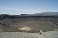
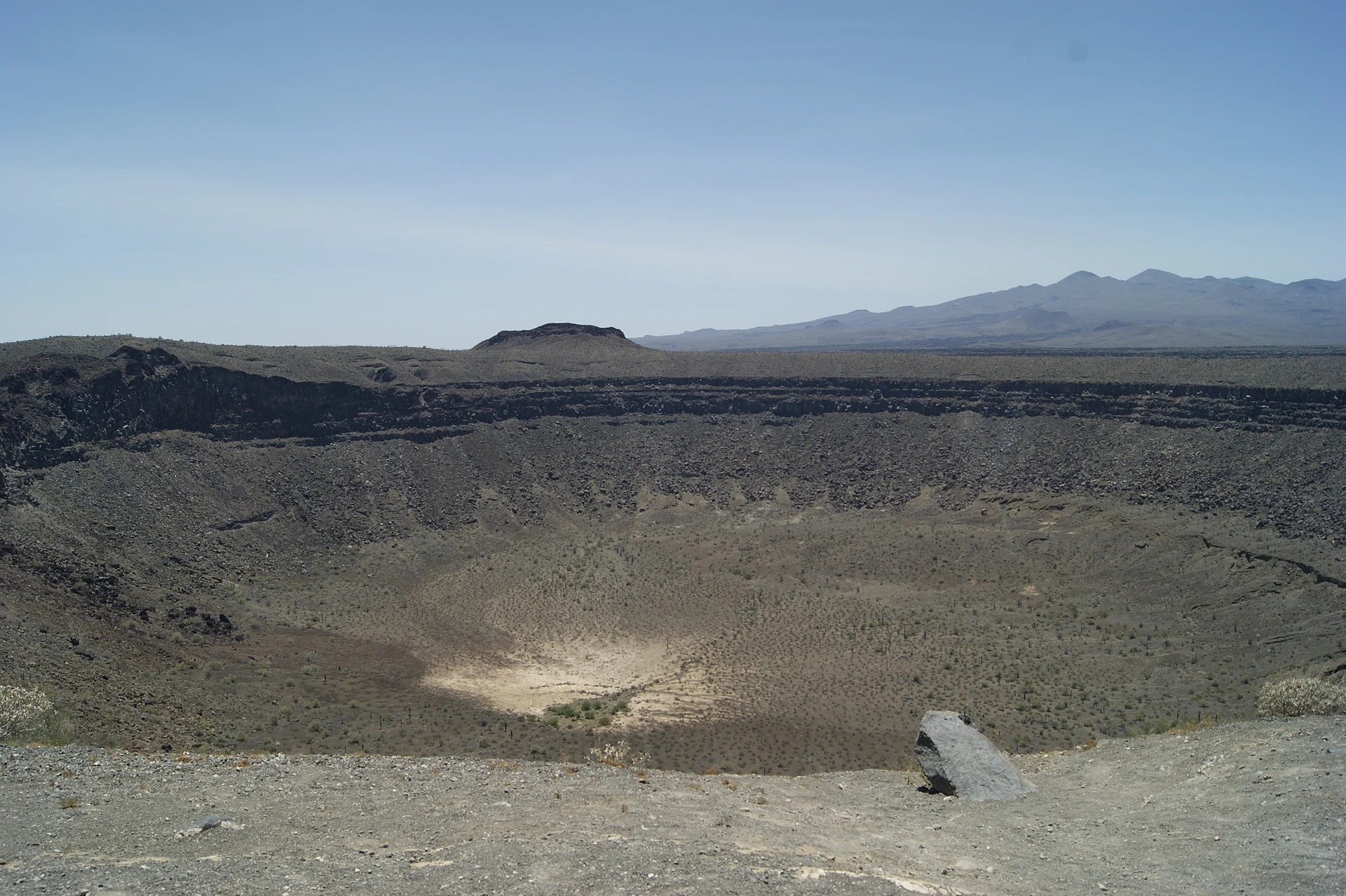
Most visitors come for the maar craters, huge pits blown open by steam where rising magma met groundwater. El Elegante, the biggest, is about 1,609 m across and 244 m deep and formed around 32,000 years ago; it once held a lake in wet periods, and you can drive almost to its rim. El Colorado, MacDougal and Sykes are nearby. From 1965 to 1970 NASA sent astronauts here to practise moonwalks on terrain that looks like the lunar surface. To the west lie the dunes of the Gran Desierto de Altar, in linear, star and dome shapes, some up to 200 m high.
The desert looks empty but holds more than 540 plant species, about 40 mammals and 200 birds, among them the Sonoran pronghorn, bighorn sheep, Gila monster and desert tortoise. The last native people here were the Pinacateños, a band of the Hia-Ced O'odham who moved between rain-filled rock pools (tinajas) down to the sea, and the Tohono O'odham now take part in running the reserve. Father Kino climbed the peak in 1698. Summer heat passes 40 °C, and winter nights can drop below freezing.
How to get to Reserva de la Biosfera El Pinacate y Gran Desierto de Altar
The reserve is explored from Federal Highway 8 between Sonoyta and Puerto Peñasco. The Schuk Toak museum and visitor centre is at km 72, where a paved road of about 6 km runs west past the granite Sierra Blanca; it is roughly 20 minutes from Puerto Peñasco. The crater route starts at km 52, halfway between the two towns (about half an hour from Puerto Peñasco): register your vehicle there, then follow a maintained dirt circuit of about 80 km. Low cars can scrape or get stuck, so a high-clearance vehicle is best. On the north side, Federal Highway 2 from San Luis Río Colorado to Sonoyta skirts the reserve at Los Vidrios. San Luis Río Colorado, the nearest city, is 1 h 45 min and 123 km away by road. There is no public transport into the reserve: come by car, by taxi from Puerto Peñasco or on a tour.
Directions to Reserva de la Biosfera El Pinacate y Gran Desierto de Altar on Google Maps
Distances are in a straight line; the road is usually longer.
Links open a partner site. We may earn a commission if you book, at no cost to you.
From the nearest cities to Reserva de la Biosfera El Pinacate y Gran Desierto de Altar
- Puerto Peñasco · about 90 km by road, ~1 h 20 min
- San Luis Río Colorado · about 150 km by road, ~2 h 15 min
- Mexicali · about 245 km by road, ~3 h 35 min
Drive times by road from OpenStreetMap, without traffic or stops. Times marked ~ are estimated from the straight-line distance.
Before you go to Reserva de la Biosfera El Pinacate y Gran Desierto de Altar: hours, prices and tips
- Hours
- Schuk Toak visitor centre: 9:00 to 17:00, closed Tuesday and Wednesday. Worth confirming before you go. Wikivoyage (en) · checked Oct 2026
- Entry
- Reserve entry: 217.32 pesos per person per day; Mexican visitors pay half. Children under 12, INAPAM card holders, people with disabilities, pensioners and retirees go free. The Schuk Toak museum asks a separate donation of 60 pesos (30 for residents, free under 6). Ley Federal de Derechos, art. 198; Chilango · checked Oct 2026
- Best season
- Autumn to spring. Summer passes 40 °C and the heat is dangerous; spring is when the desert flowers. Chilango; Rocky Point Times · checked Oct 2026
- What to bring
- All your water and supplies if you camp: the campsites are primitive. A high-clearance vehicle for the dirt roads. Chilango; Desert Peaks · checked Oct 2026
- Rules
- Register your vehicle at the start of the crater route and read the circuit rules. Register before camping at El Tecolote or Cono Rojo. The reserve itself runs no tours; book a local operator. Rocky Point Times; Chilango · checked Oct 2026
Hours and prices change, especially around holidays. Each fact links to where we checked it.
Visiting Reserva de la Biosfera El Pinacate y Gran Desierto de Altar: what to see and do
The Schuk Toak museum and visitor centre, built on a lava flow, with its three short trails
El Elegante crater, 1.6 km across and 244 m deep, from the rim
El Colorado, MacDougal and Sykes craters
The crater route, about three hours of dirt road through lava fields
The 2.4 km dune trail, October to May
The climb to Cerro del Pinacate (1,190 m) from the Cono Rojo campground
A night at El Tecolote campground, between El Elegante and El Colorado
Sierra Blanca, a granite hill about 300 million years old
Plan your trip
Places to stay in Reserva de la Biosfera El Pinacate y Gran Desierto de Altar
Compare hotels, posadas, and rentals in and around Reserva de la Biosfera El Pinacate y Gran Desierto de Altar.
Tours & activities
Day trips and guided outings from Sonora often include Reserva de la Biosfera El Pinacate y Gran Desierto de Altar; with a local guide you can get there without a car.
Travel insurance
If you plan on hiking at Reserva de la Biosfera El Pinacate y Gran Desierto de Altar, check that your policy covers it: some plans leave adventure activities out.
Mobile data
Signal can drop away from Sonora: download a map of the way to Reserva de la Biosfera El Pinacate y Gran Desierto de Altar before you set out, or carry an eSIM with data.
Links open a partner site. We may earn a commission if you book, at no cost to you.
Near Reserva de la Biosfera El Pinacate y Gran Desierto de Altar
-
Reserva de la Biosfera Alto Golfo de California y Delta del Río Colorado · Nature reserve · Sonora
~1 h 35 min drive · 82 km


Drive times by road from OpenStreetMap, without traffic. Times marked ~ are estimated from the straight-line distance.
Lists with Reserva de la Biosfera El Pinacate y Gran Desierto de Altar
Nature Parks in Sonora · 7Location from OpenStreetMap. Written by Puebloteca.