
Village San Luis Río Colorado, Sonora Municipality of San Luis Río Colorado
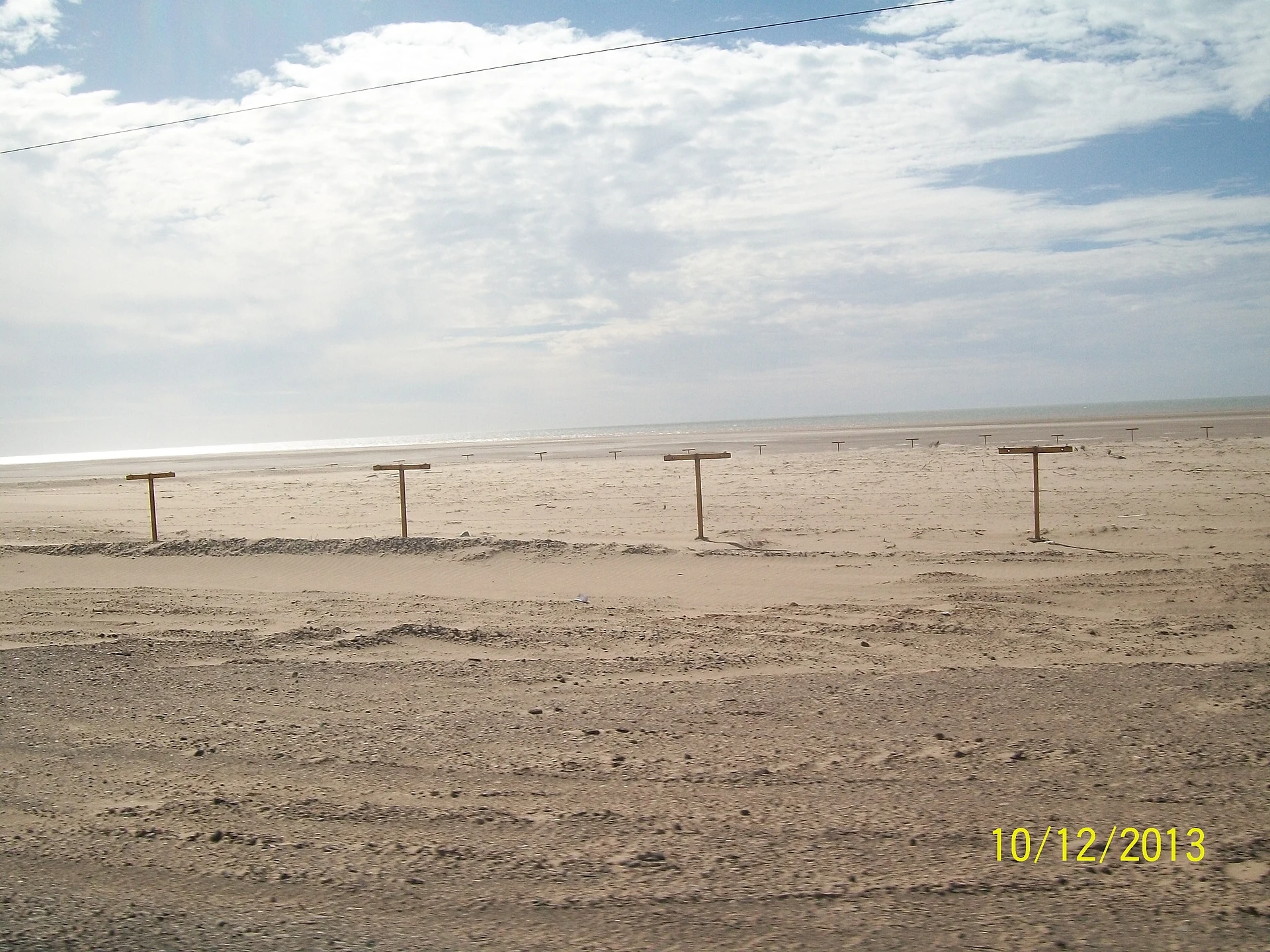
Corvina-fishing village at the very top of the Gulf of California: wide beaches, huge tides and the El Machorro dune.
From San Luis Río Colorado: about 1 h 40 min by road (~115 km) How to get there ↓
Plan your visit to Golfo de Santa Clara
Where to stay near Golfo de Santa Clara
Compare hotels, posadas and guest houses in Golfo de Santa Clara.
Tours to Golfo de Santa Clara
Day trips and guided outings from Sonora often include Golfo de Santa Clara; with a local guide you can get there without a car.
How to get to Golfo de Santa Clara
- From San Luis Río Colorado: about 1 h 40 min by road (~115 km)
Links open a partner site. We may earn a commission if you book, at no cost to you.
About Golfo de Santa Clara
El Golfo, as people in San Luis Río Colorado call it, sits right where the Colorado River fans out into its delta and the Sea of Cortez begins, which is why locals nickname it Mexico's armpit. It had 4,618 residents at the 2020 census and lives mostly from small-boat fishing: Gulf corvina, shrimp, sierra mackerel, sharks and rays. In April 2026 the Sonora government launched a pilot program here to buy up to 1,000 tonnes of corvina and pay some 200 fishermen in cash at the moment of the catch.
The name goes back a long way. In the autumn of 1698 the Jesuit Eusebio Francisco Kino reached this shore looking for the river mouth and identified the harbor that old geographers called Santa Clara. By 1873 a landing called Puerto Isabel operated nearby, where ocean ships transferred cargo to the steamboats that ran up the Colorado to Yuma; the traffic faded once the railroad reached Yuma in 1877. The present village grew out of camps of totoaba fishermen, after the gulf's biggest fish, now nearly extinct, and was formally founded as a fishing colony in 1966.
The beach is wide and flat and runs for dozens of kilometers to the south. Tides here rise and fall more than six meters, so check a tide chart before camping on the sand or driving onto it. The El Machorro dune, about 50 meters high, looks over the sea and is a favorite of dune-buggy and ATV riders. From January to March, just after the full and new moons, grunion come ashore to spawn and draw dozens of bird species to the waterline. Easter week is another story: in 2026 about 35,000 people and 12,000 vehicles came, most of them to El Machorro beach. The village lies inside the Upper Gulf of California and Colorado River Delta Biosphere Reserve, created in 1996.
How to get to Golfo de Santa Clara
From San Luis Río Colorado, head south on state highway 40 (shown on some maps as Sonora 3), which includes a toll stretch and is paved all the way to the boulevard into the village: 1 h 25 min and 96 km by road. Along the coast, state highway 3 links El Golfo with Puerto Peñasco in about an hour and a half, and ABC buses serve that route. We found no regular bus from San Luis; ask at the bus station on Avenida Benito Juárez, or come by car or taxi.
Directions to Golfo de Santa Clara on Google Maps
Distances are in a straight line; the road is usually longer.
Links open a partner site. We may earn a commission if you book, at no cost to you.
From the nearest cities to Golfo de Santa Clara
- San Luis Río Colorado · about 115 km by road, ~1 h 40 min
- Puerto Peñasco · about 130 km by road, ~1 h 55 min
- Mexicali · about 185 km by road, ~2 h 45 min
Drive times by road from OpenStreetMap, without traffic or stops. Times marked ~ are estimated from the straight-line distance.
Before you go to Golfo de Santa Clara: hours, prices and tips
- Best season
- Grunion spawn January to March, just after the full and new moons. A Corvina Festival in May and the "San Luis on the Beach" festivities in August. Easter week brings tens of thousands of visitors. Wikivoyage (en); Mexico News Daily; El Imparcial · checked Oct 2026
- Rules
- Tides rise and fall more than six meters: check a tide chart before camping or driving on the beach. The packed sand is deceptive and vehicles get stuck easily. MexPro · checked Oct 2026
Hours and prices change, especially around holidays. Each fact links to where we checked it.
Visiting Golfo de Santa Clara: what to see and do
Walk or drive the wide beach south of town and watch the pangas come in.
Climb the El Machorro dune, about 50 meters high, for views of sea and desert.
Watch grunion spawn on the beach, January to March after the full or new moon.
Look for shorebirds and pelicans along the shore and in the delta.
Stop at the Colorado River Delta lookout on the road into town.
Eat corvina, clams, octopus, seafood cocktails and campechana at the local restaurants.
Take a boat or banana ride off the beach.
Plan your trip
Places to stay in Golfo de Santa Clara
Compare hotels, posadas, and rentals in and around Golfo de Santa Clara.
Tours & activities
Day trips and guided outings from Sonora often include Golfo de Santa Clara; with a local guide you can get there without a car.
Mobile data
Signal can drop away from Sonora: download a map of the way to Golfo de Santa Clara before you set out, or carry an eSIM with data.
Links open a partner site. We may earn a commission if you book, at no cost to you.
Closest to Golfo de Santa Clara
-
Reserva de la Biosfera Alto Golfo de California y Delta del Río Colorado · Nature reserve · 7 km away

Near Golfo de Santa Clara
-
Reserva de la Biosfera El Pinacate y Gran Desierto de Altar · Nature reserve · Sonora
~1 h 30 min drive · 80 km -
San Luis Río Colorado · City
~1 h 40 min drive · 88 km



Drive times by road from OpenStreetMap, without traffic. Times marked ~ are estimated from the straight-line distance.
Location from OpenStreetMap. Written by Puebloteca.