

Village Ucú, Yucatán Mérida and around
Small municipal seat 20 km north-west of Mérida, with a church raised on a Maya platform and a village fiesta for the Virgin each 8 September.
From Mérida: 15 min by car (15 km by road) How to get there ↓
Near here
See everything nearby ↓


Plan your visit to Ucú
Where to stay near Ucú
Compare hotels, posadas and guest houses in Ucú.
Tours to Ucú
Day trips and guided outings from Sisal often include Ucú; with a local guide you can get there without a car.
 Tours from Merida
From Merida: Chichen Itza Tour, Izamal, Cenote Ik Kil and Food
★ 4.9 (578) · From US$74
How to get to Ucú
- From Mérida: about 15 min by road (~15 km)
- Nearest airport: Mérida (MID), 1 h 7 min by car to Sisal
Links open a partner site. We may earn a commission if you book, at no cost to you.
Tours from Merida, near Ucú


Tours, prices and ratings from Viator, checked weekly. We may earn a commission if you book.
About Ucú
Ucú is the seat of the small municipality of the same name, about 20 km north-west of Mérida in the flat, low-forest country between the capital and Hunucmá. The municipality covers some 130 km² and borders Progreso to the north, Umán to the south, Mérida to the east and Hunucmá to the west; it is now counted as part of the Mérida metropolitan area. The town had 3,119 inhabitants in 2020, up from about 500 a century earlier, as Mérida's growth has pushed out towards it. The Maya name is usually read as 'place of the seven moons' (uuc, seven, and u, moon), though the municipal coat of arms prefers another reading, the wild pigeon, úukum.
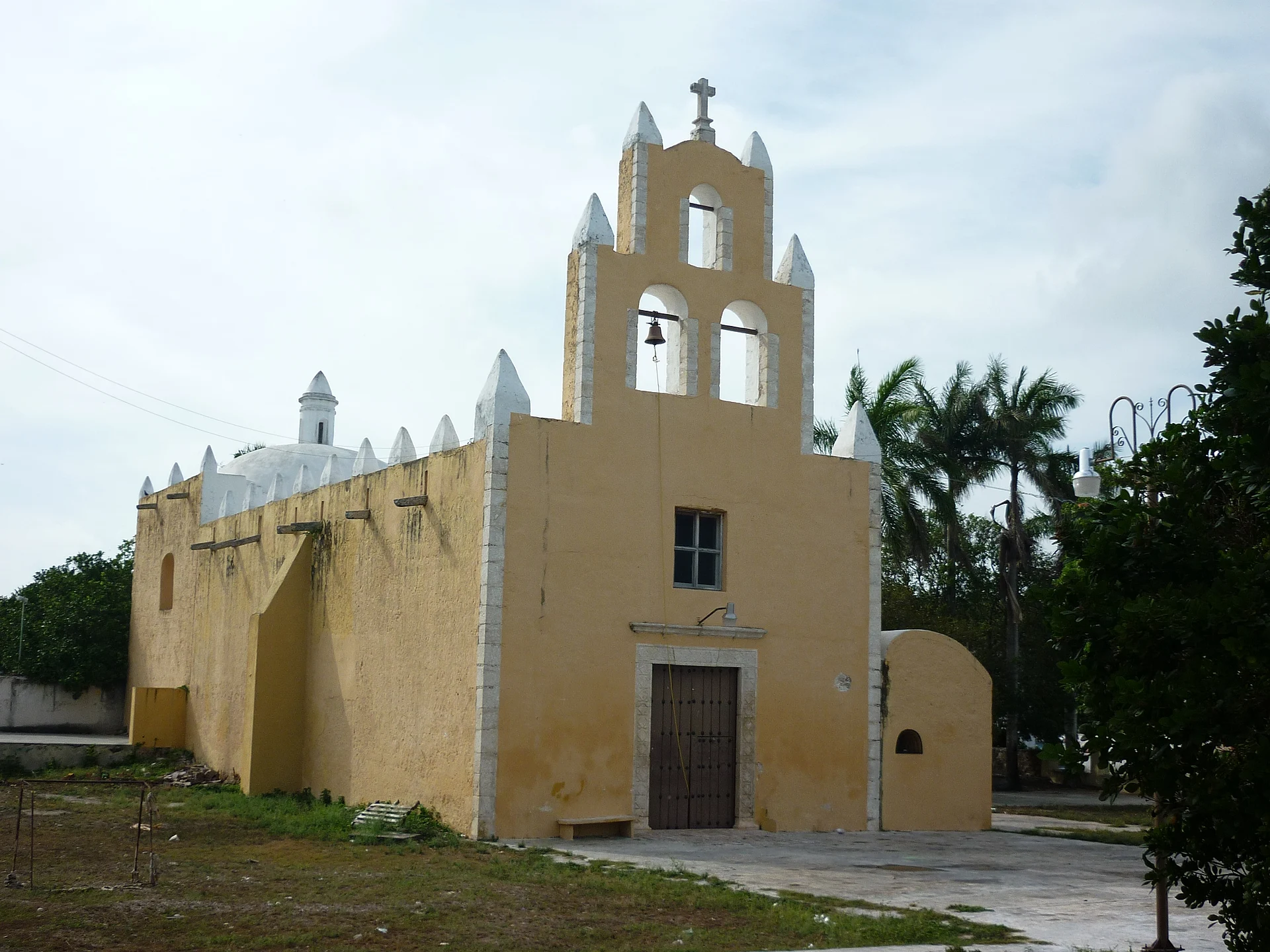
Before the Spanish conquest Ucú belonged to the Maya chiefdom of Ah Canul. After the conquest it was held in encomienda, among others by Doña Francisca Rodríguez Vicario. In 1825 it was placed in the partido of Mérida and later moved to that of Hunucmá, and on 22 December 1925 it became a free municipality. The town's main church was built on top of an ancient Maya platform, a common practice in colonial Yucatán, and there are pre-Hispanic remains both in the town itself and at Tisikul, elsewhere in the municipality. The other main locality is the old henequen hacienda village of Yaxché de Peón, just to the north.
Ucú is a quiet place without tourist infrastructure, and its interest lies in its everyday life and calendar. The main fiesta is held on 8 September for the Nativity of the Virgin Mary, with the vaquería and jarana dancing that open village fiestas across Yucatán, and dancers often compete with each other. For Hanal Pixán, the Days of the Dead, families set up altars in the main room of the house and offer the dead their favourite foods, mucbipollo, new-maize atole and hot chocolate. The arcaded municipal palace and the yellow church on the main square are the places to start, and the town makes an easy detour on the way to Yaxché de Peón or Sierra Papacal.
How to get to Ucú
Drive from Mérida: 15 min, 15 km
Ucú is about 20 km north-west of Mérida's centre; from the western side of the Periférico follow the local road north-west towards Ucú, about 30 minutes by car. Yaxché de Peón is a few kilometres further north.
Directions to Ucú on Google Maps
Distances are in a straight line; the road is usually longer.
Links open a partner site. We may earn a commission if you book, at no cost to you.
From the nearest cities to Ucú
- Mérida · 15 km by road, 15 min
- Campeche · 180 km by road, 2 h 15 min
- Valladolid · 177 km by road, 2 h 25 min
Drive times by road from OpenStreetMap, without traffic or stops. Times marked ~ are estimated from the straight-line distance.
Before you go to Ucú: hours, prices and tips
- Best season
- Fiesta of the Nativity of the Virgin Mary on 8 September. Enciclopedia de los Municipios de México (INAFED) · checked Oct 2026
Hours and prices change, especially around holidays. Each fact links to where we checked it.
Visiting Ucú: what to see and do
See the yellow church on the main square, built on an ancient Maya platform.
Walk past the arcaded municipal palace on the square.
Come for the fiesta of the Nativity of the Virgin on 8 September, with vaquería and jarana dancing.
Visit Yaxché de Peón, the old henequen hacienda village just north of town.
Plan your trip
Places to stay in Ucú
Compare hotels, posadas, and rentals in and around Ucú.
Tours & activities
Day trips and guided outings from Sisal often include Ucú; with a local guide you can get there without a car.
Rental cars
Pick up a car at MID (Mérida): about 1 h 7 min by road to Sisal, then 33 km more to Ucú, on your own schedule.
Flights
The nearest airport with scheduled flights is Mérida (MID), about 1 h 7 min by road from Sisal, the base for Ucú.
Mobile data
Signal can drop away from Sisal: download a map of the way to Ucú before you set out, or carry an eSIM with data.
Links open a partner site. We may earn a commission if you book, at no cost to you.
Photos
When to go to Ucú warm
Ucú shares the climate of Sisal, 33 km away. The best months to visit are January, February, November, and December.
See the month-by-month climate of Sisal
Weather in Ucú now and the next 7 days
Live forecast from Open-Meteo. Chance of rain is the day's highest.
The closest Pueblo Mágico: Sisal

Sisal is the Pueblo Mágico closest to Ucú, with places to stay, food, and more to see.
Also close to
Closest to Ucú
-
Yaxché de Peón · Village · 2 km away
-
Caucel · Village · 5 km away
-
Cheumán · Village · 6 km away
-
Noc Ac · Village · 6 km away
-
Dzityá · Village · 7 km away
-
Cosgaya · Village · 8 km away
-
San Antonio Hool · Village · 8 km away
-
Suytunchén · Village · 8 km away


Near Ucú


Drive times by road from OpenStreetMap, without traffic. Times marked ~ are estimated from the straight-line distance.
Location from OpenStreetMap. Written by Puebloteca.