




Town Petatlán, Guerrero Municipality of Petatlán Costa Grande of Guerrero
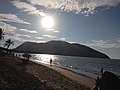
A fishing village on a mangrove lagoon south of Zihuatanejo, with beach palapas, kayaks, and over 200 bird species.
From Zihuatanejo: 25 min by car (26 km by road) How to get there ↓
Near here
See everything nearby ↓


Plan your visit to Barra de Potosí
Where to stay near Barra de Potosí
Villa Don Manuel Hotel · 1.4 km from the center Prices Flakos Hostal Hotel · 3.7 km from the center PricesTours to Barra de Potosí
Day trips around Zihuatanejo sometimes stop in Barra de Potosí; a tour is the easy way to see it without a car.
 Discover Barra de Potosí
★ 5.0 (5) · From US$127
How to get to Barra de Potosí
- From Zihuatanejo: about 25 min by road (~26 km)
- 16 km southeast of Zihuatanejo
- Nearest airport: Zihuatanejo (ZIH), 12 min by car to Zihuatanejo
Links open a partner site. We may earn a commission if you book, at no cost to you.
Popular tours to Barra de Potosí
Tours, prices and ratings from Viator, checked weekly. We may earn a commission if you book.
About Barra de Potosí
Barra de Potosí is a small fishing village where the long beach of Playa Blanca ends at the mouth of the Laguna de Potosí, about 25 kilometers southeast of Zihuatanejo. It has only a few streets and a few hundred residents, and on weekdays it feels a world away from the resorts up the coast.
The lagoon is the reason to come. It covers around 800 hectares, more than half of it mangrove, and researchers have counted over 200 bird species here, including herons, ibises, pelicans and roseate spoonbills. Villagers rent kayaks and run boat trips through the mangrove channels, as well as fishing trips, and in winter whale-watching outings to see humpbacks offshore.
The other ritual is lunch. Enramadas, open-air restaurants under palm roofs, line the lagoon and the beach and serve fresh fish to families who drive down on weekends. Offshore, the rocky Morros de Potosí islets break the horizon.
How to get to Barra de Potosí
Drive from Zihuatanejo: 25 min, 26 km
Barra de Potosí is about 35 to 40 minutes from Zihuatanejo by car or taxi: head southeast on Highway 200 past the airport and take the signed turnoff toward the coast, then follow the paved road to the village. Many taxi drivers in Zihuatanejo will do the round trip for an agreed price; travel by day.
16 km southeast of Zihuatanejo
Directions from Zihuatanejo on Google Maps
Distances are in a straight line; the road is usually longer.
Links open a partner site. We may earn a commission if you book, at no cost to you.
From the nearest cities to Barra de Potosí
- Zihuatanejo · 26 km by road, 25 min
- Lázaro Cárdenas · 121 km by road, 1 h 30 min
- Acapulco · 224 km by road, 2 h 55 min
Drive times by road from OpenStreetMap, without traffic or stops. Times marked ~ are estimated from the straight-line distance.
Before you go to Barra de Potosí: hours, prices and tips
- Time needed
- A kayak outing through the mangroves takes about 3 hours; full day tours with the Refugio de Potosí run around 6.5 hours. Lokalee tour listing · checked Oct 2026
- Best season
- In the rainy season the lagoon opens to the sea; whales have been seen offshore during their migration. México Desconocido · checked Oct 2026
- Guide or tour
- You can visit the village on your own; to see the mangroves, hire a local boat ride on the lagoon or join a kayak tour. Day tours from Ixtapa and Zihuatanejo pair the kayak with the private Refugio de Potosí nature park. Tours: Viator GetYourGuide México Desconocido / Lokalee · checked Oct 2026
- Rules
- Not a beach for weak swimmers: the current can be strong. If you come by colectivo, the last one back leaves around 6 pm in low season. Earth Vagabonds (upd. Mar 2025) · checked Oct 2026
Hours and prices change, especially around holidays. Each fact links to where we checked it.
Visiting Barra de Potosí: what to see and do
Paddle a kayak or take a boat tour through the mangrove channels of the lagoon, ideally early in the morning for birds.
Eat pescado a la talla at an enramada on the lagoon shore.
Walk the long, quiet sand of Playa Blanca; the open-ocean surf can be strong, so swim with care.
In winter, ask the local boatmen about whale-watching trips.
Plan your trip
Places to stay in Barra de Potosí
Villa Don Manuel Hotel · 1.4 km from the center Find on Expedia Flakos Hostal Hotel · 3.7 km from the center Find on ExpediaTours & activities
Day trips around Zihuatanejo sometimes stop in Barra de Potosí; a tour is the easy way to see it without a car.
Rental cars
Pick up a car at ZIH (Zihuatanejo): about 12 min by road to Zihuatanejo, then 16 km more to Barra de Potosí, on your own schedule.
Flights
The nearest airport with scheduled flights is Zihuatanejo (ZIH), about 12 min by road from Zihuatanejo, the base for Barra de Potosí.
Mobile data
Signal can drop away from Zihuatanejo: download a map of the way to Barra de Potosí before you set out, or carry an eSIM with data.
Links open a partner site. We may earn a commission if you book, at no cost to you. Hotel names from OpenStreetMap.
Photos
When to go to Barra de Potosí warm
Barra de Potosí shares the climate of Zihuatanejo, 16 km away. The best months to visit are January, February, March, and April.
See the month-by-month climate of Zihuatanejo
Weather in Barra de Potosí now and the next 7 days
Live forecast from Open-Meteo. Chance of rain is the day's highest.
Make Zihuatanejo your base

Barra de Potosí is an easy trip from Zihuatanejo, a Pueblo Mágico with places to stay, food, and more to see.
Closest to Barra de Potosí
-
Playa Larga · Beach · 11 km away
-
Xihuacan · Archaeological site · 13 km away
-
Playa La Ropa · Beach · 15 km away · Guerrero
-
Playa Las Gatas · Beach · 15 km away · Guerrero
-
Museo Arqueológico de la Costa Grande · Landmark · 16 km away · Guerrero
-
Playa La Madera · Beach · 16 km away · Guerrero
-
Playa Principal and the Paseo del Pescador · Beach · 16 km away · Guerrero
-
Petatlán · Town · 18 km away


Near Barra de Potosí


Drive times by road from OpenStreetMap, without traffic. Times marked ~ are estimated from the straight-line distance.
Something wrong or missing on this page? Suggest a fix or addition
Location from OpenStreetMap. Written by Puebloteca.