Town Rojas de Cuauhtémoc, Oaxaca Central Valleys of Oaxaca
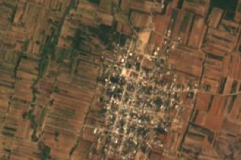
Seat of its own municipality in the Central Valleys, about 19 km from Oaxaca City, with horse stables, open pasture and the rocky peak of El Yarit.
From Oaxaca: 20 min by car (19 km by road) How to get there ↓
Near here
See everything nearby ↓



Plan your visit to Rojas de Cuauhtémoc
Where to stay near Rojas de Cuauhtémoc
Compare hotels, posadas and guest houses in Rojas de Cuauhtémoc.
Tours to Rojas de Cuauhtémoc
Day trips around Mitla sometimes stop in Rojas de Cuauhtémoc; a tour is the easy way to see it without a car.
How to get to Rojas de Cuauhtémoc
- From Oaxaca: about 20 min by road (~19 km)
- Nearest airport: Oaxaca (OAX), 47 min by car to Mitla
Links open a partner site. We may earn a commission if you book, at no cost to you.
About Rojas de Cuauhtémoc
The place was first called Barrio del Rosario and later Rancho de Santa María Rojas before taking its present name. The surname Rojas honours Pedro Rojas, described as the first settler and of French descent; Cuauhtémoc was added in memory of the last Mexica emperor. Wikipedia's entry gives 3 October 1602 as the founding date and tells a local legend about Rojas and a Spanish family's daughter. Today it is the seat of a small municipality of about 24 km² in the Tlacolula district, with 1,301 residents in 2020, 19.1% more than in 2010.
The land lies in the Oaxaca valley at an average altitude of 1,570 m, with a semi-warm, semi-dry climate, summer rain and moderate winter frosts. The Río Salado crosses the municipality from east to west and carries far more water in the rainy season. Vegetation runs from thorny scrub with mesquite and huizache to oak forest on the higher slopes, and coyotes, deer, rabbits and foxes live there.
The economy rests on livestock and farming, with some shops, rental lodging and riding schools added in recent years. Tourism is modest: visitors from Canada and the United States come to ride horses, mountain-bike, or see lagoons, caves and rock formations. The best-known sight is the rocky peak of El Yarit. The main festivals are carnival in February or March, the Virgen de la Asunción on 15 August and the Virgen del Rosario on the first Sunday of October.
How to get to Rojas de Cuauhtémoc
Drive from Oaxaca: 20 min, 19 km
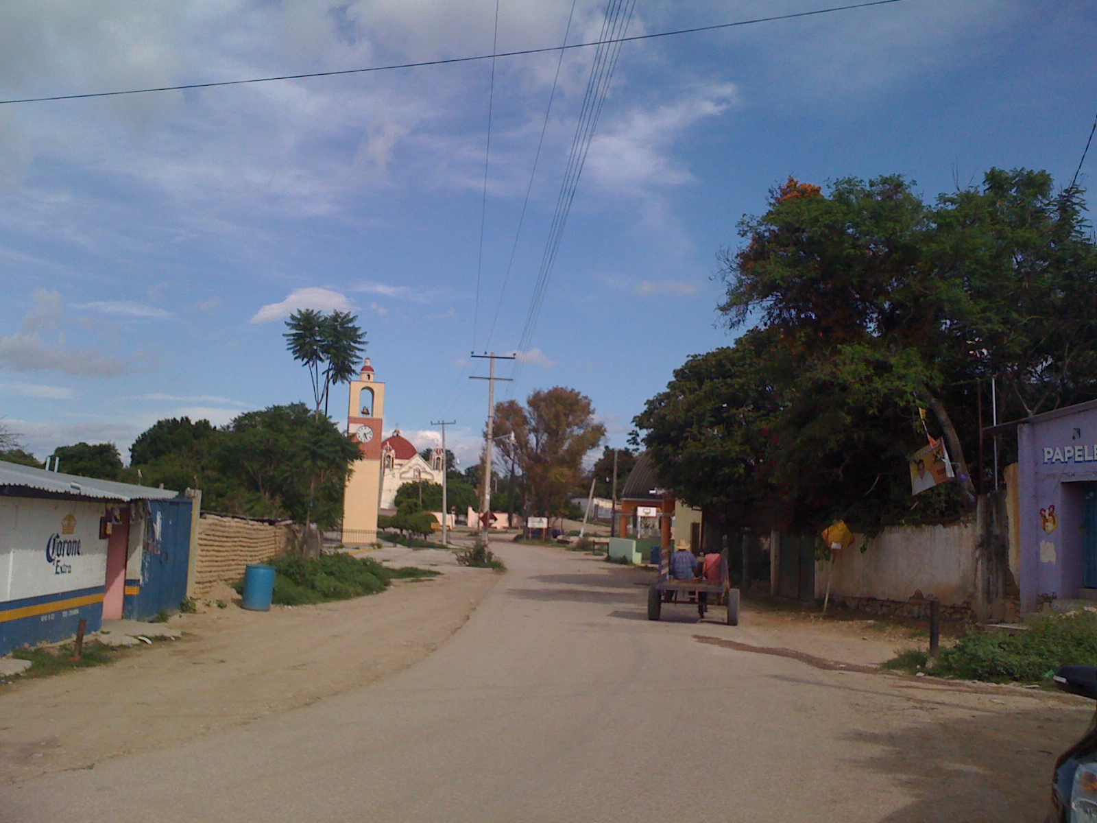
Rojas de Cuauhtémoc is about 19 km by road from the city of Oaxaca, a 20 to 30 minute drive depending on traffic (Wikipedia). Its neighbours are Santa María del Tule, Tlalixtac de Cabrera, San Antonio de la Cal, San Sebastián Abasolo and San Agustín de las Juntas, so the simplest way is to leave the city heading east toward El Tule and then take local roads into the municipality; check the last stretch on an up-to-date map. We found no source for bus or colectivo lines that reach the village: the easiest options are a taxi or colectivo from Oaxaca or from Tule, or your own car. Mitla, the nearest pueblo in our list, is about 28 km away in a straight line, roughly 30 minutes by car, and Tlacolula de Matamoros is the district seat. A photograph of the main street shows a wide road of dirt and pavement lined with low houses, so do not expect a tourist centre.
Directions to Rojas de Cuauhtémoc on Google Maps
Distances are in a straight line; the road is usually longer.
Links open a partner site. We may earn a commission if you book, at no cost to you.
From the nearest cities to Rojas de Cuauhtémoc
- Oaxaca · 19 km by road, 20 min
- Tuxtepec · about 170 km by road, ~2 h 30 min
- Huajuapan de León · 188 km by road, 2 h 40 min
Drive times by road from OpenStreetMap, without traffic or stops. Times marked ~ are estimated from the straight-line distance.
Visiting Rojas de Cuauhtémoc: what to see and do
Climb or view the rocky peak of El Yarit.
Walk the main street to the church tower.
Ride a horse with one of the local riding schools.
Follow the Río Salado and the nearby lagoons.
Come for carnival, 15 August or the first Sunday of October.
Plan your trip
Places to stay in Rojas de Cuauhtémoc
Compare hotels, posadas, and rentals in and around Rojas de Cuauhtémoc.
Tours & activities
Day trips around Mitla sometimes stop in Rojas de Cuauhtémoc; a tour is the easy way to see it without a car.
Rental cars
Pick up a car at OAX (Oaxaca): about 47 min by road to Mitla, then 28 km more to Rojas de Cuauhtémoc, on your own schedule.
Flights
The nearest airport with scheduled flights is Oaxaca (OAX), about 47 min by road from Mitla, the base for Rojas de Cuauhtémoc.
Mobile data
Signal can drop away from Mitla: download a map of the way to Rojas de Cuauhtémoc before you set out, or carry an eSIM with data.
Links open a partner site. We may earn a commission if you book, at no cost to you.
When to go to Rojas de Cuauhtémoc mild
Rojas de Cuauhtémoc shares the climate of Mitla, 28 km away. The best months to visit are January, February, March, and December.
See the month-by-month climate of Mitla
Weather in Rojas de Cuauhtémoc now and the next 7 days
Live forecast from Open-Meteo. Chance of rain is the day's highest.
The closest Pueblo Mágico: Mitla

Mitla is the Pueblo Mágico closest to Rojas de Cuauhtémoc, with places to stay, food, and more to see.
Also close to
- Capulálpam de Méndez · Oaxaca · 37 km away
Closest to Rojas de Cuauhtémoc
-
Tlacochahuaya · Landmark · 4 km away
-
Árbol del Tule · Landmark · 5 km away
-
Dainzú · Archaeological site · 6 km away
-
San Sebastián Teitipac · Town · 6 km away
-
Santa Cruz Papalutla · Town · 6 km away
-
Tlalixtac de Cabrera · Town · 8 km away
-
San Antonio de la Cal · Town · 9 km away
-
San Francisco Tutla · Town · 9 km away


Near Rojas de Cuauhtémoc


Drive times by road from OpenStreetMap, without traffic. Times marked ~ are estimated from the straight-line distance.
Location from OpenStreetMap. Written by Puebloteca.