
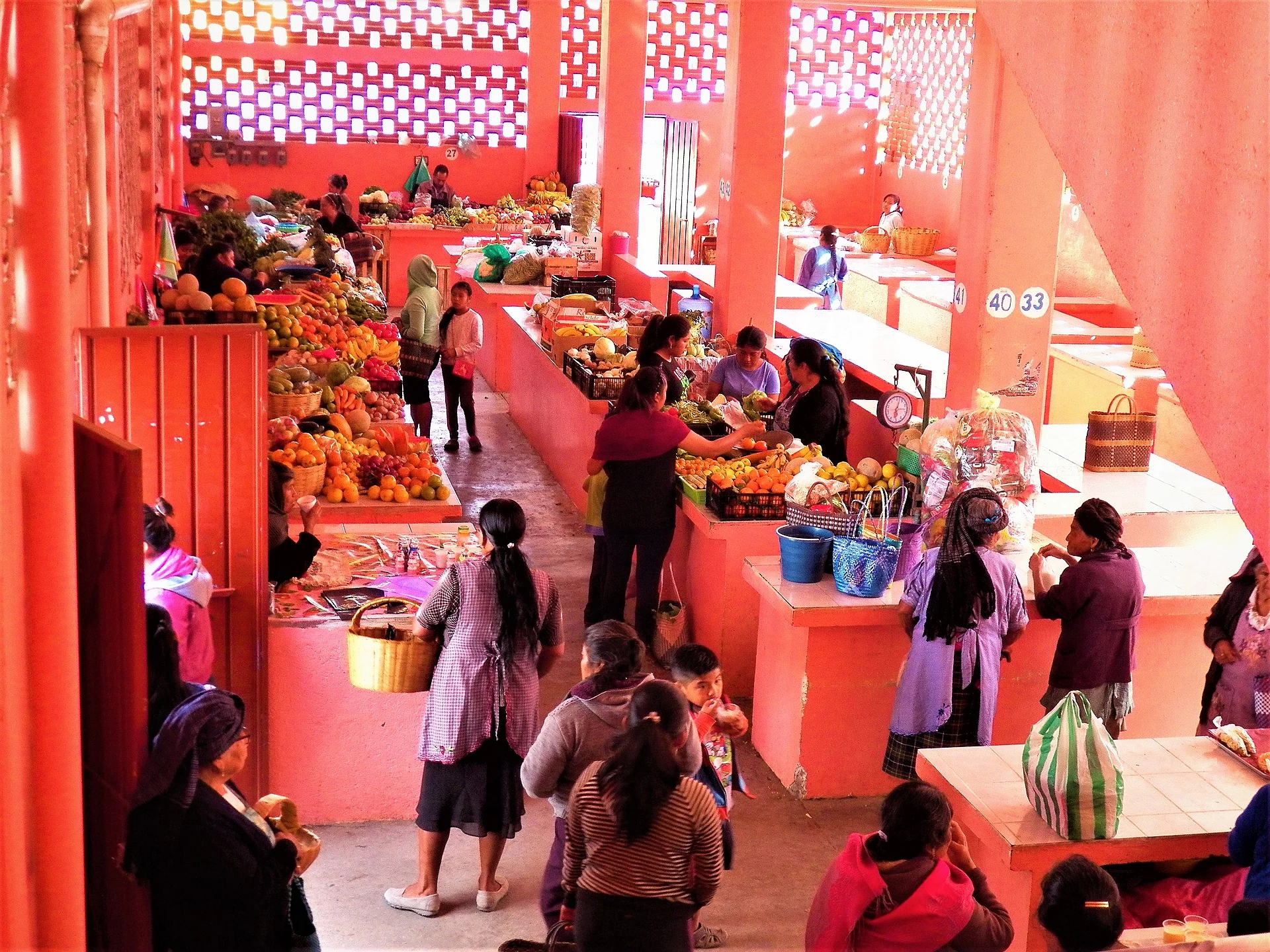
Town San Juan Guelavía, Oaxaca Central Valleys of Oaxaca
Zapotec town in the Central Valleys beside Highway 190, known for river-reed baskets and its annual Feria del Carrizo.
From Oaxaca: 30 min by car (30 km by road) How to get there ↓
Near here
See everything nearby ↓


Plan your visit to San Juan Guelavía
Where to stay near San Juan Guelavía
Compare hotels, posadas and guest houses in San Juan Guelavía.
Tours to San Juan Guelavía
Day trips around Mitla sometimes stop in San Juan Guelavía; a tour is the easy way to see it without a car.
How to get to San Juan Guelavía
- From Oaxaca: about 30 min by road (~30 km)
- Nearest airport: Oaxaca (OAX), 47 min by car to Mitla
Links open a partner site. We may earn a commission if you book, at no cost to you.
About San Juan Guelavía
Guelavía sits on the floor of the Tlacolula valley at about 1,600 metres, in a tiny municipality of barely 31 square kilometres where almost everyone lives in the seat itself: 3,175 people in the 2020 census (INEGI). Numbers have crept up since 1,505 in 1900, peaking at 3,645 in 1980, dipping to 2,992 in 1990 and recovering since.
Sources date the founding to 1560 and the land titles to 1723, and work on the parish church in the centre began in the 18th century. The name is Zapotec and has several readings: one ties it to midnight and to the first settlers arriving at dusk, another, noted by Echarri, renders it as "cornfield of air". Salt was worked in the area from pre-Hispanic times and traded for other goods.
What the town is best known for is river reed. Until the 1950s residents wove baskets and other pieces from carrizo, and plastic wiped out much of that trade. Since 2011 the local Telesecundaria has run the Feria del Carrizo on the last Sunday of January and the first Sunday of February, with baskets, food and dances. The main patronal celebrations fall in the last week of January and on 24 June, the day of San Juan Bautista.
More than half of residents aged three and over speak an indigenous language, mostly Zapotec. A community museum beside the market covers local history and traditions, and the municipality has a preschool, primary school, telesecundaria and a CBTa 317 agricultural high school. It is a town to walk through, easy to pair with Teotitlán del Valle or Tlacolula.
How to get to San Juan Guelavía
Drive from Oaxaca: 30 min, 30 km
Guelavía lies beside federal Highway 190 (Oaxaca-Tlacolula-Tehuantepec), almost opposite Teotitlán del Valle, and a short spur leaves the 190 for the town. From Oaxaca city it is about 23 km as the crow flies and around 40 minutes by car, according to a local Oaxaca culture blog (approx.). Heading for Tlacolula, the turn comes before you reach that city.
Without a car, the usual way is a shared van or bus on the 190 toward Tlacolula or Teotitlán, getting off at the junction, where mototaxis and the town's taxis wait (the municipality has two taxi associations, per Wikipedia). We found no sourced schedules or operators, so ask at the terminal in Oaxaca city. From Mitla, the nearest pueblo in our guide, it is about 19 km straight-line, roughly 20 to 30 minutes along the 190.
Directions to San Juan Guelavía on Google Maps
Distances are in a straight line; the road is usually longer.
Links open a partner site. We may earn a commission if you book, at no cost to you.
From the nearest cities to San Juan Guelavía
- Oaxaca · 30 km by road, 30 min
- Tuxtepec · about 175 km by road, ~2 h 35 min
- Huajuapan de León · 199 km by road, 2 h 50 min
Drive times by road from OpenStreetMap, without traffic or stops. Times marked ~ are estimated from the straight-line distance.
Before you go to San Juan Guelavía: hours, prices and tips
- Best season
- Feria del Carrizo (reed basket fair): last Sunday of January and first Sunday of February; patronal fiesta 24 June. Wikipedia (es), San Juan Guelavía; Hispanopedia · checked Oct 2026
Hours and prices change, especially around holidays. Each fact links to where we checked it.
Visiting San Juan Guelavía: what to see and do
Visit the municipal market and the community museum next to it.
Look for carrizo baskets, the craft that made the town known.
Come for the Feria del Carrizo, the last Sunday of January or the first of February.
Step into the parish church of San Juan Bautista, begun in the 18th century.
Join the 24 June fiesta for San Juan Bautista.
Pair the visit with Teotitlán del Valle or the Sunday market in Tlacolula.
Plan your trip
Places to stay in San Juan Guelavía
Compare hotels, posadas, and rentals in and around San Juan Guelavía.
Tours & activities
Day trips around Mitla sometimes stop in San Juan Guelavía; a tour is the easy way to see it without a car.
Rental cars
Pick up a car at OAX (Oaxaca): about 47 min by road to Mitla, then 19 km more to San Juan Guelavía, on your own schedule.
Flights
The nearest airport with scheduled flights is Oaxaca (OAX), about 47 min by road from Mitla, the base for San Juan Guelavía.
Mobile data
Signal can drop away from Mitla: download a map of the way to San Juan Guelavía before you set out, or carry an eSIM with data.
Links open a partner site. We may earn a commission if you book, at no cost to you.
When to go to San Juan Guelavía mild
San Juan Guelavía shares the climate of Mitla, 19 km away. The best months to visit are January, February, March, and December.
See the month-by-month climate of Mitla
Weather in San Juan Guelavía now and the next 7 days
Live forecast from Open-Meteo. Chance of rain is the day's highest.
The closest Pueblo Mágico: Mitla

Mitla is the Pueblo Mágico closest to San Juan Guelavía, with places to stay, food, and more to see.
Also close to
- Capulálpam de Méndez · Oaxaca · 40 km away
Closest to San Juan Guelavía
-
Santa Cruz Papalutla · Town · 4 km away
-
San Marcos Tlapazola · Town · 5 km away
-
Dainzú · Archaeological site · 6 km away
-
Lambityeco · Archaeological site · 6 km away
-
San Bartolomé Quialana · Town · 7 km away
-
Tlacochahuaya · Landmark · 7 km away
-
Tlacolula · Town · 7 km away
-
San Sebastián Teitipac · Town · 8 km away


Near San Juan Guelavía


Drive times by road from OpenStreetMap, without traffic. Times marked ~ are estimated from the straight-line distance.
Location from OpenStreetMap. Written by Puebloteca.