
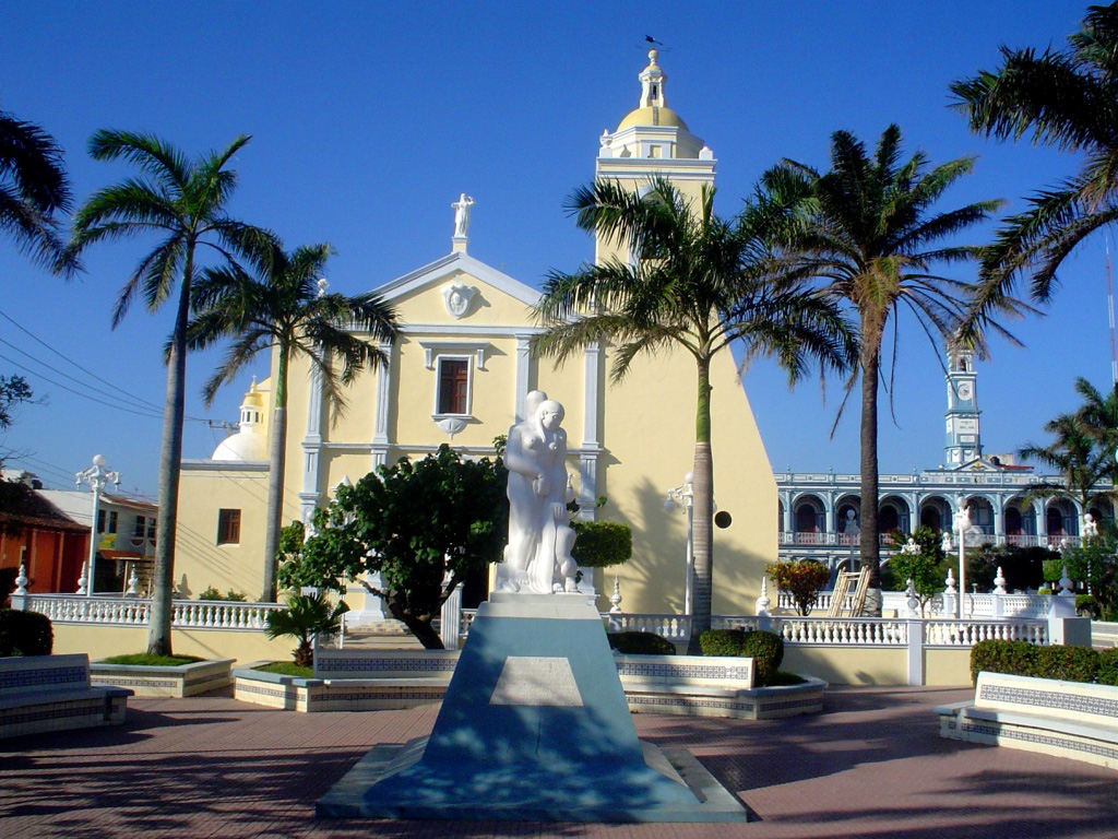
A region of Veracruz
The lowlands of the Papaloapan, one of Mexico's biggest rivers, as it winds through southern Veracruz to the Alvarado lagoon: sugarcane, pineapple and cattle country with river towns such as Cosamaloapan and Tlacotalpan, whose colourful arcaded streets are a World Heritage Site.
9 places to visit
Map
Places to visit in Papaloapan basin 9
9 places with their own page, grouped by kind.
Villages
-
El Nigromante · Village · Veracruz
Zapotec, Chinantec and Mixe village in Playa Vicente on the Oaxaca border; brass bands and the feast of Saint Cecilia, 20 to 24 November. -
La Granja · Village · Veracruz
Tres Valles village where Highway 145 meets the road to Temazcal, beside the railway, amid Papaloapan sugarcane country. -
Linda Vista · Village · Veracruz
José Azueta's second-largest community, on Highway 145 some 8 km from Villa Azueta, on the Sotavento plain near the Oaxaca border. -
Paraíso Novillero · Village · Veracruz
A Papaloapan sugar village built around a French-owned mill of 1900, keeping its chimney, the Pailles family church and an 1880 pochote tree. -
Tesechoacán · Village · Veracruz
Former colonial-era municipal seat on the Tesechoacán River in José Azueta; sugarcane village 12 minutes from Villa Azueta, near Highway 145.


Towns
-
Alvarado · Town · Veracruz
Fishing port where the Papaloapan meets the Gulf, known for seafood, its malecón, May crosses festival and famously salty language. -
Cosamaloapan · Town · Veracruz
Sugar town on the Papaloapan River, home of the Basilica of Our Lady of Cosamaloapan and a river procession every 8 December. -
Tierra Blanca · Town · Veracruz
Hot railway and ranching town of the Papaloapan basin, known for its December cattle fair, Guadalupe processions and son jarocho harpists. -
Tlacotalpan · Town · Veracruz
Arcaded, colour-washed river town on the Papaloapan, a UNESCO World Heritage Site famous for its Candelaria festival and son jarocho.


Top tours in Papaloapan basin


Tours, prices and ratings from Viator, checked weekly. We may earn a commission if you book.
Getting around Papaloapan basin
Fly into Oaxaca (OAX) and Veracruz (VER).
Most of the region is reached by road: a rental car is the easiest way to see several places in a day, and buses link the larger towns.
When to visit Papaloapan basin
Most of Papaloapan basin is at its best in February, March, April, and December.
Month-by-month climate on each Pueblo Mágico's page: Huautla, Capulálpam de Méndez, Córdoba