Village Vanegas, San Luis Potosí
Village that grew from a México-Laredo railway camp on the desert plains of northern San Luis Potosí, near Real de Catorce.
From Matehuala: about 45 min by road (~55 km) How to get there ↓
Near here
See everything nearby ↓


Plan your visit to Vanegas
Where to stay near Vanegas
Compare hotels, posadas and guest houses in Vanegas.
Tours to Vanegas
Day trips and guided outings from Real de Catorce often include Vanegas; with a local guide you can get there without a car.
How to get to Vanegas
- From Matehuala: about 45 min by road (~55 km)
- Nearest airport: San Luis Potosí (SLP), 3 h 28 min by car to Real de Catorce
Links open a partner site. We may earn a commission if you book, at no cost to you.
About Vanegas
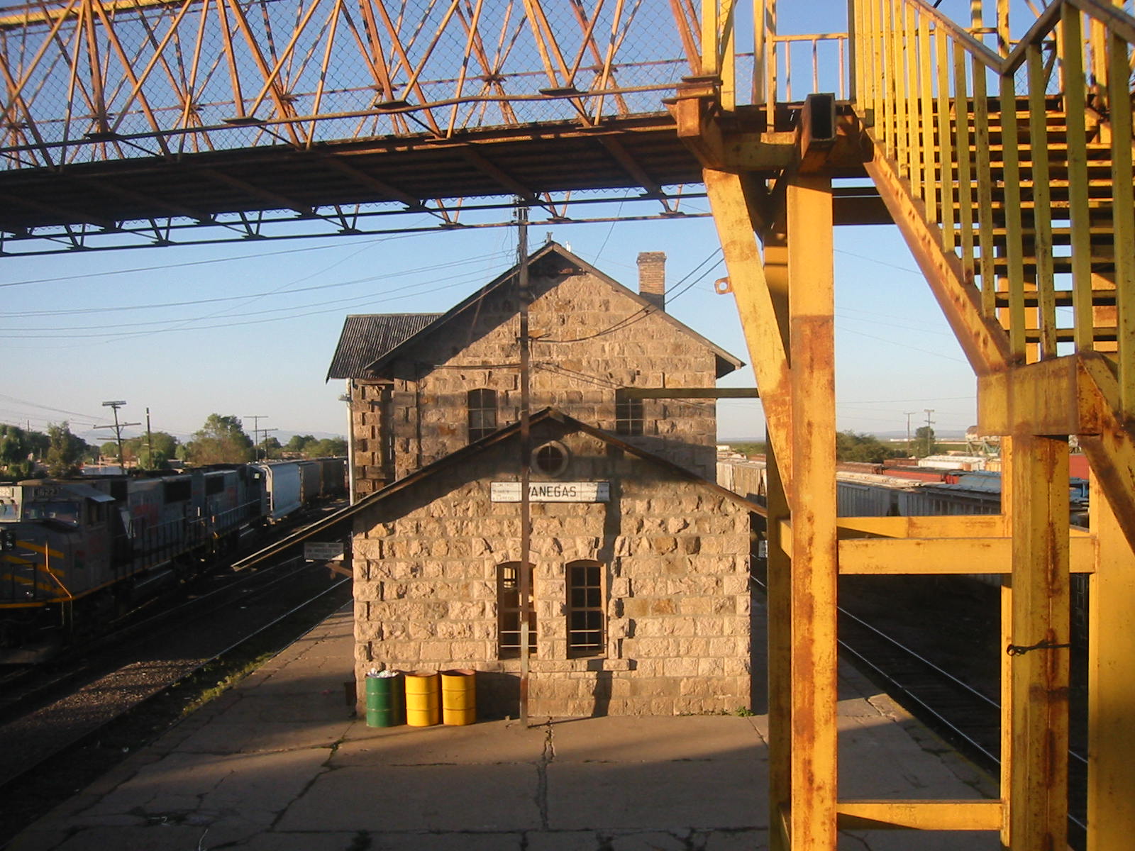
There was no Vanegas when the railway arrived. These plains, at about 1,740 metres and with under 300 mm of rain a year, held only a vast cattle estate, the Hacienda San Juan de Banegas, and the village grew out of the shacks of the track crews. Work on the Mexico City to Laredo line began in 1880 and it opened in November 1888, running dead straight across the flat desert; for years the camp's water came in a tank hauled by the work train. A station stood here by 1897, and on 9 November 1922 the state congress created a new municipality with the station as its seat.
The hacienda that gave the place its name lies to the south, where the boundaries of Cedral and Catorce meet. A spring of warm water rises there from salty ground, next to the remains of a late 18th-century chapel and the tall broken walls of the old granaries. In its heyday the estate struck its own copper tokens, called tlacos, to be spent at the company store, and ore from Real de Catorce was processed on its grounds. Francisca de la Gándara, who married Félix María Calleja in 1807 and became vicereine of New Spain, was born in Vanegas.
About 2,500 people live in the village today, mostly from livestock and farming. Within the municipality, the La Mojonera range has been a protected wildlife refuge since 1981, covering more than 9,000 hectares. Local cooking means barbacoa, nopales, pumpkin-seed sweets and mezcal.
How to get to Vanegas
From Matehuala take federal highway 62, which crosses the desert towards San Tiburcio in Zacatecas, and leave it on the paved spur road to Vanegas: 51 km by road, about 1 h. Real de Catorce, the nearest Pueblo Mágico, is 40 min away, 33 km by road. Paved roads also run from the village to El Salado and to Laguna Seca (SLP 43). We found no published bus or colectivo timetables to Vanegas; ask at the Matehuala bus station for services to the northern plateau.
Directions to Vanegas on Google Maps
Distances are in a straight line; the road is usually longer.
Links open a partner site. We may earn a commission if you book, at no cost to you.
From the nearest cities to Vanegas
- Matehuala · about 55 km by road, ~45 min
- Saltillo · about 220 km by road, ~3 h 15 min
- Linares · about 230 km by road, ~3 h 25 min
Drive times by road from OpenStreetMap, without traffic or stops. Times marked ~ are estimated from the straight-line distance.
Before you go to Vanegas: hours, prices and tips
- Best time of day
- Semi-arid climate with scant summer rain; July is the hottest month, with highs up to 41 °C. INAFED, Enciclopedia de los Municipios de México: Vanegas · checked Oct 2026
- Best season
- Regional fair June 10 to 15 and the feast of San Juan on June 24. CEFIM, Gobierno de San Luis Potosí: infografía municipal de Vanegas · checked Oct 2026
Hours and prices change, especially around holidays. Each fact links to where we checked it.
Visiting Vanegas: what to see and do
The stone station of the México-Laredo railway, where the village began
The parish church
The ruins of the Hacienda San Juan de Vanegas: 18th-century chapel and granaries
The warm-water spring
Cerro de Guanache
The Los Riscos caves
The La Mojonera range, a protected wildlife area
Plan your trip
Places to stay in Vanegas
Compare hotels, posadas, and rentals in and around Vanegas.
Tours & activities
Day trips and guided outings from Real de Catorce often include Vanegas; with a local guide you can get there without a car.
Rental cars
Pick up a car at SLP (San Luis Potosí): about 3 h 28 min by road to Real de Catorce, then 23 km more to Vanegas, on your own schedule.
Flights
The nearest airport with scheduled flights is San Luis Potosí (SLP), about 3 h 28 min by road from Real de Catorce, the base for Vanegas.
Mobile data
Signal can drop away from Real de Catorce: download a map of the way to Vanegas before you set out, or carry an eSIM with data.
Links open a partner site. We may earn a commission if you book, at no cost to you.
When to go to Vanegas cool
Vanegas shares the climate of Real de Catorce, 23 km away. The best months to visit are February, March, April, and May.
See the month-by-month climate of Real de Catorce
Weather in Vanegas now and the next 7 days
Live forecast from Open-Meteo. Chance of rain is the day's highest.
The closest Pueblo Mágico: Real de Catorce

Real de Catorce is the Pueblo Mágico closest to Vanegas, with places to stay, food, and more to see.
Closest to Vanegas
-
Estación Catorce · Town · 22 km away
-
Wirikuta · Nature reserve · 23 km away
-
Cedral · Town · 24 km away
-
Cerro del Quemado · Mountain · 24 km away
-
Estación Wadley · Town · 30 km away
-
Villa de la Paz · Village · 33 km away
Near Vanegas
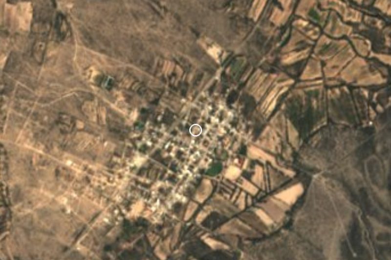

Drive times by road from OpenStreetMap, without traffic. Times marked ~ are estimated from the straight-line distance.
Location from OpenStreetMap. Written by Puebloteca.