Village Villa de la Paz, San Luis Potosí San Luis Potosí Highlands
Mining town 10 km from Matehuala at the foot of the Sierra de Catorce, built on the La Paz mine and its own railway branch.
From Matehuala: about 10 min by road (~10 km) How to get there ↓
Near here
See everything nearby ↓


Plan your visit to Villa de la Paz
Where to stay near Villa de la Paz
Compare hotels, posadas and guest houses in Villa de la Paz.
Tours to Villa de la Paz
Day trips and guided outings from Real de Catorce often include Villa de la Paz; with a local guide you can get there without a car.
How to get to Villa de la Paz
- From Matehuala: about 10 min by road (~10 km)
- Nearest airport: San Luis Potosí (SLP), 3 h 28 min by car to Real de Catorce
Links open a partner site. We may earn a commission if you book, at no cost to you.
About Villa de la Paz
Villa de la Paz sits 1,800 metres up on the edge of the Sierra de Catorce, a short hop from Matehuala, and owes everything to one mine. In January 1770 Sebastián de Ichaurrandieta told the authorities he had found a lode he named Nuestra Señora de La Paz, and its ore soon had a name as some of the best in the district.
Nearly a century later, in 1864, the Negociación Minera Santa María de La Paz y Anexas was formed. The company laid its own railway branch, whose first train arrived on November 4, 1892, and the population grew with it; in 1921 the settlement was made a villa. About 3,700 people live in the town today.
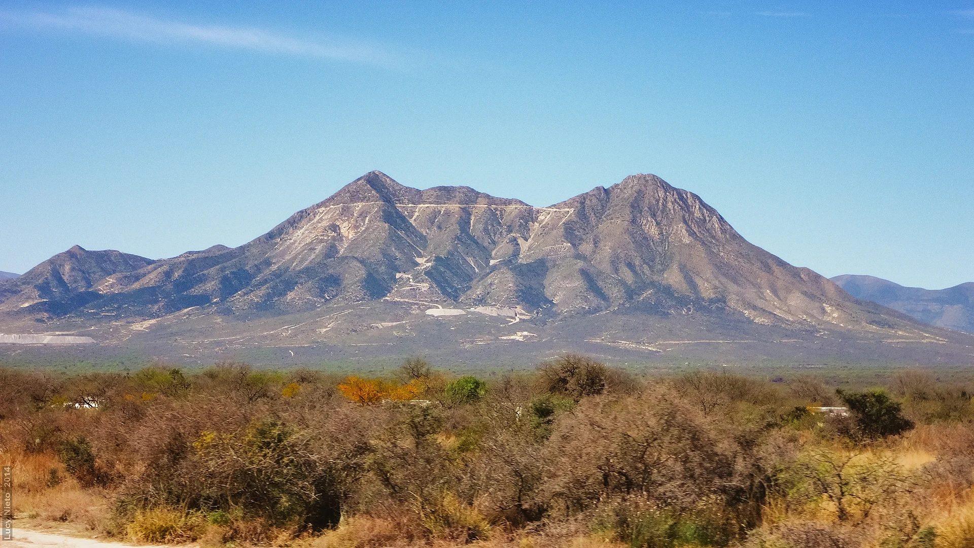
The country around is dry, broken sierra: El Fraile rises to 2,500 metres, with La Cobriza, Las Águilas, Dolores and El Muerto close by. There are no real rivers, only streams such as El Mármol and La Boca and a few springs. The climate is mild and dry, averaging 18 °C, with January lows near 3 °C and summer rain. It makes a short stop on the way from Matehuala toward Real de Catorce, a chance to see a mining town that still works as one.
How to get to Villa de la Paz
Villa de la Paz is 10 km from Matehuala by road, about 15 minutes by car, west of the city toward the sierra. Real de Catorce, the nearest Pueblo Mágico, is 54 km away by road, around 1 h 20 min, though only 18 km as the crow flies: the mountains force the long way round. The state capital is about 201 km away. We found no published public transport timetables; from Matehuala a taxi is the sure option.
Directions to Villa de la Paz on Google Maps
Distances are in a straight line; the road is usually longer.
Links open a partner site. We may earn a commission if you book, at no cost to you.
From the nearest cities to Villa de la Paz
- Matehuala · about 10 km by road, ~10 min
- Ciudad Victoria · about 210 km by road, ~3 h 5 min
- San Luis Potosí · about 225 km by road, ~3 h 20 min
Drive times by road from OpenStreetMap, without traffic or stops. Times marked ~ are estimated from the straight-line distance.
Visiting Villa de la Paz: what to see and do
The mining town and the La Paz mine works
Views of the Sierra de Catorce and El Fraile peak
Matehuala, 15 minutes away
Plan your trip
Places to stay in Villa de la Paz
Compare hotels, posadas, and rentals in and around Villa de la Paz.
Tours & activities
Day trips and guided outings from Real de Catorce often include Villa de la Paz; with a local guide you can get there without a car.
Rental cars
Pick up a car at SLP (San Luis Potosí): about 3 h 28 min by road to Real de Catorce, then 18 km more to Villa de la Paz, on your own schedule.
Flights
The nearest airport with scheduled flights is San Luis Potosí (SLP), about 3 h 28 min by road from Real de Catorce, the base for Villa de la Paz.
Mobile data
Signal can drop away from Real de Catorce: download a map of the way to Villa de la Paz before you set out, or carry an eSIM with data.
Links open a partner site. We may earn a commission if you book, at no cost to you.
When to go to Villa de la Paz cool
Villa de la Paz shares the climate of Real de Catorce, 18 km away. The best months to visit are February, March, April, and May.
See the month-by-month climate of Real de Catorce
Weather in Villa de la Paz now and the next 7 days
Live forecast from Open-Meteo. Chance of rain is the day's highest.
The closest Pueblo Mágico: Real de Catorce

Real de Catorce is the Pueblo Mágico closest to Villa de la Paz, with places to stay, food, and more to see.
Closest to Villa de la Paz
-
Wirikuta · Nature reserve · 14 km away
-
Cedral · Town · 16 km away
-
Cerro del Quemado · Mountain · 20 km away
-
Estación Catorce · Town · 28 km away
-
Estación Wadley · Town · 29 km away
-
Vanegas · Village · 33 km away
-
Villa de Guadalupe · Village · 34 km away
Near Villa de la Paz


Drive times by road from OpenStreetMap, without traffic. Times marked ~ are estimated from the straight-line distance.
Location from OpenStreetMap. Written by Puebloteca.