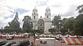

3 places with their own page in the municipality of Ixtlahuaca, in the state of Estado de México.
Map of Ixtlahuaca
Places to visit in Ixtlahuaca
Towns
-
Ixtlahuaca de Rayón · Town
Mazahua-country seat with an 18th-century parish church, the spot where López Rayón was shot, and a big Monday tianguis.

Villages
-
San Francisco de Asís · Village
A colony of about 2,255 people next to Ixtlahuaca de Rayón, at 2,540 m, on the Toluca-Atlacomulco corridor; not to be confused with namesakes elsewhere. -
San Miguel Enyege · Village
Village west of Ixtlahuaca whose Mazahua name means 'at the spring', with the memory of a former hacienda.


Neighbouring municipalities
Jocotitlán · 3 Jiquipilco · 3 Toluca · 11 Chapa de Mota · 5 Zinacantepec · 4 Villa del Carbón · 5 Acambay de Ruíz Castañeda · 4 Lerma · 6
More of Estado de México
Every place in Estado de México → Waterfalls in Estado de México · 3 Ruins in Estado de México · 11 Lakes and Lagoons in Estado de México · 7 Nature Parks in Estado de México · 13 Mountains in Estado de México · 8