
Village Ixtlahuaca, Estado de México Municipality of Ixtlahuaca Northern Estado de México
Village west of Ixtlahuaca whose Mazahua name means 'at the spring', with the memory of a former hacienda.
From Toluca: 45 min by car (47 km by road) How to get there ↓
Near here
See everything nearby ↓


Plan your visit to San Miguel Enyege
Where to stay near San Miguel Enyege
Compare hotels, posadas and guest houses in San Miguel Enyege.
Tours to San Miguel Enyege
Day trips and guided outings from El Oro often include San Miguel Enyege; with a local guide you can get there without a car.
How to get to San Miguel Enyege
- From Toluca: about 45 min by road (~47 km)
- Nearest airport: Toluca (TLC), 1 h 27 min by car to El Oro
Links open a partner site. We may earn a commission if you book, at no cost to you.
About San Miguel Enyege
San Miguel Enyege is a village in the municipality of Ixtlahuaca, in the north of the State of Mexico, at 2,552 m above sea level and west of the municipal seat. INEGI counted 2,384 people in 2020; in 1900 there were only 363, and the census shows steady growth until it levelled off at around 2,400 from 2010. The name comes from Mazahua and means "in the spring" or "water": springs in the hills to the west watered the farmland of the former hacienda.
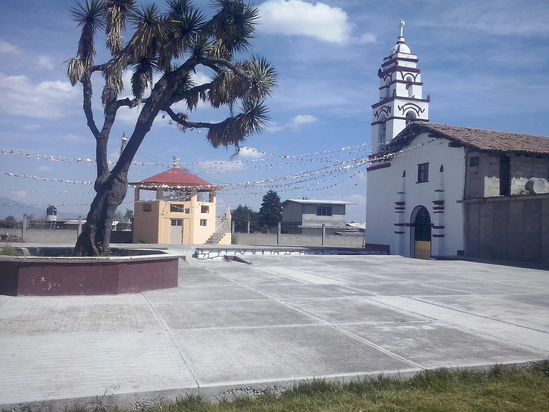
That hacienda, the ex hacienda of San Miguel Enyegé, occupied the land between the ejidos of San Miguel Enyegé, San Miguel el Alto and San Juan de las Manzanas, and has been studied by INAH Estado de México archaeologist Gilberto Pérez Rico. One of its nineteenth-century owners was Isidoro Fernando de la Torre y Gil, and its administration passed from Juan Nepomuceno Trujillo to his son Blas. Today the village centres on its church of San Miguel Arcángel, the patron saint that gives the place its name. It is somewhere to pass through quietly and to see Ixtlahuaca's farming country; there are no documented visitor services.
How to get to San Miguel Enyege
Drive from Toluca: 45 min, 47 km
San Miguel Enyege lies west of Ixtlahuaca de Rayón, the municipal seat, which Wikipedia puts about 30 km from Toluca. From Toluca follow the Toluca-Atlacomulco highway north to Ixtlahuaca, then look for the local road west; no published source names the exact junction, so check a map before leaving. By public transport there are Toluca-Ixtlahuaca buses (about 22 pesos per Wikipedia), and from Ixtlahuaca you will need to ask for a shared taxi or taxi to the village. Allow about 45 minutes to an hour by car from Toluca; El Oro is about 38 km away as the crow flies.
Directions to San Miguel Enyege on Google Maps
Distances are in a straight line; the road is usually longer.
Links open a partner site. We may earn a commission if you book, at no cost to you.
From the nearest cities to San Miguel Enyege
- Toluca · 47 km by road, 45 min
- Zitácuaro · 86 km by road, 1 h 25 min
- Mexico City · 113 km by road, 1 h 45 min
Drive times by road from OpenStreetMap, without traffic or stops. Times marked ~ are estimated from the straight-line distance.
Visiting San Miguel Enyege: what to see and do
The church of San Miguel Arcángel in the middle of the village.
The farmland around it, with the western hills the water comes down from.
What remains of the ex hacienda of San Miguel Enyegé, among the neighbouring ejidos (ask in the village).
Plan your trip
Places to stay in San Miguel Enyege
Compare hotels, posadas, and rentals in and around San Miguel Enyege.
Tours & activities
Day trips and guided outings from El Oro often include San Miguel Enyege; with a local guide you can get there without a car.
Rental cars
Pick up a car at TLC (Toluca): about 1 h 27 min by road to El Oro, then 38 km more to San Miguel Enyege, on your own schedule.
Flights
The nearest airport with scheduled flights is Toluca (TLC), about 1 h 27 min by road from El Oro, the base for San Miguel Enyege.
Mobile data
Signal can drop away from El Oro: download a map of the way to San Miguel Enyege before you set out, or carry an eSIM with data.
Links open a partner site. We may earn a commission if you book, at no cost to you.
When to go to San Miguel Enyege cool
San Miguel Enyege shares the climate of El Oro, 38 km away. The best months to visit are January, February, March, and April.
See the month-by-month climate of El Oro
Weather in San Miguel Enyege now and the next 7 days
Live forecast from Open-Meteo. Chance of rain is the day's highest.
The closest Pueblo Mágico: El Oro

El Oro is the Pueblo Mágico closest to San Miguel Enyege, with places to stay, food, and more to see.
Also close to
- Tlalpujahua · Michoacán · 42 km away
- Villa del Carbón · Estado de México · 45 km away
- Metepec · Estado de México · 45 km away
- Angangueo · Michoacán · 45 km away
- Valle de Bravo · Estado de México · 51 km away
Closest to San Miguel Enyege
-
Ixtlahuaca de Rayón · Town · 10 km away
-
San Francisco de Asís · Village · 11 km away
-
Ciudad de Jocotitlán · Town · 17 km away
-
San Felipe del Progreso · Town · 18 km away
-
Villa Victoria · Town · 20 km away
-
Jocotitlán · Mountain · 21 km away
-
San Felipe y Santiago · Village · 22 km away
-
San Miguel Tenochtitlán · Village · 22 km away

Near San Miguel Enyege


Drive times by road from OpenStreetMap, without traffic. Times marked ~ are estimated from the straight-line distance.
Location from OpenStreetMap. Written by Puebloteca.