Village Toluca, Estado de México Municipality of Toluca Toluca Valley
Old farming village now wrapped into Toluca: palm baskets, San Isidro in May and quintonil tamales at the Santa Ana feast in July.
From Toluca: 5 min by car (4 km by road) How to get there ↓
Near here
See everything nearby ↓




Plan your visit to Santa Ana Tlapaltitlán
Where to stay near Santa Ana Tlapaltitlán
Compare hotels, posadas and guest houses in Santa Ana Tlapaltitlán.
Tours to Santa Ana Tlapaltitlán
Day trips and guided outings from Metepec often include Santa Ana Tlapaltitlán; with a local guide you can get there without a car.
How to get to Santa Ana Tlapaltitlán
- From Toluca: about 5 min by road (~4 km)
- Nearest airport: Toluca (TLC), 17 min by car to Metepec
Links open a partner site. We may earn a commission if you book, at no cost to you.
About Santa Ana Tlapaltitlán
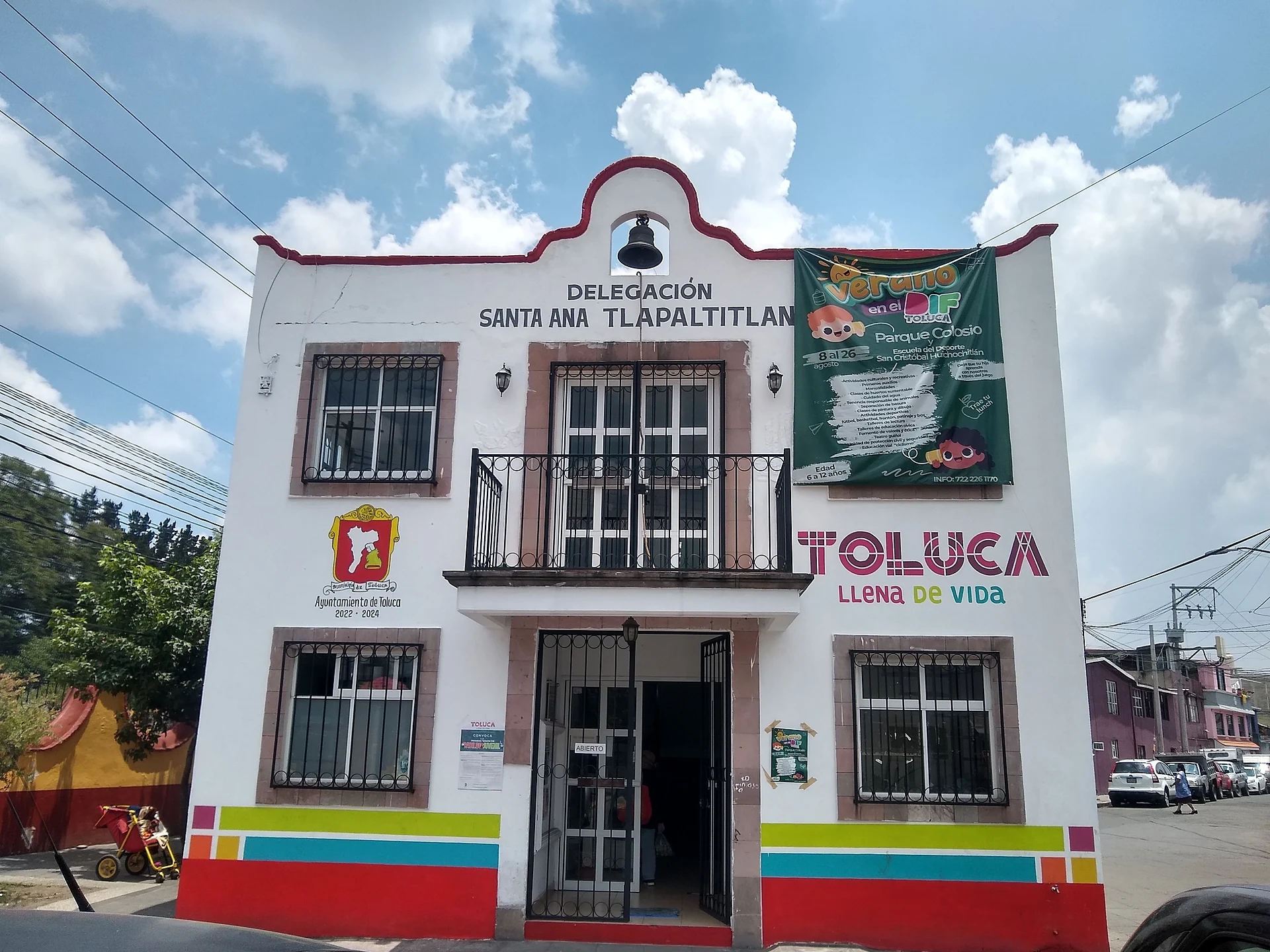
When it was founded the place was called Tlancingo, "among little teeth", and after the Mexica took it, Atipac, "among water", for its many springs. The present name dates from colonial times and has two readings: "among colours" or "place in the damp earth". Santa Ana Tlapaltitlán is an original village with delegation status on the flat alluvial floor of the Toluca valley, at about 2,640 m. The city has grown around it: Toluca borders it on the west and Metepec on the south, and part of Toluca's industrial zone and the Galerías Toluca mall now fall inside its limits. It still keeps its village centre, the barrio of Santa María Zozoquipan and the ejido settlements of La Loma, Buenavista and La Machincuepa; INEGI counted 33,089 residents in 2020.
For generations families here wove baskets from royal palm and criolla palm, dyed red, pink, green or blue, with flowers, geometric borders and roosters. The fiestas follow the farming year: San Isidro Labrador on 15 May, with the planting dance, ox teams and a parade on the nearest Sunday, and the patron feast of Santa Ana on 26 July, with red mole and quintonil tamales, a fair and brass bands in the churchyard. On Carnival Tuesday the Señor de la Columna is honoured, Holy Week is staged by residents, and on the night of 1 to 2 November families keep vigil at the cemetery.
How to get to Santa Ana Tlapaltitlán
Drive from Toluca: 5 min, 4 km
Santa Ana Tlapaltitlán is stuck to the city of Toluca: it borders it on the west and Metepec on the south, and until 1990 its northern edge was the Paseo Tollocan. From Mexico City, take the México–Toluca highway into the city and continue about 5 minutes (approx.) to the village; Metepec is about 6 km away, roughly 6 minutes by car. The easiest landmark is Galerías Toluca, which lies inside the delegation, or the Las Torres road that marks its southern edge. City transport runs from central Toluca; if you are unsure of the route, ask for "Santa Ana". On feast days, park away from the churchyard and walk in.
Directions to Santa Ana Tlapaltitlán on Google Maps
Distances are in a straight line; the road is usually longer.
Links open a partner site. We may earn a commission if you book, at no cost to you.
From the nearest cities to Santa Ana Tlapaltitlán
- Toluca · 4 km by road, 5 min
- Mexico City · 64 km by road, 1 h 5 min
- Zitácuaro · 92 km by road, 1 h 10 min
Drive times by road from OpenStreetMap, without traffic or stops. Times marked ~ are estimated from the straight-line distance.
Before you go to Santa Ana Tlapaltitlán: hours, prices and tips
- Best season
- San Isidro Labrador on 15 May (parade on the nearest Sunday); patron feast of Santa Ana on 26 July, lasting at least three days; Carnival on the Tuesday before Ash Wednesday; Day of the Dead vigil on 1 to 2 November. Wikipedia (es) · checked Oct 2026
Hours and prices change, especially around holidays. Each fact links to where we checked it.
Visiting Santa Ana Tlapaltitlán: what to see and do
The parish of Santa Ana and its churchyard, where the 26 July fair is set up.
The chapel of the Señor de la Columna (or de los Trabajitos) in the village centre.
The old barrio of Santa María Zozoquipan and its 8 September fiesta.
The feast of San Isidro Labrador (15 May): the planting dance to violin music, ox teams, horses and floats.
The palm basketry still woven in some homes, and the Holy Week Passion play.
The Day of the Dead vigil at the cemetery, 1 to 2 November.
Plan your trip
Places to stay in Santa Ana Tlapaltitlán
Compare hotels, posadas, and rentals in and around Santa Ana Tlapaltitlán.
Tours & activities
Day trips and guided outings from Metepec often include Santa Ana Tlapaltitlán; with a local guide you can get there without a car.
Rental cars
Pick up a car at TLC (Toluca): about 17 min by road to Metepec, then 4 km more to Santa Ana Tlapaltitlán, on your own schedule.
Flights
The nearest airport with scheduled flights is Toluca (TLC), about 17 min by road from Metepec, the base for Santa Ana Tlapaltitlán.
Mobile data
Signal can drop away from Metepec: download a map of the way to Santa Ana Tlapaltitlán before you set out, or carry an eSIM with data.
Links open a partner site. We may earn a commission if you book, at no cost to you.
When to go to Santa Ana Tlapaltitlán cool
Santa Ana Tlapaltitlán shares the climate of Metepec, 4 km away. The best months to visit are January, February, March, and December.
See the month-by-month climate of Metepec
Weather in Santa Ana Tlapaltitlán now and the next 7 days
Live forecast from Open-Meteo. Chance of rain is the day's highest.
The closest Pueblo Mágico: Metepec

Metepec is the Pueblo Mágico closest to Santa Ana Tlapaltitlán, with places to stay, food, and more to see.
Also close to
- Malinalco · Estado de México · 39 km away
- Ixtapan de la Sal · Estado de México · 49 km away
- Villa del Carbón · Estado de México · 53 km away
- Tonatico · Estado de México · 53 km away
- Valle de Bravo · Estado de México · 54 km away
Closest to Santa Ana Tlapaltitlán
-
San Felipe Tlalmimilolpan · Town · 5 km away
-
San Mateo Otzacatipan · Village · 6 km away
-
San Mateo Oxtotitlán · Village · 6 km away
-
San Antonio Buenavista · Village · 7 km away
-
San Juan Tilapa · Village · 7 km away
-
San Marcos Yachihuacaltepec · Village · 7 km away
-
Parque Estatal Sierra Morelos · Nature reserve · 8 km away
-
Santa María la Asunción · Village · 8 km away


Near Santa Ana Tlapaltitlán


Drive times by road from OpenStreetMap, without traffic. Times marked ~ are estimated from the straight-line distance.
Location from OpenStreetMap. Written by Puebloteca.