Village Almoloya de Juárez, Estado de México Toluca Valley
A small seat near Toluca with a sacred spring and pool, old haciendas and a horseback ribbon race at the September fiestas.
From Toluca: 20 min by car (19 km by road) How to get there ↓
Near here
See everything nearby ↓


Plan your visit to Almoloya de Juárez
Where to stay near Almoloya de Juárez
Compare hotels, posadas and guest houses in Almoloya de Juárez.
Tours to Almoloya de Juárez
Day trips and guided outings from Metepec often include Almoloya de Juárez; with a local guide you can get there without a car.
 Tours from Mexico City
Teotihuacan pyramids morning or afternoon without tourist traps
★ 4.9 (10,252) · From US$59
How to get to Almoloya de Juárez
- From Toluca: about 20 min by road (~19 km)
- Nearest airport: Toluca (TLC), 17 min by car to Metepec
Links open a partner site. We may earn a commission if you book, at no cost to you.
Tours from Mexico City, near Almoloya de Juárez


Tours, prices and ratings from Viator, checked weekly. We may earn a commission if you book.
About Almoloya de Juárez
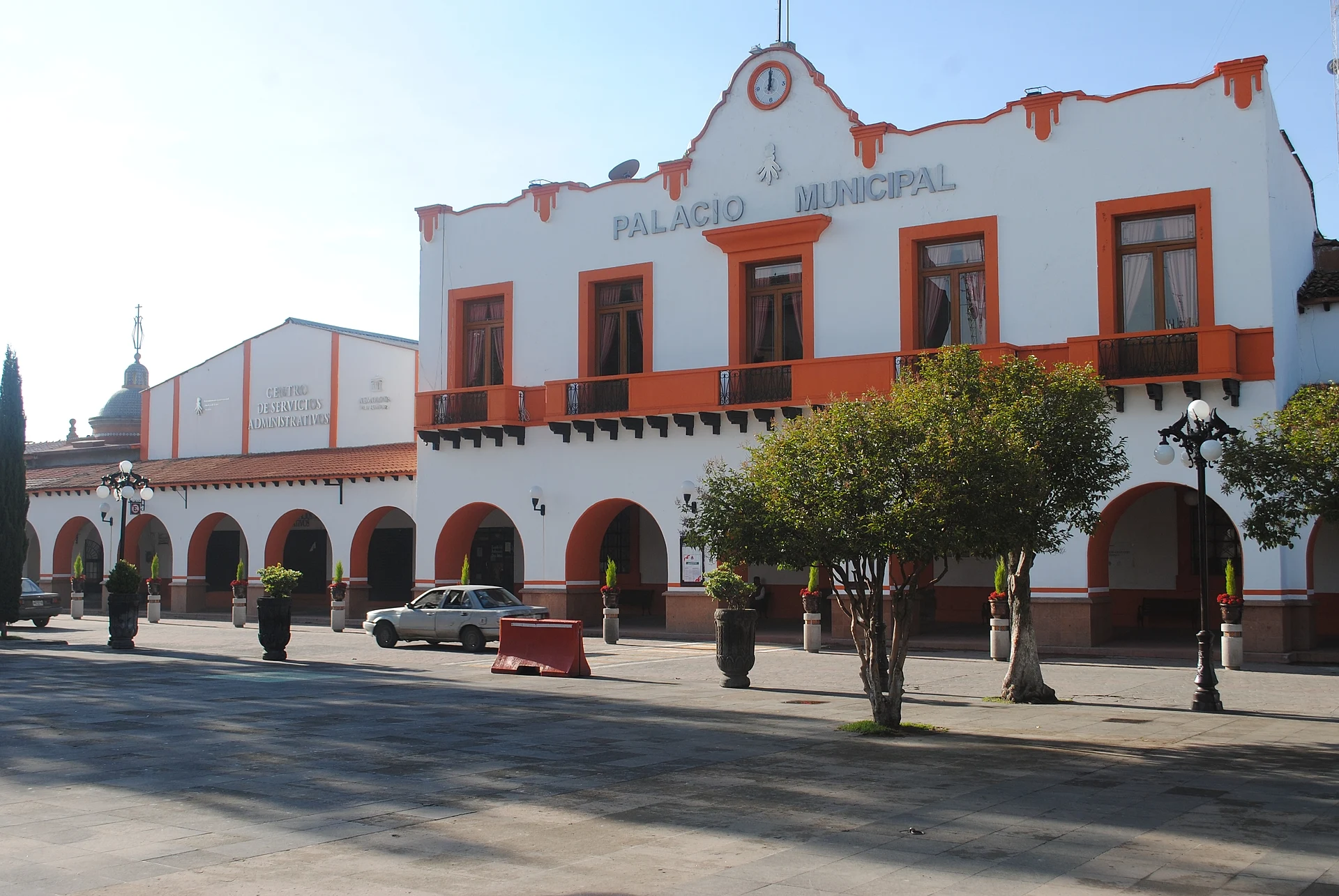
Northwest of Toluca, inside its metropolitan area and at around 2,600 m, Almoloya de Juárez gives both its name and its seat to the municipality. The town is small, just over 3,000 people in 2020; the whole municipality has 174,587. The name comes from the Nahuatl Almoloyan, "place where the spring wells up", and the spring is still the main draw: the Ojo de Agua, in the middle of town, is on record from 1570 and was declared a sanctuary in 1881. Beside it stand a chapel of the Immaculate Conception and a hermitage of St Peter; visitors toss coins into the basin and look for the "raya", a visible line across the water that locals say divides the spring's water from other currents. It now doubles as a bathing spot, with a pool and green areas, and stalls around it sell huaraches, gorditas and tacos.
The parish of San José was founded in 1568, and its feast day is 19 March. The haciendas that made the district prosperous include La Gavia, which began in 1539 as the Hacienda de la Candelaria and took its present name in 1663, as well as Las Llaves, San Miguel and La Galera. The municipality also holds the Ignacio Ramírez reservoir with its Isla de los Patos, and Cerro del Molcajete, where families climb every 12 October to picnic. Sunday is market day, with carnitas, cecina, barbacoa and tecui.
September brings the independence fiestas: the grito on the night of the 15th, and on the 17th a ribbon race in which riders on horseback try to catch a ribbon made by their madrinas. One thing worth knowing: the federal Altiplano prison, which gives the municipality's name national fame, lies about 6 km north of town and cannot be visited.
How to get to Almoloya de Juárez
Drive from Toluca: 20 min, 19 km
Almoloya de Juárez is about 20 km from Toluca according to México Desconocido (Uber estimates 17 km and around 33 minutes; allow 30 to 35 minutes, approx., and more at rush hour). By car, the Toluca-Zitácuaro toll road (A7D) runs through the area, and the town is entered by state road EM 253, signed "Carretera a Almoloya de Juárez"; another road comes in from San Luis Mextepec. Visitors from the capital enter Toluca first and carry on from there.
Public transport runs from Toluca by bus and combi; the guides give no lines or timetables, so ask at the terminal. The Ojo de Agua sanctuary is on Prolongación Manuel Bernal, opposite the Unidad Deportiva Juárez. Metepec lies some 21 km away as the crow flies; by road allow 25 to 30 minutes (approx.).
Directions to Almoloya de Juárez on Google Maps
Distances are in a straight line; the road is usually longer.
Links open a partner site. We may earn a commission if you book, at no cost to you.
From the nearest cities to Almoloya de Juárez
- Toluca · 19 km by road, 20 min
- Zitácuaro · 72 km by road, 1 h
- Mexico City · 89 km by road, 1 h 20 min
Drive times by road from OpenStreetMap, without traffic or stops. Times marked ~ are estimated from the straight-line distance.
Before you go to Almoloya de Juárez: hours, prices and tips
- Hours
- The Ojo de Agua is open every day of the year, 9:00 to 18:00. México Desconocido · checked Oct 2026
- Entry
- Entry to the Ojo de Agua is around 30 pesos and may change with the season or the administration. México Desconocido · checked Oct 2026
- Best time of day
- Sunday is market day in town, with regional food. Wikipedia (es) · checked Oct 2026
- Best season
- Feast of the Immaculate Conception at the Ojo de Agua on 8 December; San José on 19 March; independence fiestas with the ribbon race on 17 September; the climb to Cerro del Molcajete on 12 October. Wikipedia (es) · checked Oct 2026
Hours and prices change, especially around holidays. Each fact links to where we checked it.
Visiting Almoloya de Juárez: what to see and do
The Ojo de Agua: a sanctuary spring with its "raya" line in the water, the Immaculate Conception chapel and the pool.
The parish of San José, founded 1568, in the centre.
Hacienda La Gavia, begun in 1539.
Cerro del Molcajete, climbed and picnicked on every 12 October.
The Ignacio Ramírez reservoir and Isla de los Patos.
The Sunday market: carnitas, cecina, barbacoa and tecui.
The horseback ribbon race on 17 September.
Plan your trip
Places to stay in Almoloya de Juárez
Compare hotels, posadas, and rentals in and around Almoloya de Juárez.
Tours & activities
Day trips and guided outings from Metepec often include Almoloya de Juárez; with a local guide you can get there without a car.
Rental cars
Pick up a car at TLC (Toluca): about 17 min by road to Metepec, then 21 km more to Almoloya de Juárez, on your own schedule.
Flights
The nearest airport with scheduled flights is Toluca (TLC), about 17 min by road from Metepec, the base for Almoloya de Juárez.
Mobile data
Signal can drop away from Metepec: download a map of the way to Almoloya de Juárez before you set out, or carry an eSIM with data.
Links open a partner site. We may earn a commission if you book, at no cost to you.
When to go to Almoloya de Juárez cool
Almoloya de Juárez shares the climate of Metepec, 21 km away. The best months to visit are January, February, March, and December.
See the month-by-month climate of Metepec
Weather in Almoloya de Juárez now and the next 7 days
Live forecast from Open-Meteo. Chance of rain is the day's highest.
The closest Pueblo Mágico: Metepec

Metepec is the Pueblo Mágico closest to Almoloya de Juárez, with places to stay, food, and more to see.
Also close to
- Valle de Bravo · Estado de México · 44 km away
- Villa del Carbón · Estado de México · 50 km away
- Malinalco · Estado de México · 54 km away
- Ixtapan de la Sal · Estado de México · 59 km away
- Angangueo · Michoacán · 62 km away
Closest to Almoloya de Juárez
-
Colinas del Sol · Village · 2 km away
-
San Martín Toltepec · Village · 6 km away
-
Zona Arqueológica de Calixtlahuaca · Archaeological site · 8 km away
-
Parque Estatal Sierra Morelos · Nature reserve · 9 km away
-
Ex Convento de Zinacantepec · Landmark · 10 km away
-
San Marcos Yachihuacaltepec · Village · 10 km away
-
San Mateo Oxtotitlán · Village · 11 km away
-
San Antonio Buenavista · Village · 13 km away

Near Almoloya de Juárez


Drive times by road from OpenStreetMap, without traffic. Times marked ~ are estimated from the straight-line distance.
Location from OpenStreetMap. Written by Puebloteca.