Town Jocotitlán, Estado de México Municipality of Jocotitlán Northern Estado de México
A Mazahua-country town below the Xocotépetl volcano, Pueblo con Encanto since 2021: a two-level plaza, black-stone church and a market of wild greens.
From Toluca: 45 min by car (53 km by road) How to get there ↓
Near here
See everything nearby ↓


Plan your visit to Ciudad de Jocotitlán
Where to stay near Ciudad de Jocotitlán
Compare hotels, posadas and guest houses in Ciudad de Jocotitlán.
Tours to Ciudad de Jocotitlán
Day trips around Villa del Carbón sometimes stop in Ciudad de Jocotitlán; a tour is the easy way to see it without a car.
 Tours from Mexico City
Teotihuacan pyramids morning or afternoon without tourist traps
★ 4.9 (10,269) · From US$59
How to get to Ciudad de Jocotitlán
- From Toluca: about 45 min by road (~53 km)
- Nearest airport: Toluca (TLC), 1 h 12 min by car to Villa del Carbón
Links open a partner site. We may earn a commission if you book, at no cost to you.
Tours from Mexico City, near Ciudad de Jocotitlán


Tours, prices and ratings from Viator, checked weekly. We may earn a commission if you book.
About Ciudad de Jocotitlán
Jocotitlán, officially the Heroica Ciudad de Jocotitlán, is the seat of the municipality of the same name in the north of the State of Mexico, between Ixtlahuaca and Atlacomulco. It sits against the lower slopes of the Jocotitlán or Xocotépetl volcano, which has its own Puebloteca page, looking out over the flat Ixtlahuaca valley at about 2,670 m. It had 7,965 residents in 2020. The Nahuatl name is usually translated as "among the tejocote trees". This has been Mazahua country since before the conquest, and the state named the town a Pueblo con Encanto on 30 August 2021.
The Spanish town was founded by royal decree in 1540. From 1592 until his death in 1635 its priest was Diego de Nájera Yanguas, who learned his parishioners' language and wrote a Mazahua-language catechism, published in 1637 and described as the only known book printed in Mazahua. Two centuries later the War of Independence came close: the parish priest, José Ignacio Muñiz, handed Hidalgo the edict of excommunication at Ixtlahuaca in 1810, and in April 1811 the town rose up, killed the Ixtlahuaca district officer in the plaza and was crushed by royalist troops under Juan Bautista de la Torre, leaving more than 400 dead. That is why the municipality was declared a "heroic city" in 2013.
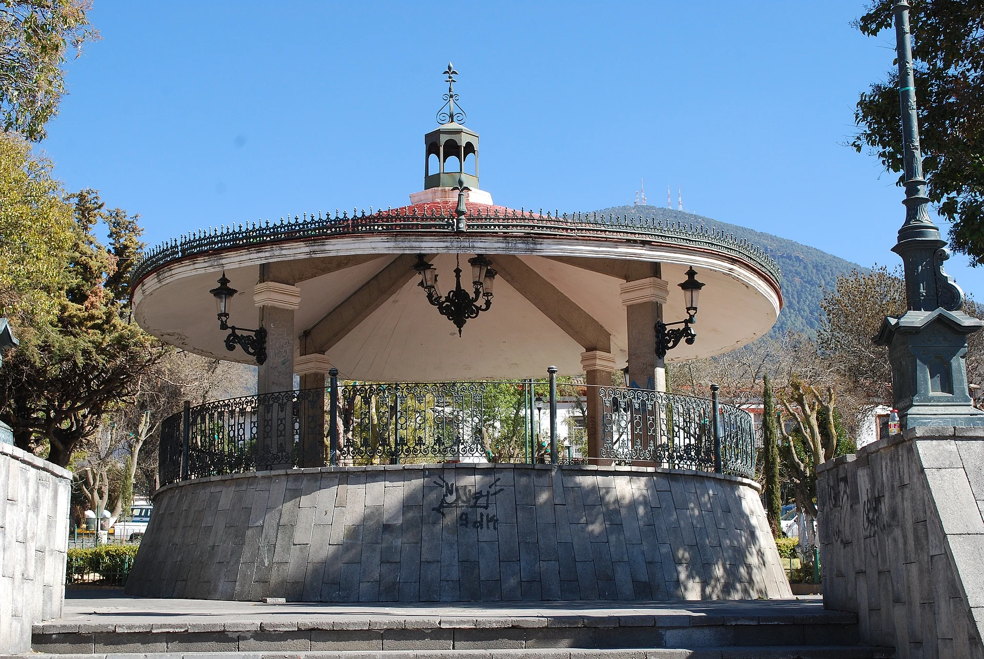
The centre has cobbled streets and houses with red tile roofs. The main plaza has two levels, with the bandstand and trees on the upper one and the parish church of Jesús Nazareno on its east side. The church was founded in 1575 and has gone through three building phases: the 16th-century atrium cross survives from the first Franciscan church, while the present Neoclassical building of black sandstone with brick trim was begun in the 1860s, its towers only finished in 1983. Inside are a baptismal font carved from a single block of stone, probably 16th-century, and the white-and-gold Santísimo chapel.
Across the plaza to the south, the arcades hold the Diego de Nájera Yanguas culture centre, and a little further south the municipal market serves barbacoa, mole and quelites, plus wild mushrooms, escamoles, maguey flowers and cupiches, a kind of butterfly larva. Knitted goods in thread and yarn are still made in town.
How to get to Ciudad de Jocotitlán
Drive from Toluca: 45 min, 53 km
From Toluca it is about 54 km, roughly 45 minutes: head north on Federal Highway 55 and join the Toluca–Ixtlahuaca–Atlacomulco toll road (55D); past Ixtlahuaca take the Jocotitlán exit; the last couple of kilometres climb into the centre. From Atlacomulco it is about 19 km on the 55D or the free 55, around 20 minutes. From Mexico City the drive takes about an hour and a half or more.
By bus, Caminante runs from the Terminal Poniente (Observatorio) to Atlacomulco about hourly, taking 1 hour 40 minutes to 2 hours, and Flecha Roja runs hourly to Ixtlahuaca; from either, finish by taxi. From Toluca, Autovías La Línea, Flecha Roja and Primera Plus run to Atlacomulco in about an hour. Villa del Carbón, the nearest of our pueblos, is about 49 km away on the Jilotepec–Ixtlahuaca road, roughly an hour.
Directions to Ciudad de Jocotitlán on Google Maps
Distances are in a straight line; the road is usually longer.
Links open a partner site. We may earn a commission if you book, at no cost to you.
From the nearest cities to Ciudad de Jocotitlán
- Toluca · 53 km by road, 45 min
- Zitácuaro · 116 km by road, 1 h 25 min
- San Juan del Río · 97 km by road, 1 h 35 min
Drive times by road from OpenStreetMap, without traffic or stops. Times marked ~ are estimated from the straight-line distance.
Before you go to Ciudad de Jocotitlán: hours, prices and tips
- Best season
- The town's biggest celebrations are Holy Week, with 17th- and 18th-century images, and the feast of 6 August. In May, for the Day of the Holy Cross, each neighbourhood holds a street party with fireworks, music and snacks, and in December farmers organise a day out on the hill to give thanks for the harvest. Enciclopedia de los Municipios de México (INAFED) · checked Oct 2026
Hours and prices change, especially around holidays. Each fact links to where we checked it.
Visiting Ciudad de Jocotitlán: what to see and do
The two-level plaza, with its bandstand and the volcano behind it.
The black-stone parish church of Jesús Nazareno, with its 16th-century atrium cross and single-stone baptismal font.
The white-and-gold Santísimo chapel.
The arcades and the Diego de Nájera Yanguas culture centre.
The food stalls of the municipal market: barbacoa, quelites, escamoles, maguey flowers and mushrooms.
The road up the Xocotépetl volcano, which starts in town.
The municipality's Mazahua villages, such as Santiago Casandejé and San Miguel Tenochtitlán, for pottery and woollen textiles.
Plan your trip
Places to stay in Ciudad de Jocotitlán
Compare hotels, posadas, and rentals in and around Ciudad de Jocotitlán.
Tours & activities
Day trips around Villa del Carbón sometimes stop in Ciudad de Jocotitlán; a tour is the easy way to see it without a car.
Rental cars
Pick up a car at TLC (Toluca): about 1 h 12 min by road to Villa del Carbón, then 34 km more to Ciudad de Jocotitlán, on your own schedule.
Flights
The nearest airport with scheduled flights is Toluca (TLC), about 1 h 12 min by road from Villa del Carbón, the base for Ciudad de Jocotitlán.
Mobile data
Signal can drop away from Villa del Carbón: download a map of the way to Ciudad de Jocotitlán before you set out, or carry an eSIM with data.
Links open a partner site. We may earn a commission if you book, at no cost to you.
When to go to Ciudad de Jocotitlán cool
Ciudad de Jocotitlán shares the climate of Villa del Carbón, 34 km away. The best months to visit are January, February, March, and December.
See the month-by-month climate of Villa del Carbón
Weather in Ciudad de Jocotitlán now and the next 7 days
Live forecast from Open-Meteo. Chance of rain is the day's highest.
The closest Pueblo Mágico: Villa del Carbón

Villa del Carbón is the Pueblo Mágico closest to Ciudad de Jocotitlán, with places to stay, food, and more to see.
Also close to
- El Oro · Estado de México · 37 km away
- Jilotepec · Estado de México · 38 km away
- Tlalpujahua · Michoacán · 42 km away
- Aculco · Estado de México · 47 km away
- Angangueo · Michoacán · 53 km away
Closest to Ciudad de Jocotitlán
-
Jocotitlán · Mountain · 5 km away
-
Atlacomulco de Fabela · Town · 13 km away
-
San Bartolo Morelos · Village · 15 km away
-
San Francisco de Asís · Village · 15 km away
-
San Miguel Tenochtitlán · Village · 15 km away
-
Ixtlahuaca de Rayón · Town · 16 km away
-
San Felipe del Progreso · Town · 17 km away
-
San Miguel Enyege · Village · 17 km away


Near Ciudad de Jocotitlán
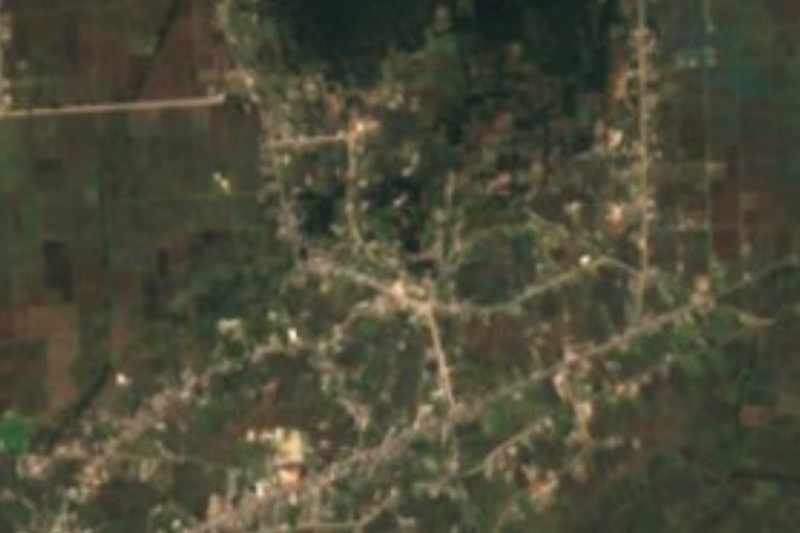


Drive times by road from OpenStreetMap, without traffic. Times marked ~ are estimated from the straight-line distance.
Location from OpenStreetMap. Written by Puebloteca.