

Village Temascalcingo, Estado de México Municipality of Temascalcingo Monarch Butterfly country Northern Estado de México
A Temascalcingo village at 2,539 m, "on the round hill": a San Francisco church and hand-embroidered quesquémetls with flowers and birds.
From Toluca: 1 h 10 min by car (81 km by road) How to get there ↓
Near here
See everything nearby ↓


Plan your visit to San Francisco Tepeolulco
Where to stay near San Francisco Tepeolulco
Compare hotels, posadas and guest houses in San Francisco Tepeolulco.
Tours to San Francisco Tepeolulco
Day trips and guided outings from El Oro often include San Francisco Tepeolulco; with a local guide you can get there without a car.
How to get to San Francisco Tepeolulco
- From Toluca: about 1 h 10 min by road (~81 km)
- Nearest airport: Toluca (TLC), 1 h 27 min by car to El Oro
Links open a partner site. We may earn a commission if you book, at no cost to you.
About San Francisco Tepeolulco
San Francisco Tepeolulco is in Temascalcingo municipality, in the northwest of the State of Mexico. With 7,090 people in 2020 (INEGI) and an altitude of 2,539 m, it is a large locality for the area. The name joins the patron saint, Francis of Assisi, with Nahuatl tepetl (hill), ololli (round) and co (place): "on the round hill". It lies about 10 km in a straight line south of Temascalcingo, the municipal seat.
Its craft has a name within the municipality: quesquémetls, the region's typical shawl-like garment, are embroidered here by hand with designs of flowers and birds. Other Temascalcingo villages work clay in Santiago Coachochitlán, make the Corpus "viejos" in La Magdalena Cruz Blanca, or weave rod sashes and baskets in San Pedro Potla. The village church dedicated to San Francisco has a photo on Wikimedia Commons.
The whole municipality has been a Pueblo con Encanto since 2008. Around it are 19th-century haciendas, among them Solís, the El Borbollón hot spring, and orchards of peach, apple and plum, which scent the landscape with peach blossom in winter. Tepeolulco has no attractions set up for tourists; it is a working village of craftswomen. There is no published patron-saint feast date in a source I can cite; 4 October is the day of St Francis of Assisi.
How to get to San Francisco Tepeolulco
Drive from Toluca: 1 h 10 min, 81 km
San Francisco Tepeolulco lies about 10 km (straight-line) south of Temascalcingo, in the far northwest of the State of Mexico, and about 16 km in a straight line from El Oro, the nearest pueblo. San Juan del Río (Querétaro) is about 62 km straight-line, roughly 1 hour 10 minutes by car. Toluca is much farther, across the State of Mexico. There is no published published bus or colectivo timetables; ask at the Atlacomulco terminal about those to Temascalcingo and then on to Tepeolulco. The municipality borders Acambay to the north, El Oro and Atlacomulco to the south, and the states of Querétaro and Michoacán to the west.
Directions to San Francisco Tepeolulco on Google Maps
Distances are in a straight line; the road is usually longer.
Links open a partner site. We may earn a commission if you book, at no cost to you.
From the nearest cities to San Francisco Tepeolulco
- Toluca · 81 km by road, 1 h 10 min
- Ciudad Hidalgo · 86 km by road, 1 h 20 min
- Acámbaro · 91 km by road, 1 h 25 min
Drive times by road from OpenStreetMap, without traffic or stops. Times marked ~ are estimated from the straight-line distance.
Visiting San Francisco Tepeolulco: what to see and do
Step into the church of San Francisco and its atrium.
Look for hand-embroidered quesquémetls with flowers and birds.
Follow the municipality's craft trail: clay at Coachochitlán, sashes and baskets at San Pedro Potla.
Come in winter to Temascalcingo, when the peach trees bloom.
Visit Solís hacienda and the El Borbollón hot spring in the municipality.
Plan your trip
Places to stay in San Francisco Tepeolulco
Compare hotels, posadas, and rentals in and around San Francisco Tepeolulco.
Tours & activities
Day trips and guided outings from El Oro often include San Francisco Tepeolulco; with a local guide you can get there without a car.
Rental cars
Pick up a car at TLC (Toluca): about 1 h 27 min by road to El Oro, then 16 km more to San Francisco Tepeolulco, on your own schedule.
Flights
The nearest airport with scheduled flights is Toluca (TLC), about 1 h 27 min by road from El Oro, the base for San Francisco Tepeolulco.
Mobile data
Signal can drop away from El Oro: download a map of the way to San Francisco Tepeolulco before you set out, or carry an eSIM with data.
Links open a partner site. We may earn a commission if you book, at no cost to you.
When to go to San Francisco Tepeolulco cool
San Francisco Tepeolulco shares the climate of El Oro, 16 km away. The best months to visit are January, February, March, and April.
See the month-by-month climate of El Oro
Weather in San Francisco Tepeolulco now and the next 7 days
Live forecast from Open-Meteo. Chance of rain is the day's highest.
The closest Pueblo Mágico: El Oro

El Oro is the Pueblo Mágico closest to San Francisco Tepeolulco, with places to stay, food, and more to see.
Also close to
- Tlalpujahua · Michoacán · 20 km away
- Aculco · Estado de México · 37 km away
- Angangueo · Michoacán · 40 km away
- Amealco · Querétaro · 43 km away
- Jilotepec · Estado de México · 49 km away
Closest to San Francisco Tepeolulco
-
San Juan de los Jarros · Village · 7 km away
-
Temascalcingo · Town · 9 km away
-
San Miguel Tenochtitlán · Village · 10 km away
-
Atlacomulco de Fabela · Town · 12 km away
-
San Felipe del Progreso · Town · 14 km away
-
San Pedro de los Metates · Village · 15 km away
-
Exhacienda de Solís · Village · 18 km away
-
Mina Las Dos Estrellas · Landmark · 18 km away


Near San Francisco Tepeolulco
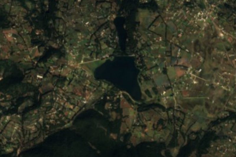


Drive times by road from OpenStreetMap, without traffic. Times marked ~ are estimated from the straight-line distance.
Location from OpenStreetMap. Written by Puebloteca.