Town San José del Rincón, Estado de México Monarch Butterfly country Northern Estado de México
A Mazahua municipal seat created in 2001 on the Villa Victoria–El Oro road, and the jumping-off point for the La Mesa monarch sanctuary.
From Zitácuaro: 1 h 5 min by car (56 km by road) How to get there ↓
Near here
See everything nearby ↓


Plan your visit to San José del Rincón
Where to stay near San José del Rincón
Compare hotels, posadas and guest houses in San José del Rincón.
Tours to San José del Rincón
Day trips around Angangueo sometimes stop in San José del Rincón; a tour is the easy way to see it without a car.
How to get to San José del Rincón
- From Zitácuaro: about 1 h 5 min by road (~56 km)
- Nearest airport: Morelia (MLM), 1 h 42 min by car to Angangueo
Links open a partner site. We may earn a commission if you book, at no cost to you.
About San José del Rincón
San José del Rincón is the seat of a municipality that only came into being in 2001. Decree 36 of the state legislature, published on 2 October that year, carved 494.9 km² out of San Felipe del Progreso, and a provisional council took office on 1 January 2002. The town itself, officially San José del Rincón Centro, had 3,827 people in the 2010 census, while the whole municipality counted 100,082 in 2020 according to INEGI, spread over more than 130 mostly rural communities between 2,500 and 3,700 m. Locals are called monteros, because the neighbouring towns always referred to people from here as "the ones from the mountain".
This is Mazahua country. The municipal emblem shows a hill topped by a pine with a spring at its foot and a monarch butterfly, xofiy in Mazahua, an animal held sacred in these communities. Spanish land grants carved up the area from the 1500s, and later came haciendas such as La Providencia, San Onofre, Jaltepec and Lamillas. They lived off zacatón, a bunchgrass whose roots were exported to Europe, along with timber, pulque, wool and charcoal, all shipped out on the rail spur that mining companies ran from Tultenango to El Oro and Tlalpujahua in 1895, with a stop at Carmona station.
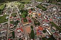
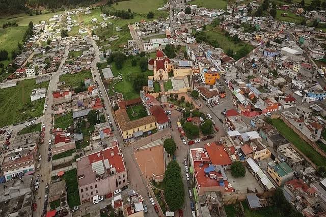
The main square is faced by the parish church of Señor San José, built of quarried stone on land given by Elías Marín's hacienda and made a parish around 1907. The bigger draw lies to the west: roughly 15,200 hectares of pine and sacred-fir forest inside the Monarch Butterfly Biosphere Reserve. There the La Mesa ejido guides visitors to the wintering butterflies from November to March, and the Las Rosas conservation unit has trails for spotting the forest's birds and other wildlife.
How to get to San José del Rincón
Drive from Zitácuaro: 1 h 5 min, 56 km
By car from Toluca it is about 95 km, roughly 1 hour 30 minutes: take the Toluca–Zitácuaro toll road or federal highway 15 to Villa Victoria, then head north on the free Villa Victoria–El Oro road, which runs into town. From Atlacomulco you can instead take the free road to El Oro and turn south, or go via San Felipe del Progreso. The municipality puts Mexico City at about 173 km and around 3 hours. By bus, the México–Toluca–Zinacantepec y Ramales line links the town with Toluca, Atlacomulco, San Felipe del Progreso, El Oro, Villa Victoria, Angangueo and Zitácuaro, and there are two shared-taxi stands in the centre. For the La Mesa sanctuary, follow the Villa Victoria–El Oro road to the Guadalupe La Capillita turn-off (which also has a shared-taxi stand) and drive about 12 km to the visitor lodge; from town it is about 17 km and half an hour. Angangueo, the Pueblo Mágico across the border in Michoacán, is about 15 km away as the crow flies; the municipality's directions use the free road from Zitácuaro through Angangueo.
Directions to San José del Rincón on Google Maps
Distances are in a straight line; the road is usually longer.
Links open a partner site. We may earn a commission if you book, at no cost to you.
From the nearest cities to San José del Rincón
- Zitácuaro · 56 km by road, 1 h 5 min
- Ciudad Hidalgo · 62 km by road, 1 h 10 min
- Toluca · 93 km by road, 1 h 25 min
Drive times by road from OpenStreetMap, without traffic or stops. Times marked ~ are estimated from the straight-line distance.
Before you go to San José del Rincón: hours, prices and tips
- Best season
- The town's big feast is 19 March, Saint Joseph's day. At the La Mesa sanctuary the monarchs overwinter from November to March. H. Ayuntamiento de San José del Rincón · checked Oct 2026
Hours and prices change, especially around holidays. Each fact links to where we checked it.
Visiting San José del Rincón: what to see and do
The stone parish church of Señor San José, facing the town's main square.
The La Mesa monarch butterfly sanctuary, with a visitor lodge, cabins, food and ejido guides (November to March).
The Las Rosas conservation unit, a pine and fir forest park with cabins, camping and wildlife trails.
The former Hacienda La Providencia, a zacatón hacienda founded in 1776, now used for photo shoots and religious events.
The forests on the municipality's western side, part of the Monarch Butterfly Biosphere Reserve.
Plan your trip
Places to stay in San José del Rincón
Compare hotels, posadas, and rentals in and around San José del Rincón.
Tours & activities
Day trips around Angangueo sometimes stop in San José del Rincón; a tour is the easy way to see it without a car.
Rental cars
Pick up a car at MLM (Morelia): about 1 h 42 min by road to Angangueo, then 15 km more to San José del Rincón, on your own schedule.
Flights
The nearest airport with scheduled flights is Morelia (MLM), about 1 h 42 min by road from Angangueo, the base for San José del Rincón.
Mobile data
Signal can drop away from Angangueo: download a map of the way to San José del Rincón before you set out, or carry an eSIM with data.
Links open a partner site. We may earn a commission if you book, at no cost to you.
When to go to San José del Rincón cool
San José del Rincón shares the climate of Angangueo, 15 km away. The best months to visit are February, March, April, and November.
See the month-by-month climate of Angangueo
Weather in San José del Rincón now and the next 7 days
Live forecast from Open-Meteo. Chance of rain is the day's highest.
The closest Pueblo Mágico: Angangueo

Angangueo is the Pueblo Mágico closest to San José del Rincón, with places to stay, food, and more to see.
Also close to
- El Oro · Estado de México · 16 km away
- Tlalpujahua · Michoacán · 16 km away
- Valle de Bravo · Estado de México · 52 km away
- Amealco · Querétaro · 59 km away
- Aculco · Estado de México · 63 km away
Closest to San José del Rincón
-
Santuario de la Mariposa Monarca La Mesa · Nature reserve · 8 km away
-
Presa Brockman · Lake · 12 km away
-
Mina Las Dos Estrellas · Landmark · 14 km away
-
Santuario El Rosario · Nature reserve · 14 km away
-
Santuario Sierra Chincua · Nature reserve · 15 km away
-
Ocampo · Town · 21 km away
-
San Felipe del Progreso · Town · 22 km away
-
San Francisco Tepeolulco · Village · 26 km away


Near San José del Rincón


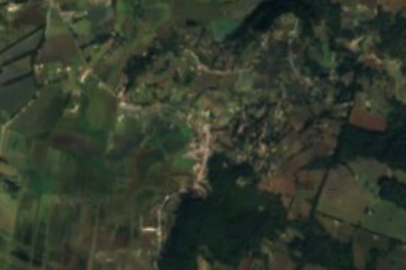


Drive times by road from OpenStreetMap, without traffic. Times marked ~ are estimated from the straight-line distance.
Location from OpenStreetMap. Written by Puebloteca.