Village Atlacomulco, Estado de México Northern Estado de México
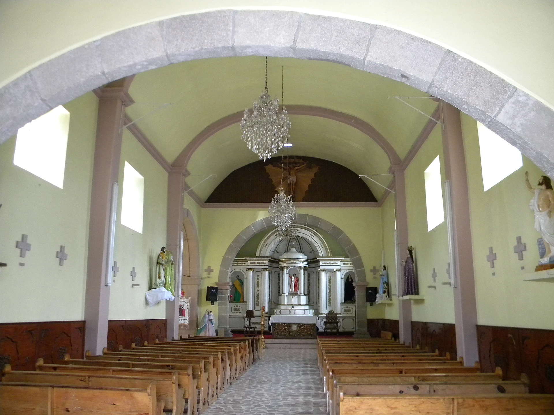
Hill village in Atlacomulco, once Cuiyatepec, regrouped in 1604 from Mazahua, Otomí and Nahua settlements; church of San Juan Bautista.
From Toluca: 1 h 5 min by car (74 km by road) How to get there ↓
Near here
See everything nearby ↓


Plan your visit to San Juan de los Jarros
Where to stay near San Juan de los Jarros
Compare hotels, posadas and guest houses in San Juan de los Jarros.
Tours to San Juan de los Jarros
Day trips and guided outings from El Oro often include San Juan de los Jarros; with a local guide you can get there without a car.
 Tours from Mexico City
Teotihuacan pyramids morning or afternoon without tourist traps
★ 4.9 (10,269) · From US$59
How to get to San Juan de los Jarros
- From Toluca: about 1 h 5 min by road (~74 km)
- Nearest airport: Toluca (TLC), 1 h 27 min by car to El Oro
Links open a partner site. We may earn a commission if you book, at no cost to you.
Tours from Mexico City, near San Juan de los Jarros


Tours, prices and ratings from Viator, checked weekly. We may earn a commission if you book.
About San Juan de los Jarros
San Juan de los Jarros is a community in the municipality of Atlacomulco, in the northern Toluca valley, at 2,480 m, with 2,660 residents in the 2020 census. Its past is better documented than that of many larger towns, thanks to a 1604 document that UNAM published in 2020: the congregación of San Juan de los Jarros. It records that before the regrouping the village was called Cuiyatepec, Nahuatl for "hill of the frogs", and sat on a hillside. None of the sources we read explains where "jarros" (jars) comes from.
A congregación was a viceregal policy of gathering scattered settlements into one. On 11 May 1603, after Mass, the judge Jorge de Baeza y Carvajal and the parish priest Juan González de Urbina addressed the Indigenous residents; the priest spoke Otomí and Mazahua, so no interpreter was needed. Seven small settlements were joined, leaving about 390 to 398 tributaries of Mazahua, Otomí and some Nahua origin. Their lands gave maize, fava beans, pulses, pigs and hens, and the barrio of San Bartolomé grew maguey and sold pulque to the Tlalpujahua mines. The governor at the time was Francisco de Villegas, a Mazahua.
The priest himself described a village on a high rise, one league from the head town, on cold and windy ground where no water reaches and it must be fetched from a short distance away. In 1712 the Real Audiencia sided with the subject barrios of San Bartolomé, Santo Domingo and San Felipe against Spaniards trying to settle on their land, and this same document was produced in their defence. Today the draw is the atrium and the church of San Juan Bautista, a catalogued historic monument, and the hill scenery of the north of the valley.
How to get to San Juan de los Jarros
Drive from Toluca: 1 h 5 min, 74 km
San Juan de los Jarros lies about 8 km north-west of Atlacomulco de Fabela, the seat, as the crow flies. From Mexico City the typical route is Avenida Constituyentes and Reforma toward Toluca, the Mexico–Toluca 15D past La Marquesa, the Libramiento Ruta de la Independencia Bicentenario (134D) and the Toluca–Atlacomulco toll road (55D) to Atlacomulco; that is about 129 km and roughly 1 h 55 min according to a route planner, with tolls. From Atlacomulco it is a few kilometres on local roads; we found no published bus or combi, so ask in the centre or take a taxi. By bus, Atlacomulco is served by lines such as Flecha Roja (Toluca and Querétaro), Caminante (Mexico City Poniente and El Oro) and La Línea (Mexico Poniente, Morelia and Tepotzotlán). The nearest pueblo, El Oro, is about 24 km away in a straight line; San Juan del Río is about 60 km.
Directions to San Juan de los Jarros on Google Maps
Distances are in a straight line; the road is usually longer.
Links open a partner site. We may earn a commission if you book, at no cost to you.
From the nearest cities to San Juan de los Jarros
- Toluca · 74 km by road, 1 h 5 min
- San Juan del Río · 77 km by road, 1 h 20 min
- Ciudad Hidalgo · 98 km by road, 1 h 25 min
Drive times by road from OpenStreetMap, without traffic or stops. Times marked ~ are estimated from the straight-line distance.
Visiting San Juan de los Jarros: what to see and do
The church of San Juan Bautista and its wide atrium, catalogued as a historic monument.
The hill scenery of the northern Toluca valley around the village.
The trace of old Cuiyatepec ("hill of the frogs") and of subject barrios such as San Bartolomé.
Atlacomulco, about 8 km away, for food and onward buses.
Plan your trip
Places to stay in San Juan de los Jarros
Compare hotels, posadas, and rentals in and around San Juan de los Jarros.
Tours & activities
Day trips and guided outings from El Oro often include San Juan de los Jarros; with a local guide you can get there without a car.
Rental cars
Pick up a car at TLC (Toluca): about 1 h 27 min by road to El Oro, then 24 km more to San Juan de los Jarros, on your own schedule.
Flights
The nearest airport with scheduled flights is Toluca (TLC), about 1 h 27 min by road from El Oro, the base for San Juan de los Jarros.
Mobile data
Signal can drop away from El Oro: download a map of the way to San Juan de los Jarros before you set out, or carry an eSIM with data.
Links open a partner site. We may earn a commission if you book, at no cost to you.
When to go to San Juan de los Jarros cool
San Juan de los Jarros shares the climate of El Oro, 24 km away. The best months to visit are January, February, March, and April.
See the month-by-month climate of El Oro
Weather in San Juan de los Jarros now and the next 7 days
Live forecast from Open-Meteo. Chance of rain is the day's highest.
The closest Pueblo Mágico: El Oro

El Oro is the Pueblo Mágico closest to San Juan de los Jarros, with places to stay, food, and more to see.
Also close to
- Tlalpujahua · Michoacán · 28 km away
- Aculco · Estado de México · 32 km away
- Jilotepec · Estado de México · 41 km away
- Amealco · Querétaro · 43 km away
- Angangueo · Michoacán · 47 km away
Closest to San Juan de los Jarros
-
San Francisco Tepeolulco · Village · 7 km away
-
San Pedro de los Metates · Village · 7 km away
-
Atlacomulco de Fabela · Town · 8 km away
-
San Miguel Tenochtitlán · Village · 11 km away
-
Temascalcingo · Town · 11 km away
-
Acambay · Town · 13 km away
-
Zona Arqueológica de Huamango · Archaeological site · 14 km away
-
San Felipe del Progreso · Town · 17 km away


Near San Juan de los Jarros
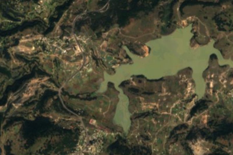


Drive times by road from OpenStreetMap, without traffic. Times marked ~ are estimated from the straight-line distance.
Location from OpenStreetMap. Written by Puebloteca.