


Village Dzilam de Bravo, Yucatán Costa Esmeralda (Yucatán)
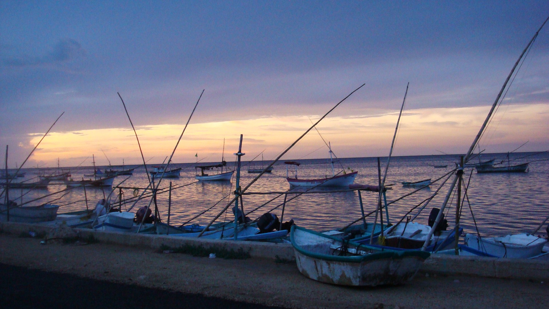
Fishing port at the end of the coast road, base for boat trips to the springs, mangroves and empty beaches of the Dzilam reserve, and Lafitte's supposed grave.
From Tizimín: 1 h 35 min by car (100 km by road) How to get there ↓
Near here
See everything nearby ↓


Plan your visit to Dzilam de Bravo
Where to stay near Dzilam de Bravo
Compare hotels, posadas and guest houses in Dzilam de Bravo.
Tours to Dzilam de Bravo
Day trips and guided outings from Motul often include Dzilam de Bravo; with a local guide you can get there without a car.
 Tours from Rio Lagartos
Eco Safari through the Ria Lagartos Natural Park
★ 5.0 (41) · From US$58
How to get to Dzilam de Bravo
- From Tizimín: about 1 h 35 min by road (~100 km)
- Nearest airport: Mérida (MID), 47 min by car to Motul
Links open a partner site. We may earn a commission if you book, at no cost to you.
Tours from Rio Lagartos, near Dzilam de Bravo


Tours, prices and ratings from Viator, checked weekly. We may earn a commission if you book.
About Dzilam de Bravo
Dzilam de Bravo is a fishing port of 2,455 people (2020 census) on Yucatán's north coast, the last town on the coastal highway that runs east from Progreso, about an hour and a half by car from Mérida. It sits between the beach village of Santa Clara to the west and the estuaries of the Bocas de Dzilam to the east, about 13 kilometers north of its parent town, Dzilam González. The name comes from the Maya dzilam, "peeled" or "stripped bare". A white lighthouse stands near the seafront, and the malecón runs along the harbour where the boats come in.
The port has a long history. Francisco de Montejo the elder landed here in 1531 during his campaign to conquer the peninsula, and for most of the colonial period this was simply the port of Dzilam González. Later the coast became a refuge for pirates, and the best-known story in town is that the French corsair Jean Lafitte died here around 1821 and was buried in the local cemetery. Historians have never confirmed it; local tradition says the old seaside cemetery was destroyed by a hurricane, and a tombstone for Lafitte stands at a monument known as Las Tres Cruces, put up in his memory in 1961. The port belonged to the municipality of Dzilam González until 25 December 1921, when it became a municipality and took the name Dzilam de Bravo.
East of town begins the Reserva Estatal de Dzilam, decreed in 1989 and covering about 69,000 hectares, including a marine strip, across the municipalities of Dzilam de Bravo and San Felipe; it is also a Ramsar wetland of international importance. Mangrove covers about two-thirds of it, and inside lies Isla Cerritos, a small island that served as the sea port of Chichén Itzá between about 800 and 1100, with a 330-meter stone breakwater built by the Maya.
Visitors come for the boat trips run by local cooperatives. Typical stops are Punta Arena, a quiet beach at the far end of the trip; the Chacaltún rocks, for shallow snorkeling among fish; Xbuya Há, a freshwater spring that bubbles up through the sea with a strong current; and Cenote Elepetén, a freshwater pool in the mangroves reached by a long boardwalk. Longer trips go to the Río Angosto lagoon and the Bocas de Dzilam, where flamingos, herons and egrets feed and crocodiles rest on the banks, and some operators offer camping in the Bocas, night trips to see bioluminescence, and trolling for fish that ends as ceviche. Fishing, especially for octopus and shark, is still the town's living.
How to get to Dzilam de Bravo
Drive from Tizimín: 1 h 35 min, 100 km
Dzilam de Bravo is about an hour and a half from Mérida. Either drive to Progreso and follow the coastal highway east past Telchac Puerto, San Crisanto, Chabihau and Santa Clara to its end, or go inland via Motul and Dzilam González and turn north for the last 13 kilometers. The town has public transport to Mérida.
Directions to Dzilam de Bravo on Google Maps
Distances are in a straight line; the road is usually longer.
Links open a partner site. We may earn a commission if you book, at no cost to you.
From the nearest cities to Dzilam de Bravo
- Tizimín · 100 km by road, 1 h 35 min
- Mérida · 102 km by road, 1 h 35 min
- Valladolid · 149 km by road, 2 h 25 min
Drive times by road from OpenStreetMap, without traffic or stops. Times marked ~ are estimated from the straight-line distance.
Before you go to Dzilam de Bravo: hours, prices and tips
- Entry
- Boat tours are priced per boat (up to 7 people): about 1,800 MXN for the 2.5–3 hour Punta Arena, Chacaltún, Xbuya Há and Elepetén trip, 2,400 MXN with trolling and ceviche, and 3,800 MXN for a 5-hour trip into the Bocas. Night bioluminescence tours about 2,000 MXN. Yucatán Today (June 2024) · checked Oct 2026
- Best time of day
- Go early in the morning for flamingos and other birds. Bioluminescence tours run only on nights with little moon and favourable tides. Yucatán Today · checked Oct 2026
- Guide or tour
- The reserve's springs, beaches and estuaries are reached by boat with local cooperatives such as Tico's Tours and the Sayachuleb cooperative; the town itself needs no guide. Tours: Viator GetYourGuide Yucatán Today · checked Oct 2026
- What to bring
- Water shoes for the long dock at Cenote Elepetén, and snorkel gear for the Chacaltún rocks. Yucatán Today · checked Oct 2026
Hours and prices change, especially around holidays. Each fact links to where we checked it.
Visiting Dzilam de Bravo: what to see and do
Take a cooperative boat trip to Punta Arena, the Chacaltún rocks, the Xbuya Há spring and Cenote Elepetén.
Go further into the Bocas de Dzilam to see flamingos, herons and crocodiles in the mangroves.
Walk the malecón and see the white lighthouse near the seafront.
Visit Las Tres Cruces, the monument with the tombstone said to be Jean Lafitte's.
Try a trolling trip that ends with fresh ceviche, or a night bioluminescence tour.
Plan your trip
Places to stay in Dzilam de Bravo
Compare hotels, posadas, and rentals in and around Dzilam de Bravo.
Tours & activities
Day trips and guided outings from Motul often include Dzilam de Bravo; with a local guide you can get there without a car.
Rental cars
Pick up a car at MID (Mérida): about 47 min by road to Motul, then 52 km more to Dzilam de Bravo, on your own schedule.
Flights
The nearest airport with scheduled flights is Mérida (MID), about 47 min by road from Motul, the base for Dzilam de Bravo.
Mobile data
Signal can drop away from Motul: download a map of the way to Dzilam de Bravo before you set out, or carry an eSIM with data.
Links open a partner site. We may earn a commission if you book, at no cost to you.
Photos
When to go to Dzilam de Bravo warm
Dzilam de Bravo shares the climate of Motul, 52 km away. The best months to visit are January, February, November, and December.
See the month-by-month climate of Motul
Weather in Dzilam de Bravo now and the next 7 days
Live forecast from Open-Meteo. Chance of rain is the day's highest.
The closest Pueblo Mágico: Motul

Motul is the Pueblo Mágico closest to Dzilam de Bravo, with places to stay, food, and more to see.
Also close to
Closest to Dzilam de Bravo
-
Santa Clara · Beach · 12 km away
-
Dzilam González · Town · 13 km away
-
Xbec · Village · 17 km away
-
Chucmichén · Village · 18 km away
-
Dzidzantún · Town · 22 km away
-
Buctzotz · Town · 23 km away
-
Chabihau · Village · 23 km away
-
San Antonio Cámara · Village · 24 km away


Near Dzilam de Bravo


Drive times by road from OpenStreetMap, without traffic. Times marked ~ are estimated from the straight-line distance.
Location from OpenStreetMap. Written by Puebloteca.