

Beach Dzidzantún, Yucatán Costa Esmeralda (Yucatán)
Tiny fishing and salt-making port of Dzidzantún with a quiet beach, pink salt ponds and a July boat procession for Saint Clare.
From Mérida: 1 h 25 min by car (91 km by road) How to get there ↓
Near here
See everything nearby ↓


Plan your visit to Santa Clara
Where to stay near Santa Clara
Compare hotels, posadas and guest houses in Santa Clara.
Tours to Santa Clara
Day trips and guided outings from Motul often include Santa Clara; with a local guide you can get there without a car.
 Tours from Progreso
Learn Paddle Board and Explore the Mangroves of Progreso
★ 5.0 (356) · From US$80
How to get to Santa Clara
- From Mérida: about 1 h 25 min by road (~91 km)
- Nearest airport: Mérida (MID), 47 min by car to Motul
Links open a partner site. We may earn a commission if you book, at no cost to you.
Tours from Progreso, near Santa Clara


Tours, prices and ratings from Viator, checked weekly. We may earn a commission if you book.
About Santa Clara
Santa Clara is the beach and fishing port of the municipality of Dzidzantún, a scatter of houses and fishing boats on the Gulf coast about 14 kilometers north of the town, between Chabihau to the west and Dzilam de Bravo, some 12 kilometers to the east. Only 38 people were counted here in the 2020 census, so this is a quiet place outside holidays. Its old Maya name was Tiyaxcah, usually translated as "first town".
Salt has been made here since before the Spanish arrived, and it still is: the salt pans line the road in from Dzidzantún, and on the way along the coast you pass the pink lagoons of Santa Clara. In the henequen era this stretch of shore, with San Crisanto, Chabihau and the nearby port of Mina de Oro, was used to ship out the region's produce; Mina de Oro, about 3 kilometers east and now abandoned, was linked by a narrow-gauge tramway to the hacienda of San Francisco Manzanilla near Dzidzantún.
The port takes its name from a statue of Saint Clare of Assisi that, by local tradition, fishermen found in the sea in the early 17th century: a figure of about 1.5 meters, said to have been bound from Spain for a church in Cuba when its ship was wrecked. They carried it on their shoulders the 14 kilometers to Dzidzantún, where it stays. Every 22 July the image is brought back to the port and taken out on the fishing boats to ask for protection and good catches; it remains a week and returns to Dzidzantún on 2 August, ahead of its feast on 11 August.
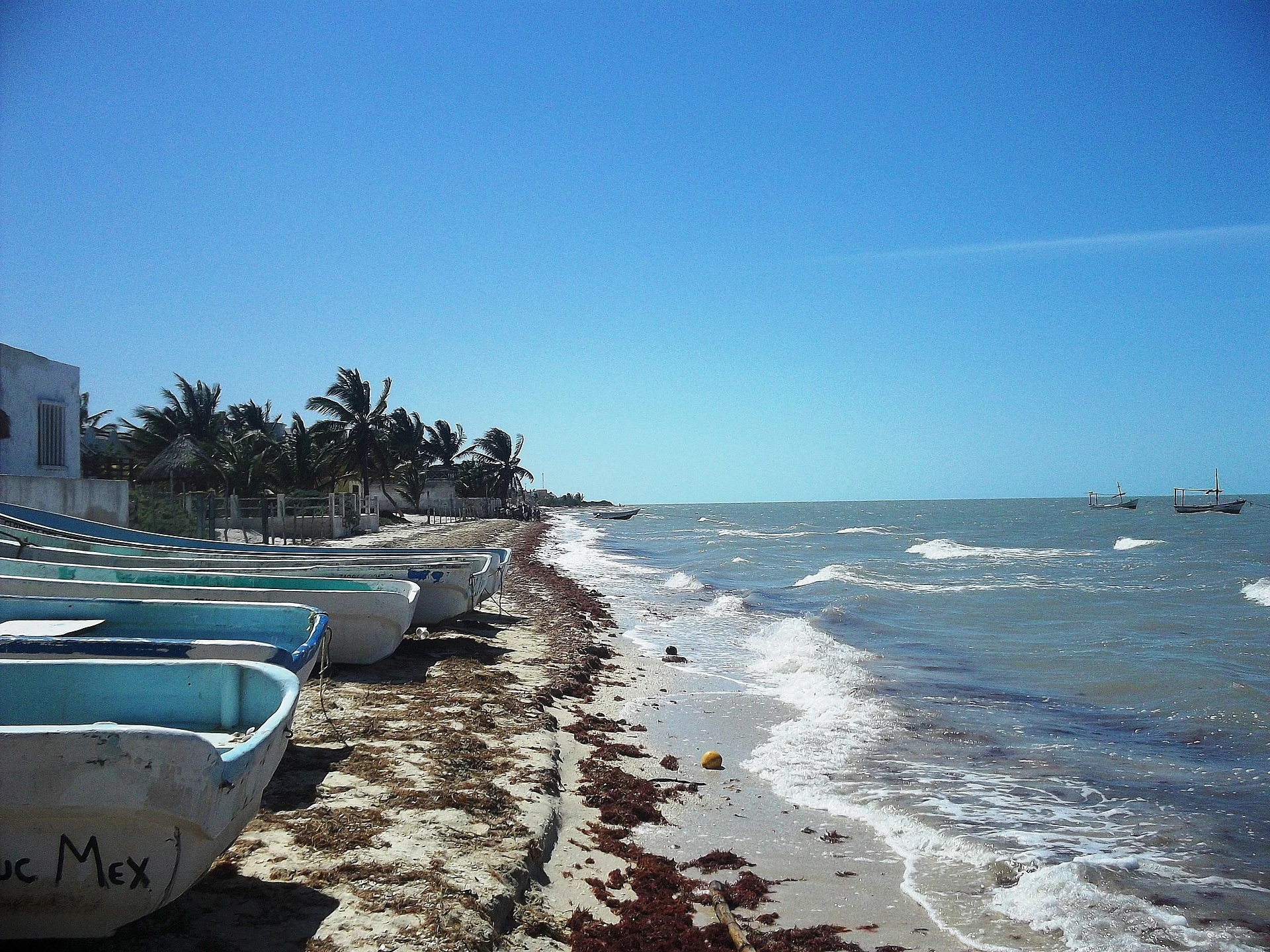
The beach itself is simple: pale sand, fishing boats pulled up on shore, pelicans, and a breeze off the sea. Small local eateries serve ceviche and fried fish, and mangroves and lagoons lie behind the shore. It makes a quiet swim stop on a drive along the coast road or after visiting the convent church in Dzidzantún.
How to get to Santa Clara
Drive from Mérida: 1 h 25 min, 91 km
From Dzidzantún, about 76 kilometers north-east of Mérida, a road runs 14 kilometers north to Santa Clara, about 15 minutes by car. Santa Clara is also on the coastal highway from Progreso, between Chabihau and Dzilam de Bravo.
Directions to Santa Clara on Google Maps
Distances are in a straight line; the road is usually longer.
Links open a partner site. We may earn a commission if you book, at no cost to you.
From the nearest cities to Santa Clara
- Mérida · 91 km by road, 1 h 25 min
- Tizimín · 114 km by road, 1 h 50 min
- Valladolid · 172 km by road, 2 h 35 min
Drive times by road from OpenStreetMap, without traffic or stops. Times marked ~ are estimated from the straight-line distance.
Before you go to Santa Clara: hours, prices and tips
- Best season
- On 22 July the image of Saint Clare is brought from Dzidzantún and taken out on the fishing boats; it stays a week and returns on 2 August. Her feast in Dzidzantún is on 11 August. Wikipedia (es) · checked Oct 2026
Hours and prices change, especially around holidays. Each fact links to where we checked it.
Visiting Santa Clara: what to see and do
Swim from the quiet beach among the moored fishing boats.
See the salt pans along the road and the pink lagoons along the coast.
Eat ceviche or fried fish at one of the small local eateries.
Come on 22 July for the boat procession with the image of Saint Clare.
Combine it with the 16th-century convent church in Dzidzantún, 14 km south.
Plan your trip
Places to stay in Santa Clara
Compare hotels, posadas, and rentals in and around Santa Clara.
Tours & activities
Day trips and guided outings from Motul often include Santa Clara; with a local guide you can get there without a car.
Rental cars
Pick up a car at MID (Mérida): about 47 min by road to Motul, then 42 km more to Santa Clara, on your own schedule.
Flights
The nearest airport with scheduled flights is Mérida (MID), about 47 min by road from Motul, the base for Santa Clara.
Travel insurance
If you plan on swimming or surfing at Santa Clara, check that your policy covers it: some plans leave adventure activities out.
Mobile data
Signal can drop away from Motul: download a map of the way to Santa Clara before you set out, or carry an eSIM with data.
Links open a partner site. We may earn a commission if you book, at no cost to you.
Photos
When to go to Santa Clara warm
Santa Clara shares the climate of Motul, 42 km away. The best months to visit are January, February, November, and December.
Santa Clara is best for swimming and time on the water in the warmest months (April, May, and June); in the rainiest ones (June, September, and October) expect storms in the afternoon.
See the month-by-month climate of Motul
Weather in Santa Clara now and the next 7 days
Live forecast from Open-Meteo. Chance of rain is the day's highest.
The closest Pueblo Mágico: Motul

Motul is the Pueblo Mágico closest to Santa Clara, with places to stay, food, and more to see.
Also close to
- Izamal · Yucatán · 49 km away
Closest to Santa Clara
-
Chabihau · Village · 11 km away
-
Dzilam de Bravo · Village · 12 km away
-
Dzilam González · Town · 13 km away
-
Dzidzantún · Town · 14 km away
-
San Crisanto · Nature reserve · 17 km away
-
Chucmichén · Village · 18 km away
-
Yobaín · Village · 19 km away
-
Xbec · Village · 24 km away


Near Santa Clara


Drive times by road from OpenStreetMap, without traffic. Times marked ~ are estimated from the straight-line distance.
Lists with Santa Clara
Beaches in Yucatán · 3Location from OpenStreetMap. Written by Puebloteca.