

Village Motul, Yucatán Municipality of Motul Costa Esmeralda (Yucatán)
A village just north of Motul built beside an ancient Maya city, where an 18 km stone causeway once set out east toward Cansahcab.
From Mérida: 45 min by car (46 km by road) How to get there ↓
Near here
See everything nearby ↓


Plan your visit to Ucí
Where to stay near Ucí
Compare hotels, posadas and guest houses in Ucí.
Tours to Ucí
Day trips and guided outings from Motul often include Ucí; with a local guide you can get there without a car.
How to get to Ucí
- From Mérida: about 45 min by road (~46 km)
- Nearest airport: Mérida (MID), 47 min by car to Motul
Links open a partner site. We may earn a commission if you book, at no cost to you.
About Ucí
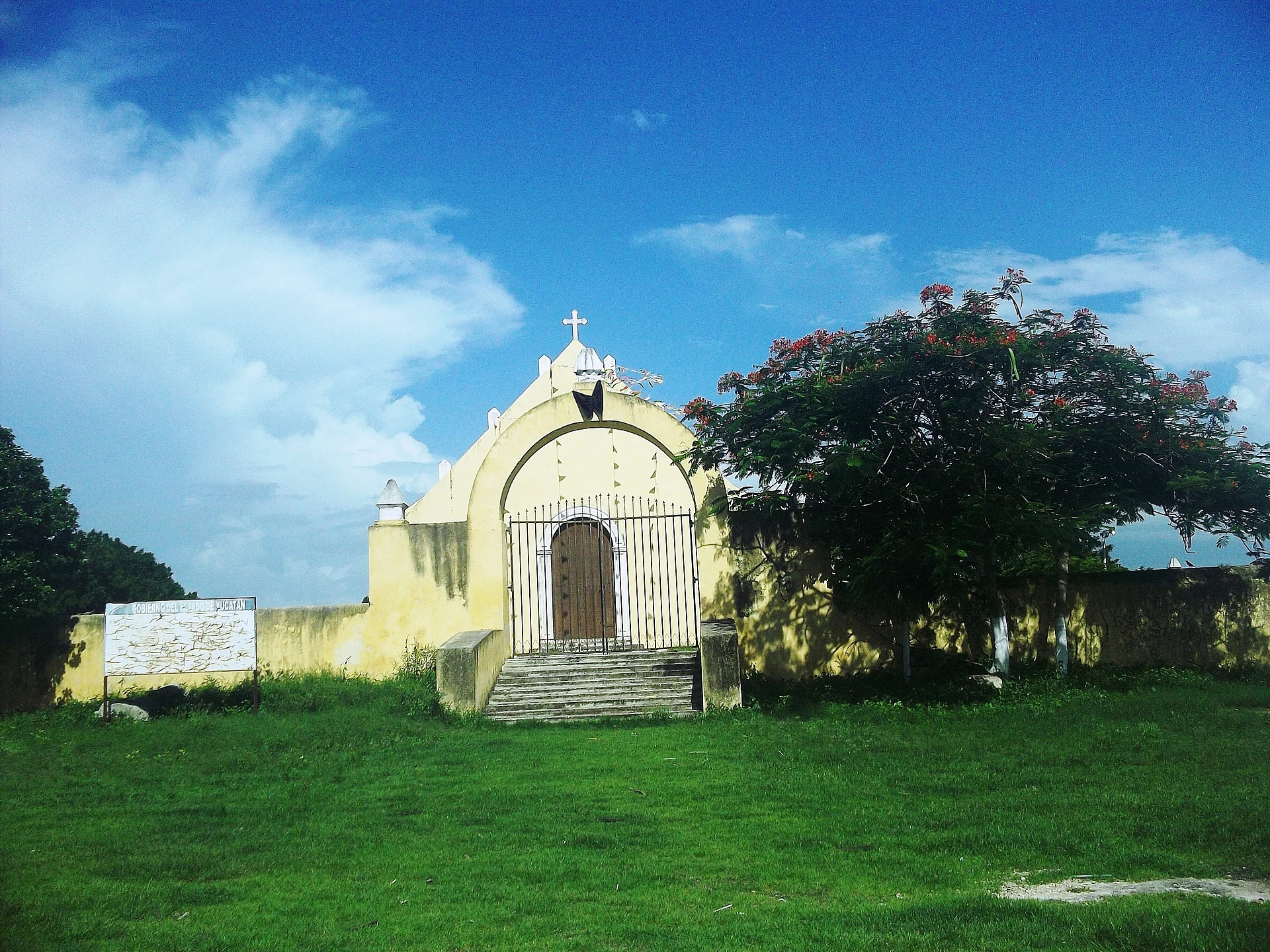
Ucí is a village and comisaría of Motul municipality, a few kilometres north of the town of Motul, which is itself about 42 km east of Mérida. With 1,212 people at the 2020 census it is one of the larger comisarías of the municipality. The modern village, with its main church and comisaría building, sits on top of and beside the remains of a sizeable ancient Maya city of the same name.
Ancient Ucí was the western end of one of the four long-distance causeways, or sacbé, known in northern Yucatán. The causeway runs about 18 km east from Ucí to Cansahcab, passing the sites of Kancab, 8 km away, and Ukana; it is a raised stone road 5 to 10 metres wide and usually half a metre to a metre high, built with more than 100,000 cubic metres of stone. Archaeologists have long debated its purpose: one view is that Ucí was the capital of a small polity reaching to Cansahcab and built the road to hold its borders against Dzilam, while others think it served processions or trade. Rubén Maldonado surveyed the area between 1979 and 1982, and since 2008 the Ucí–Cansahcab Causeway Project, led by Scott Hutson of the University of Kentucky, has mapped and excavated the site and the settlements along the road.
The centre of the old city lies southwest of the present village. Its builders set their monumental architecture around five natural depressions in the bedrock, one of them reaching water through small caves, and used megalithic blocks with rounded corners, a style also seen at Aké and Izamal. The best preserved group is a platform 5 metres high and 77 by 72 metres across topped by an 8-metre temple, and nearby stands a pyramid about 12 metres high. Much of the site was damaged around 1950, when stone from the largest buildings was taken as fill for a road, and estimates put the ancient settlement at 7.5 to 11 square kilometres. What you see today are grassy mounds and platforms, not restored temples.
How to get to Ucí
Drive from Mérida: 45 min, 46 km
From Mérida, take Highway 176 east toward Motul, about 42–45 km. Ucí lies a few kilometres north of Motul on a local road; from the centre of Motul it is a short drive or a taxi ride.
Directions to Ucí on Google Maps
Distances are in a straight line; the road is usually longer.
Links open a partner site. We may earn a commission if you book, at no cost to you.
From the nearest cities to Ucí
- Mérida · 46 km by road, 45 min
- Tizimín · 123 km by road, 1 h 50 min
- Valladolid · 147 km by road, 2 h 10 min
Drive times by road from OpenStreetMap, without traffic or stops. Times marked ~ are estimated from the straight-line distance.
Visiting Ucí: what to see and do
Look for the mounds and platforms of the ancient Maya city on the southwest side of the village.
Trace the start of the 18 km sacbé that ran east from Ucí toward Kancab and Cansahcab.
See the main church and the comisaría building in the village centre.
Combine the visit with Motul, a few kilometres south, and its 17th-century church of San Juan Bautista.
Plan your trip
Places to stay in Ucí
Compare hotels, posadas, and rentals in and around Ucí.
Tours & activities
Day trips and guided outings from Motul often include Ucí; with a local guide you can get there without a car.
Rental cars
Pick up a car at MID (Mérida): about 47 min by road to Motul, then 4 km more to Ucí, on your own schedule.
Flights
The nearest airport with scheduled flights is Mérida (MID), about 47 min by road from Motul, the base for Ucí.
Mobile data
Signal can drop away from Motul: download a map of the way to Ucí before you set out, or carry an eSIM with data.
Links open a partner site. We may earn a commission if you book, at no cost to you.
Photos
When to go to Ucí warm
Ucí shares the climate of Motul, 4 km away. The best months to visit are January, February, November, and December.
See the month-by-month climate of Motul
Weather in Ucí now and the next 7 days
Live forecast from Open-Meteo. Chance of rain is the day's highest.
The closest Pueblo Mágico: Motul

Motul is the Pueblo Mágico closest to Ucí, with places to stay, food, and more to see.
Also close to
Closest to Ucí
-
Komchén Martínez · Village · 3 km away
-
Kiní · Village · 5 km away
-
Kancabchén Ucí · Village · 6 km away
-
San Pedro Chacabal · Village · 8 km away
-
San José Hilí · Village · 9 km away
-
Telchac Pueblo · Village · 9 km away
-
Dzemul · Village · 10 km away
-
Sacapuc · Village · 10 km away


Near Ucí


Drive times by road from OpenStreetMap, without traffic. Times marked ~ are estimated from the straight-line distance.
Location from OpenStreetMap. Written by Puebloteca.