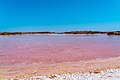


Lagoon Dzemul, Yucatán Municipality of Dzemul Costa Esmeralda (Yucatán)
Pink salt ponds on the coast near Telchac where salt is still harvested by hand, with flamingos often feeding in the background.
From Mérida: 1 h 5 min by car (62 km by road) How to get there ↓
Near here
See everything nearby ↓


Plan your visit to Xtampú
Where to stay near Xtampú
Compare hotels, posadas and guest houses in Xtampú.
Tours to Xtampú
Day trips and guided outings from Motul often include Xtampú; with a local guide you can get there without a car.
 Yucatan Discovery: Motul, Hacienda, Pink Lake, Ruins & Progreso
★ 4.7 (14) · From US$89
How to get to Xtampú
- From Mérida: about 1 h 5 min by road (~62 km)
- Nearest airport: Mérida (MID), 47 min by car to Motul
Links open a partner site. We may earn a commission if you book, at no cost to you.
Popular tours to Xtampú

Tours, prices and ratings from Viator, checked weekly. We may earn a commission if you book.
About Xtampú
Xtampú is a tiny coastal settlement in the municipality of Dzemul, on the stretch of shore the state calls the Costa Esmeralda, between Telchac Puerto and the Maya site of Xcambó. Only about ten people lived here at the 2020 census, down from a peak of around 150 in 1960, and it sits barely a meter above sea level. What brings visitors is its salt works, a group of shallow evaporation ponds known as the Laguna Rosada, about an hour's drive from Mérida.
Salt has been gathered on this coast since Maya times. Xcambó, a couple of kilometers to the south, was a Classic-period port that controlled salt-producing centers along the shore, Xtampú among them, and traded salt inland toward Izamal. Production flourished again in the 20th century, and salt is still grown and raked here by hand. As the seawater evaporates and the brine becomes very concentrated, the ponds turn shades of pink, deeper in some pools and paler in others.
The Laguna Rosada is a smaller, quieter version of the famous pink lagoons of Las Coloradas, and far closer to Mérida. Local guides show how the salt is harvested and offer a salt or mud scrub at the lagoon's edge, and flamingos often feed in the shallows around the ponds. Tours usually combine it with Xcambó, the carved-stone church of Santa Ana in Dzemul and a working henequen hacienda, and the beaches of Telchac Puerto are a few minutes away.
How to get to Xtampú
Drive from Mérida: 1 h 5 min, 62 km
Xtampú is about an hour's drive from Mérida. Head for Telchac Puerto on the coast and follow the coastal road west toward Progreso; the salt ponds lie between Telchac Puerto and the turnoff for Xcambó, which is about 6 km from Telchac Puerto. Local operators run guided tours of the salt works that start nearby; book by phone or through their social media.
Directions to Xtampú on Google Maps
Distances are in a straight line; the road is usually longer.
Links open a partner site. We may earn a commission if you book, at no cost to you.
From the nearest cities to Xtampú
- Mérida · 62 km by road, 1 h 5 min
- Tizimín · 153 km by road, 2 h 25 min
- Valladolid · 176 km by road, 2 h 45 min
Drive times by road from OpenStreetMap, without traffic or stops. Times marked ~ are estimated from the straight-line distance.
Before you go to Xtampú: hours, prices and tips
- Hours
- Tours run daily, 9:00 to 18:00, all year. Yucatán Travel (SEFOTUR) · checked Oct 2026
- Entry
- A guided 'salt harvest' tour costs about 600 pesos per person, including entry, guiding and lunch; it also visits Xcambó, Dzemul and a henequen hacienda. Yucatán Travel (SEFOTUR) · checked Oct 2026
- Time needed
- The full salt-route tour with Xcambó and Dzemul takes about 5 hours. Yucatán Travel (SEFOTUR) · checked Oct 2026
- Guide or tour
- Local guides run the salt works tours for groups of 4 to 18; reservations by phone (991 102 4772) or via the Salineras de Xtampú Facebook page. Tours: Viator GetYourGuide Yucatán Travel (SEFOTUR) · checked Oct 2026
- What to bring
- A change of clothes and sandals for the mud and salt scrub; payment is in cash or by bank transfer. Yucatán Travel (SEFOTUR) · checked Oct 2026
- Rules
- No pets on the tour. Yucatán Travel (SEFOTUR) · checked Oct 2026
Hours and prices change, especially around holidays. Each fact links to where we checked it.
Visiting Xtampú: what to see and do
Walk the edges of the pink salt ponds of the Laguna Rosada.
Learn how salt is grown and raked by hand on a guided tour of the salt works.
Try the salt or mud scrub at the lagoon.
Look for flamingos feeding in the shallows behind the ponds.
Visit the Maya salt port of Xcambó, a couple of kilometers south.
Plan your trip
Places to stay in Xtampú
Compare hotels, posadas, and rentals in and around Xtampú.
Tours & activities
Day trips and guided outings from Motul often include Xtampú; with a local guide you can get there without a car.
Rental cars
Pick up a car at MID (Mérida): about 47 min by road to Motul, then 28 km more to Xtampú, on your own schedule.
Flights
The nearest airport with scheduled flights is Mérida (MID), about 47 min by road from Motul, the base for Xtampú.
Mobile data
Signal can drop away from Motul: download a map of the way to Xtampú before you set out, or carry an eSIM with data.
Links open a partner site. We may earn a commission if you book, at no cost to you.
Photos
When to go to Xtampú warm
Xtampú shares the climate of Motul, 28 km away. The best months to visit are January, February, November, and December.
See the month-by-month climate of Motul
Weather in Xtampú now and the next 7 days
Live forecast from Open-Meteo. Chance of rain is the day's highest.
The closest Pueblo Mágico: Motul

Motul is the Pueblo Mágico closest to Xtampú, with places to stay, food, and more to see.
Also close to
Closest to Xtampú
-
Xcambó · Archaeological site · 2 km away
-
Telchac Puerto · Beach · 9 km away
-
Dzemul · Village · 15 km away
-
Timul · Village · 16 km away
-
Telchac Pueblo · Village · 17 km away
-
Parador Uaymitún · Viewpoint · 18 km away
-
Sacapuc · Village · 19 km away
-
San Crisanto · Nature reserve · 19 km away


Near Xtampú
-
El Corchito · Nature reserve · Yucatán
40 min: drive to El Corchito landing, Progreso, then 5 min by boat


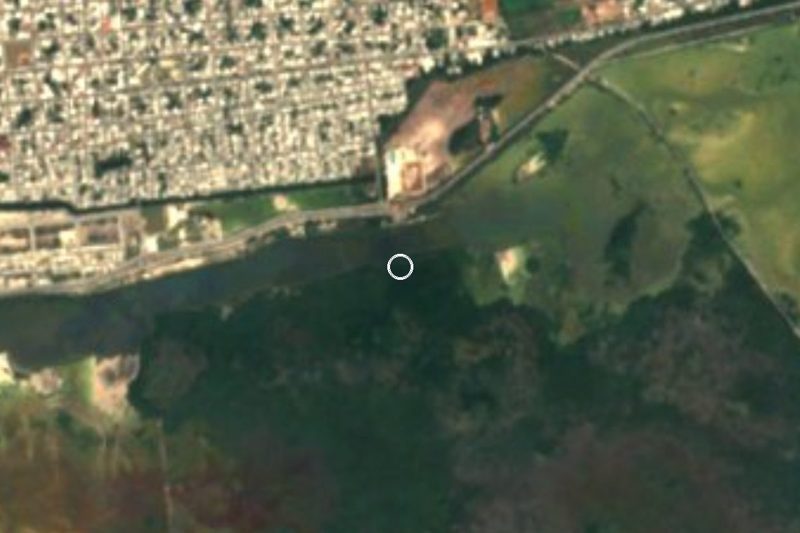


Drive times by road from OpenStreetMap, without traffic. Times marked ~ are estimated from the straight-line distance.
Location from OpenStreetMap. Written by Puebloteca.