

Village Progreso, Yucatán Municipality of Progreso Costa Esmeralda (Yucatán)
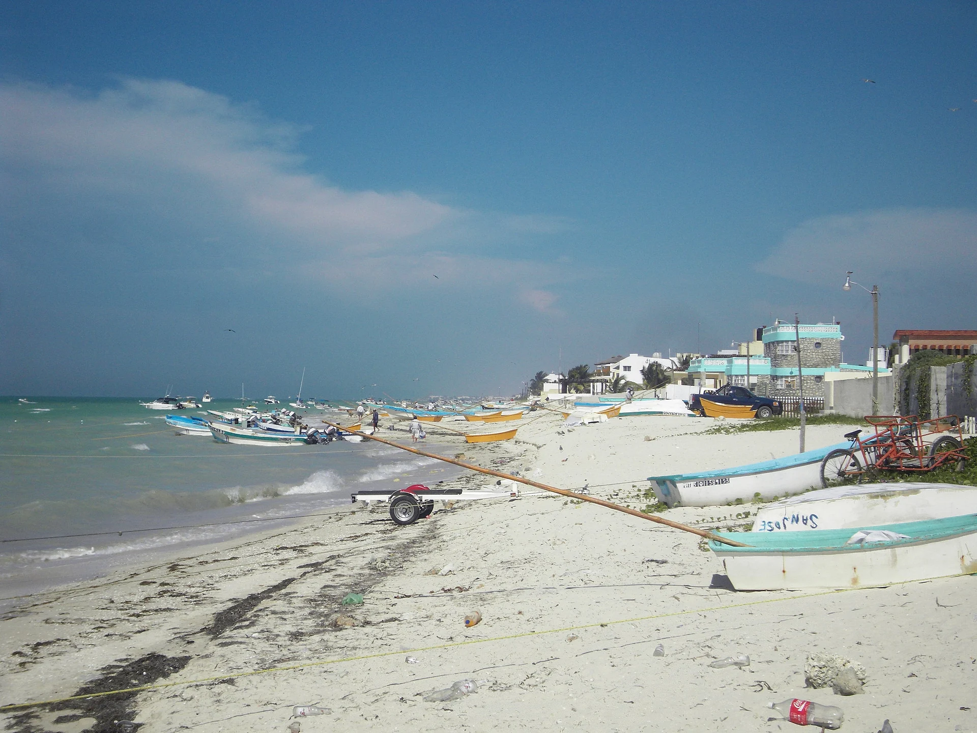
A beach village just east of Progreso that sits near the centre of the crater left by the asteroid that wiped out the dinosaurs 66 million years ago.
From Mérida: 40 min by car (42 km by road) How to get there ↓
Near here
See everything nearby ↓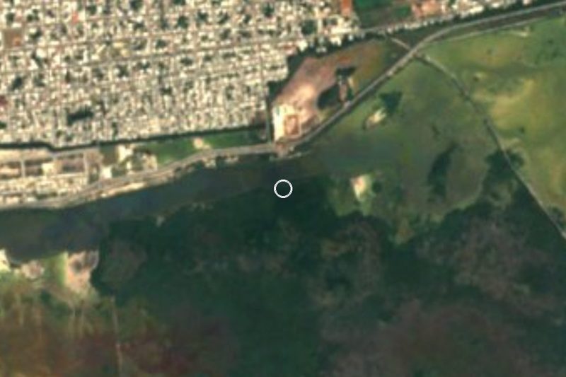


Plan your visit to Chicxulub Puerto
Where to stay near Chicxulub Puerto
Compare hotels, posadas and guest houses in Chicxulub Puerto.
Tours to Chicxulub Puerto
Day trips and guided outings from Motul often include Chicxulub Puerto; with a local guide you can get there without a car.
 Tours from Progreso
Learn Paddle Board and Explore the Mangroves of Progreso
★ 5.0 (356) · From US$80
How to get to Chicxulub Puerto
- From Mérida: about 40 min by road (~42 km)
- Nearest airport: Mérida (MID), 47 min by car to Motul
Links open a partner site. We may earn a commission if you book, at no cost to you.
Tours from Progreso, near Chicxulub Puerto


Tours, prices and ratings from Viator, checked weekly. We may earn a commission if you book.
About Chicxulub Puerto
Chicxulub Puerto is a seaside village on the Gulf of Mexico, a comisaría of Progreso municipality, about 8 km east of the port of Progreso and roughly 40 km north of Mérida. It is not the same place as Chicxulub Pueblo, the inland town of the same name about 20 km to the south. The name is Maya and is usually translated as 'devil's flea', from ch'ik (flea) and xulub (devil). The village has grown fast: 217 people lived here in 1900, 3,024 in 1980 and 7,591 at the 2020 census, many of them in beach houses strung along the shore road.
The village is known around the world for what lies beneath it. It sits near the centre of the Chicxulub crater, a buried impact structure about 180 km across that extends out under the sea, left when an asteroid roughly 10 km wide struck about 66 million years ago. That impact is linked to the mass extinction at the end of the Cretaceous that killed off the non-avian dinosaurs. Nothing of the crater is visible at the surface, but the village has made the most of it: a monument in the main square marks the supposed point of impact, and dinosaur statues stand around the plaza and the seafront.
The village has a long history as a lookout post: in 1663 the governor Juan Francisco Esquivel y de la Rosa named Chicxulub and Chuburná coastal watch towns against pirates. Today it is a quiet beach town with a pier, a seafront with large colourful CHICXULUB letters, seafood restaurants and beach clubs, and it is far calmer than Progreso's malecón. Behind the village is mangrove and wetland; on an old abandoned road through it, the Sendero Jurásico opened in May 2022 with dinosaur replicas and audio explanations of the impact, and it had received more than 130,000 visitors by mid-2026. The Museo del Meteorito is a few minutes away on the Progreso malecón.
How to get to Chicxulub Puerto
Drive from Mérida: 40 min, 42 km
From Mérida, take Calle 60 north onto Federal Highway 261 to Progreso, about 35 km and 30 minutes. In Progreso, head east along Calle 29, which becomes the coastal road YUC-027, and continue about 8 km to Chicxulub Puerto; the whole trip is roughly 40 km. Autoprogreso buses run from Mérida to Progreso every 10–15 minutes from early morning; from Progreso a taxi covers the last stretch.
Directions to Chicxulub Puerto on Google Maps
Distances are in a straight line; the road is usually longer.
Links open a partner site. We may earn a commission if you book, at no cost to you.
From the nearest cities to Chicxulub Puerto
- Mérida · 42 km by road, 40 min
- Valladolid · 198 km by road, 2 h 40 min
- Campeche · 212 km by road, 2 h 40 min
Drive times by road from OpenStreetMap, without traffic or stops. Times marked ~ are estimated from the straight-line distance.
Before you go to Chicxulub Puerto: hours, prices and tips
- Rules
- Take care on the village pier: part of its concrete deck collapsed under two visitors in September 2025 and residents have asked for repairs. Por Esto · checked Oct 2026
Hours and prices change, especially around holidays. Each fact links to where we checked it.
Visiting Chicxulub Puerto: what to see and do
See the monument in the main square that marks the supposed impact point of the Chicxulub asteroid.
Walk the Sendero Jurásico through the wetland behind the village, with more than 20 dinosaur figures.
Photograph the giant CHICXULUB letters and the dinosaur statues on the seafront.
Spend a calm beach day away from the Progreso crowds and eat seafood at a beach restaurant.
Look at the mangroves on the edge of the village.
Pair the visit with the Museo del Meteorito on the Progreso malecón, about 8 km west.
Plan your trip
Places to stay in Chicxulub Puerto
Compare hotels, posadas, and rentals in and around Chicxulub Puerto.
Tours & activities
Day trips and guided outings from Motul often include Chicxulub Puerto; with a local guide you can get there without a car.
Rental cars
Pick up a car at MID (Mérida): about 47 min by road to Motul, then 40 km more to Chicxulub Puerto, on your own schedule.
Flights
The nearest airport with scheduled flights is Mérida (MID), about 47 min by road from Motul, the base for Chicxulub Puerto.
Mobile data
Signal can drop away from Motul: download a map of the way to Chicxulub Puerto before you set out, or carry an eSIM with data.
Links open a partner site. We may earn a commission if you book, at no cost to you.
Photos
When to go to Chicxulub Puerto warm
Chicxulub Puerto shares the climate of Motul, 40 km away. The best months to visit are January, February, November, and December.
See the month-by-month climate of Motul
Weather in Chicxulub Puerto now and the next 7 days
Live forecast from Open-Meteo. Chance of rain is the day's highest.
The closest Pueblo Mágico: Motul

Motul is the Pueblo Mágico closest to Chicxulub Puerto, with places to stay, food, and more to see.
Also close to
Closest to Chicxulub Puerto
-
El Corchito · Nature reserve · 4 km away
-
Malecón de Progreso · Landmark · 5 km away
-
Museo del Meteorito · Landmark · 5 km away
-
Muelle de Progreso · Landmark · 6 km away
-
Progreso · City · 6 km away
-
Parador Uaymitún · Viewpoint · 9 km away
-
Yucalpetén · Landmark · 10 km away
-
Chelem · Village · 14 km away


Near Chicxulub Puerto


Drive times by road from OpenStreetMap, without traffic. Times marked ~ are estimated from the straight-line distance.
Location from OpenStreetMap. Written by Puebloteca.